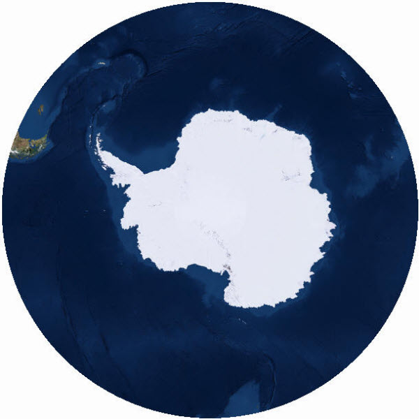
In response to feedback from our user community, the ArcGIS Content Team is happy to announce the release of the Antarctic imagery map as a new basemap! This map is designed to supplement the Arctic Imagery map, which we previously blogged about publishing last year. The Antarctic Imagery Basemap uses the WGS 1984 Antarctic Polar Stereographic (WKID 3031) and is cached from ~1:900 million to ~1:110k. It provides 15 meter TerraColor imagery for the southern polar region (90 to 50 degrees south latitude), though the projection will support display of data to lower latitudes. We are planning to complement this basemap with Antarctic Ocean Base and Reference layers.
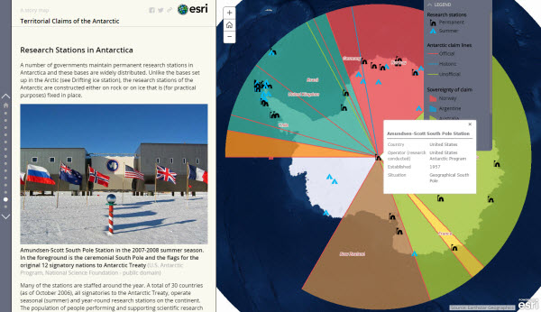
The Antarctic Imagery map is designed to be used as a basemap for overlaying other data for the Antarctic region. An example of this can be seen in this Story Map detailing the territorial claims and research stations of the southern pole.
- Antarctic Imagery web map:
http://www.arcgis.com/home/item.html?id=6553466517dd4d5e8b0c518b8d6b64cb - Antarctic Imagery service:
http://services.arcgisonline.com/arcgis/rest/services/Polar/Antarctic_Imagery/MapServer

Article Discussion: