Updated December 15, 2016: The Esri Vector Basemaps are no longer in beta release and are now available to use in production web maps and apps. The best way to access them in ArcGIS Online is through the Esri owned Vector Basemaps group, which contains the latest set of web maps and tile layers. See this blog post for information related to this update.
—
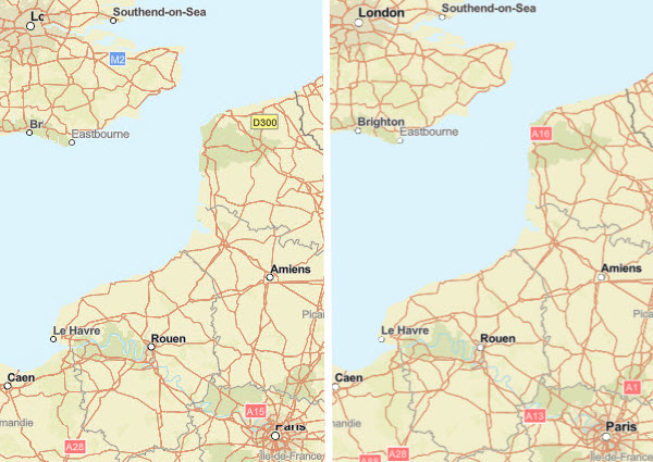
The Esri vector tile basemaps (beta) were updated with new data content and map style refinements. The ArcGIS Online update earlier this week also affected the vector tile basemap display. The two recent releases together made noticeable improvements to the maps such as:
- improved map display with reduced label clipping along tile edges
- proper right-to-left text display for languages like Arabic, Hebrew, and Urdu
- additional community contributed data appearing across all vector map styles
- more fonts available for user customization
 —
Resolved right-to-left (RTL) label display of Arabic.
Shown in this World Street Map (Local Language) web map. الدار البيضاء — Casablanca, Morocco
—
Resolved right-to-left (RTL) label display of Arabic.
Shown in this World Street Map (Local Language) web map. الدار البيضاء — Casablanca, Morocco

Why Vector Tile Basemaps?
There are four primary benefits of the Esri vector basemaps over their raster counterparts:
- More frequent update cycle based on faster tile set creation and deployment
- Community contributions appear in all vector styles, and appear online in the vector maps sooner than in the raster basemaps
- User customization of content, color, and fonts
- Better display on high-resolution devices
Where can I find the Vector Maps?
There are two main ways to find the vector tile basemaps in ArcGIS Online, both tile layers and web maps. The first is in this public group: Esri Vector Basemaps (Beta). Bookmark it! This set of 9 tile layers and 9 web maps are the most up-to-date set of our basemaps. They are items owned by “esri_vector”. That leads to the second way to find them. In the map on ArcGIS.com, when you add data, search for layers using the syntax “owner:esri_vector”. This collects all the vector tile layer styles that are also in the group detailed above.
What data updates are in this latest release?
These community contributions were added in this current release. Authoritative data is contributed to the Living Atlas of the World through the Community Map Program in an effort to build the best available maps on ArcGIS Online. See the benefits of contributing your organization’s data to the program.
- American Fork, UT
- Amherst, MA
- Aurora, CO
- Carroll Co, MD
- Clear Creek Co, CO
- College Station, TX
- Cupertino, CA
- Dakota Co, MN
- Launceston, Australia
- Madison Co & Rexburg, ID
- Montana State Univ
- Natrona Co, WY
- New Castle Co, DE
- Pulaski Co, AR
- Raleigh, NC
- Smith Co, TX
- Suffolk Co, NY
- Will Co, IL
Canvas Maps Updated
Additionally, the Light Gray Canvas and Dark Gray Canvas web maps were updated to “map sandwiches”. The maps are now comprised of two layers each, the reference overlay (cities) and the base layer (all other map features). The base and reference services are fused together into one ArcGIS Online map layer. The addition of user generated cached features will display in between the base and the reference layers.
Customized Map Designs & More Fonts
With the addition of more fonts as part of the map style resources, users are able to make more customized map designs. The new fonts include additional options for Serif and Sans Serif fonts, script styles, and more. The full list of fonts available to apply in your maps is found in our Vector Basemap Reference Document. This PDF also details how users can make a copy of the vector tile layer in their ArcGIS online account and the tools available to customize the map. See our online collection showcasing different levels of customized vector tile basemaps. From left to right, these unique Esri maps are the Mid-Century, Newspaper, and Spring seasonal map.
Currently there are two styling apps available to customize the vector basemaps.
Vector Basemap Style Editor (beta) is a styling app that allows you to quickly and easily turn on and off feature layers, find features by colors, apply bulk color changes for all features with that specific color, and more. Click on the ‘id’ name of a layer and more detailed, json-based edits can be made. Updating the item from the app saves the new style changes in your online account.
Vector Style JSON Editor (beta) is another styling app that exposes the json code in one half of the window, and the map in the other half. The app offers a color picker and the ability to search and find features to change by layer names or hex colors. Applying changes to the code shows immediate results on the right side of the window. Saving the style changes updates that tile layer in your online account.
Where do we go from here?
Bookmark this space for additional blogs detailing the latest information about the Esri Vector Tile Basemaps. While there are still known issues in the maps, we continue to work on improving the maps during this beta period. Future updates will resolve these issues and prepare the vector basemaps to be released as full production tile layers and web maps consumable across much of the platform.


Article Discussion: