 The most popular lesson from Learn ArcGIS has been updated with a scenario which allows you to help Houston prepare for an incoming hurricane.
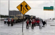
Get Started with ArcGIS Online was one of our first lessons when Learn ArcGIS was launched in 2014. Then, the lesson focused on finding shelters in Hawaii in the event of a severe volcano eruption. Now, the updated lesson allows you identify evacuation routes and neighborhoods with few vehicles in Houston before an incoming hurricane makes landfall.
The new, 45-minute lesson includes adding layers to a map, styling layers, configuring pop-ups, sharing a map as an app, and editing item details.
The lesson includes links to a pair of story maps reflecting the aftermath of the record-setting storm that struck Texas and Louisiana in 2017: Where Harvey Hit Hardest and Hurricane Harvey: Who left, where did they go, and who stayed?
About the author


Article Discussion: