ArcGIS Enterprise 10.8 is here and it delivers exciting new enhancements throughout the product, from administration to data, maps, and apps.
If Field Apps are not yet part of your System of Engagement (SoE), there has never been a better time to take ArcGIS to the field. For an overview of Field Operations, please visit our Field Operations site. This article will highlight key enhancements in ArcGIS Enterprise 10.8 that are important when deploying field apps within your organization.
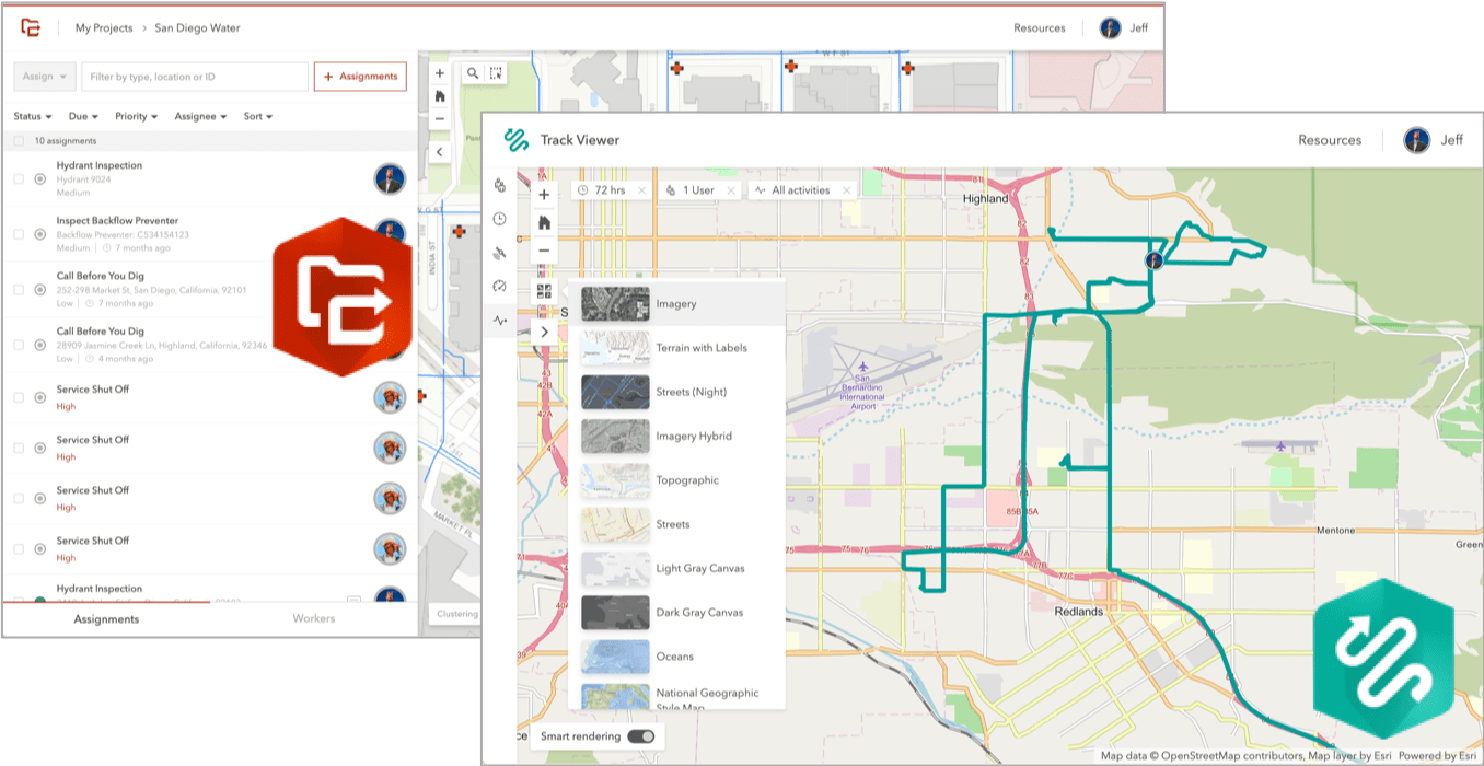
Workforce and Tracker web apps now included with ArcGIS Enterprise 10.8 portal
In previous releases of ArcGIS Enterprise, you’ve had to download and separately install both the Workforce for ArcGIS web app and the Track Viewer web app. Now both are included with ArcGIS Enterprise 10.8 and no longer require a separate installation.
The web apps have significant updates, usability improvements, and bug fixes. In fact, you can now change basemaps when viewing tracks in the Track Viewer. Important notice for Workforce users -we no longer support IE 11 with this update.

For more information, see the Workforce help and the Tracker help.
Offline Map Area Improvements
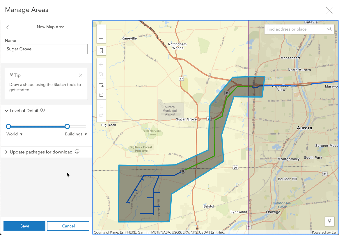
Taking web maps offline allows you to view, collect, and update features when you are disconnected from the internet. With ArcGIS Enterprise 10.7, map authors could create map areas to package data for specific areas ahead of time. Map areas speed up and simplify the map download process for field workers.
New with the 10.8 release is the ability to draw a polygon to define the area you need to take offline. Now you can click the Sketch polygon map area button and draw the polygon on the map. This is particularly useful when working within a utility corridor or along a roadway.

Streaming the Sign in Process
Perhaps one of the biggest challenges faced when deploying field apps with ArcGIS Enterprise is the sign in process. Typing the URL of your ArcGIS Enterprise portal is not only tedious and error-prone – it can be downright frustrating. We’ve been adding new capabilities to our field apps that will dramatically simplify the process.
Using the portalURL Managed App Configuration
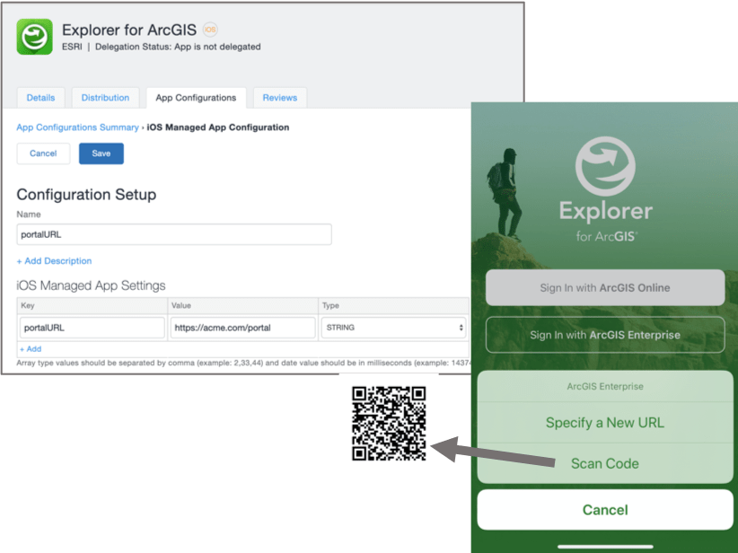
Enterprise organizations are using Mobile Device Management (MDM) software to deploy apps to devices, and we’ve added a new configuration setting called portalURL that you can use when deploying our field apps. Collector, Explorer, Navigator, Tracker, and Workforce currently support this keyword.
Using Scan Code or App Links
If you are not using an MDM within your organization, or if you need to deploy apps to the devices of contractors, you can use the new Scan Code capability included with Explorer and Collector. You can also send an app link that includes the portalURL scheme. In fact, a great way to do this is to generate a QR Code and have your users scan the code on their phones. Collector, Explorer, and Tracker support both app links and Scan Code today. These new capabilities will be coming to all apps soon on all platforms.

How to stay connected and informed
Our Field Apps release on a quarterly basis, if not more frequently, and it can be challenging to stay on top of everything that updates. We document changes with each release here on our documentation websites:


Commenting is not enabled for this article.