By Aileen Buckley, Mapping Center Lead
I was looking through the list of our blog posts, and I thought you might be interested to see which ones have gotten the most “hits”. I’ll list them here, but keep in mind that some of our older posts get higher numbers of hits because, well, they’ve just been around longer! But I think this list also helps us learn what you want to hear about. If anything in the list generates an idea about something you would like us to blog about, please send us comments to this post so we can hear from you. So, here we go…
And the winners are…(blog posts that have had over 10,000 hits)…in order of appearance:
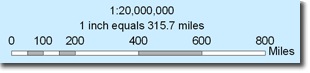
Choosing the best way to indicate map scale
17,240 Views
by: MappingCenterTeam
Aug 06 2007Tips for exporting to Adobe Illustrator format (AI) so CYMK colors are maintained
11,656 Views
by: mlaw
Sep 20 2007Creating Street Name Indexes
10,167 Views
by: cfrye
Nov 08 2007Cartographic Design: Inset Maps
16,688 Views
by: abuckley
Mar 04 2008Aspect-Slope Map
16,089 Views
by: abuckley
May 22 2008What I wish I had known about Model Builder before I started using it
11,460 Views
by: abuckley
Feb 19 2009The Buffer Wizard in ArcMap
11,597 Views
by: marg3002
Jul 15 2009
Honorable mentions…(blog posts that are nearing the 10,000 hits mark):
About geographic transformations and how to choose the right one
9,832 Views
by: abuckley
May 06 2009How can you tell what map scales are shown for online maps?
9364 Views
by: abuckley
Mar 19 2009
And just to make it an even 10…(a blog post that is “waiting in the wings” to become a winner):
Creating a legend for hypsometrically tinted shaded relief
8,959 Views
by: cfrye
Sep 07 2007
Again, we hope you’ll send us some ideas for things you’d like us to blog about. In the meantime, you might find some of these posts as interesting or useful as others have!

Article Discussion: