Last month, Esri participated in the 2016 Canadian Hydrographic Conference in Halifax, Nova Scotia. At this event, Esri, in collaboration with NOAA Marine Chart Division, presented two posters.
- Modernizing Paper Chart Production describes efficiencies gained in creating official nautical charts using ArcGIS for Maritime Charting. Using the ENC first based approach, automated processes generate many of the elements that appear on the chart such as Zone of Confidence diagrams, compass roses, and grids.
- Using the Esri Maritime Chart Service for Displaying ENC Data describes how ArcGIS for Maritime Server engages the Meso-American and Caribbean Sea Hydrographic Commission (MACHC) community to support the region’s economic infrastructure and blue water economy.
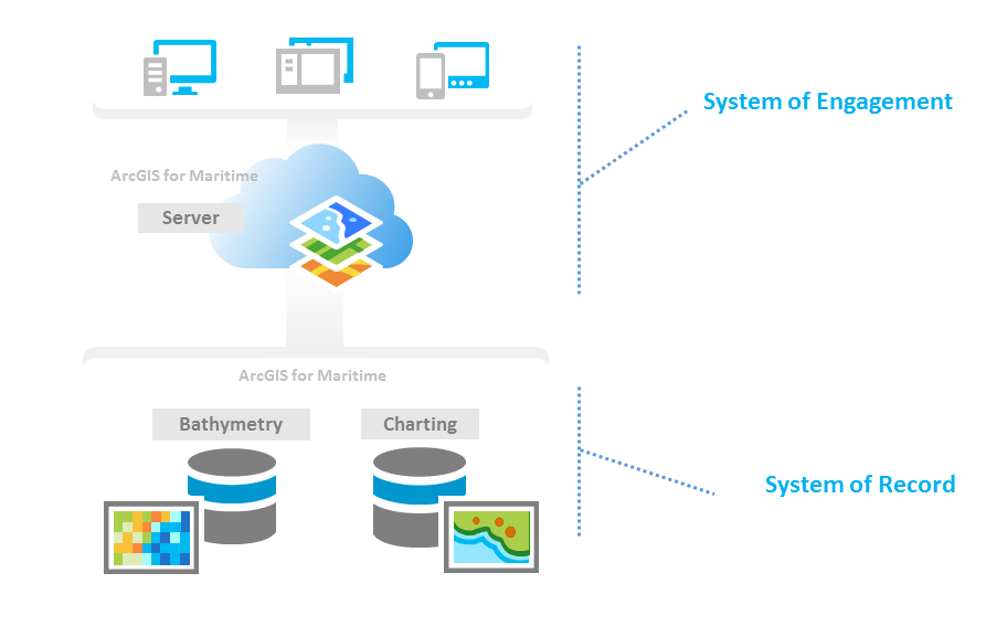
These 2 posters are great examples of the Esri platform as a’ system of record’ and ‘system of engagement’.
- A ‘system of record’ is the production and maintenance of authoritative data such as ENCs and paper nautical charts, and the databases behind those products. Esri customers have used ArcGIS as a system of record for many years to manage their geospatial data.
- A ‘system of engagement’ is a collaborative way to share data with stakeholders, the public, new users, and to engage with them in alternative ways though mobile and web apps that open up the data to new ideas, insights, and analysis. The system of record becomes much more valuable when it can serve many purposes.


Article Discussion: