The idea of a digital map mashup—recombining various geographic layers—is one of the great force multipliers in modern cartography. This ability to easily share and repurpose digital content has allowed individuals to create far more ambitious maps than would be possible if they had to work in isolation or start from scratch. The rise of the map mashup expanded cartography, so that anyone could build upon the work of others. Most of the thousands of maps created and shared every day within ArcGIS are created this way—maps that build upon the data, labor, and insights of the larger community. This era of collaborative GIS has empowered everyday citizens to participate in mapping as never before.
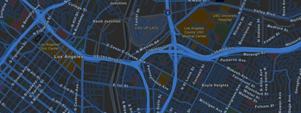 ArcGIS includes a suite of basemaps that present the world in multiple cartographic styles. This is the Streets at Night theme.
It Starts with a Basemap
In ArcGIS, map authors can readily access beautiful sets of professionally produced basemaps that provide the digital canvas on which to tell their stories. Each of the Esri basemaps has a theme or focus. Their range serves the need for almost any map type. Whether it’s terrain, oceans, roads, or another of the many themes, the right basemap complements your subject and provides the background information critical to establishing its geographic context (locations, features, and labels).
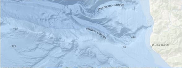 This is the Oceans basemap.
Each of the ArcGIS basemaps contains highly accurate and up-to-date information, at multiple zoom levels covering geographic scales from detailed building footprints to the entire planet. Providing data at each level of detail, for all locations on the globe, takes a small army of cartographers and eats up terabytes of data. The good news is that each of us can benefit immediately from those efforts. Some of the most widely used basemaps, such as those seen here, rack up billions of views every week.
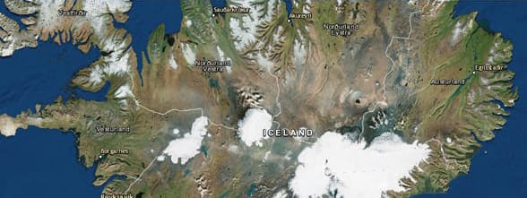 This is Imagery with Labels, the all-time most popular basemap.
Operational Layers
Basemaps seem simple and relatively unobtrusive—and this is precisely their purpose. They should provide locational context (the “stage”) for the content that is to be overlaid on them. Operational overlays carry the subject matter of the map and provide the purpose for making any map. A layer can be anything—emergency response incidents, your company’s monthly sales, life expectancy, the location of oil and gas wells, or live traffic conditions. Merging a great basemap with one or more operational layers forms the heart of the modern online map.
The Living Atlas of the World
Some map authors are data creators interested in mapping their own data. Many other authors, however, need help finding operational layers; they know what they want to map but need guidance in finding the data to fully tell the story. Fortunately, ArcGIS provides access to an array of content to use in operational layers. The GIS community, including Esri, compiles and shares thousands of ready-to-use authoritative datasets in ArcGIS, covering everything from historical census data to environmental conditions derived from live sensor networks and stunning earth observations. And it’s all in the Living Atlas of the World. Finding mappable, interesting geographic layers has never been easier.
Blending together ready-to-use basemaps, operational layers, and statistical graphs into a live, dynamic map allows you to share geographic content in a simple and concise format.
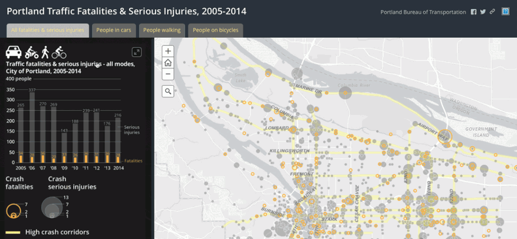 Just imagine trying to understand the subtle spatial patterns of traffic fatalities and serious injuries in Portland, Oregon, over a 10-year span by reading a spreadsheet. It would overwhelm anyone. By comparison, a map of that same data can be read and quickly understood with almost no training required. This is the power of web maps.
—–
This post is excerpted from The ArcGIS Book, Second Edition: 10 Big Ideas about Applying The Science of Where, by Christian Harder and Clint Brown. The twin goals of this book are to open your eyes to what is now possible with Web GIS, and then spur you into action by putting the technology and deep data resources in your hands. The book is available through Amazon.com and other booksellers, and is also available at TheArcGISBook.com for free.
Commenting is not enabled for this article.