
Introducing ArcGIS Location Platform
Supercharge your solutions with Esri's ArcGIS Location Platform. Gain direct access to high-quality location services and integrate location intelligence with applications and business systems using a complete set of mapping APIs, SDKs, services, and tools.
Worldwide customer confidence
Companies from across many industries utilize the ArcGIS Location Platform to meet their mapping and location service requirements for the development of applications and business systems.


Previous
Next
How businesses of all sizes leverage ArcGIS Location Platform
Discover how organizations from emerging startups to multinational corporations leverage ArcGIS Location Platform to unlock the full potential of their data and gain a competitive edge.
- Airspace Link
- GEM
- Crexi
- OpenGov
Michael Healander
President and CEO, Airspace Link
ArcGIS Location Platform has been essential in building Airspace Link’s AirHub Portal, the leading solution for safe and efficient drone operations and management. By leveraging the high-quality basemaps, precise address searching, and data enrichment capabilities in ArcGIS Location Platform, we empower more than 100,000 users to manage complex drone missions confidently.
Keith Simon
CEO, Waev, Inc, parent company of GEM
Our organization experienced a game-changing shift with Esri's ArcGIS Location Platform. By leveraging its capabilities, we’ve witnessed over 150,000 searches and engaged 7,000 users across the country, educating current and future GEM owners on everywhere they can safely drive GEM low-speed vehicles in their communities. The intuitive UI, data insights, and places basemap empowers us to make informed decisions for our growth strategies based on location-based insights.
Chris Finck
Product Manager, Crexi
By integrating Esri's geo-location data using ArcGIS Location Platform into Crexi's Intelligence subscription, users gain the ability to leverage information for any block group across the nation. This valuable data can be accessed directly from a specific property listing or viewed in aggregate on a map, alongside other Intelligence data. This comprehensive approach empowers commercial real estate professionals to make informed decisions.
 Demographic data displayed in the Crexi Intelligence platform.
Terrence Curley
Chief Product Officer, OpenGov
ArcGIS Location Platform has transformed our Cartegraph Asset Management software solution by enhancing its spatial analysis and mapping capabilities. This integration allows users more effective visualization and management of their assets, improved decision-making, and operational efficiency. The platform's robust capabilities enable users to easily share and analyze complex data, significantly benefiting their organization by streamlining workflows and increasing productivity.
Go to market faster
Get ready-to-use content with extensive documentation, ideal for commercial applications.
Previous
Next
Discover the versatility of ArcGIS Location Platform
Easily leverage comprehensive location services, securely host your data, harness the powerful capabilities of spatial analysis, and gain unparalleled insights and decision-making capabilities.
- Location services
- Host your data
- Spatial analysis
Explore an array of location services
Access mapping and spatial analysis capabilities through mapping APIs. Display maps and style layers, find routes, search for places, and perform operations such as data enrichment and spatial analysis. Elevate your location-based workflows with Esri’s comprehensive services.
-
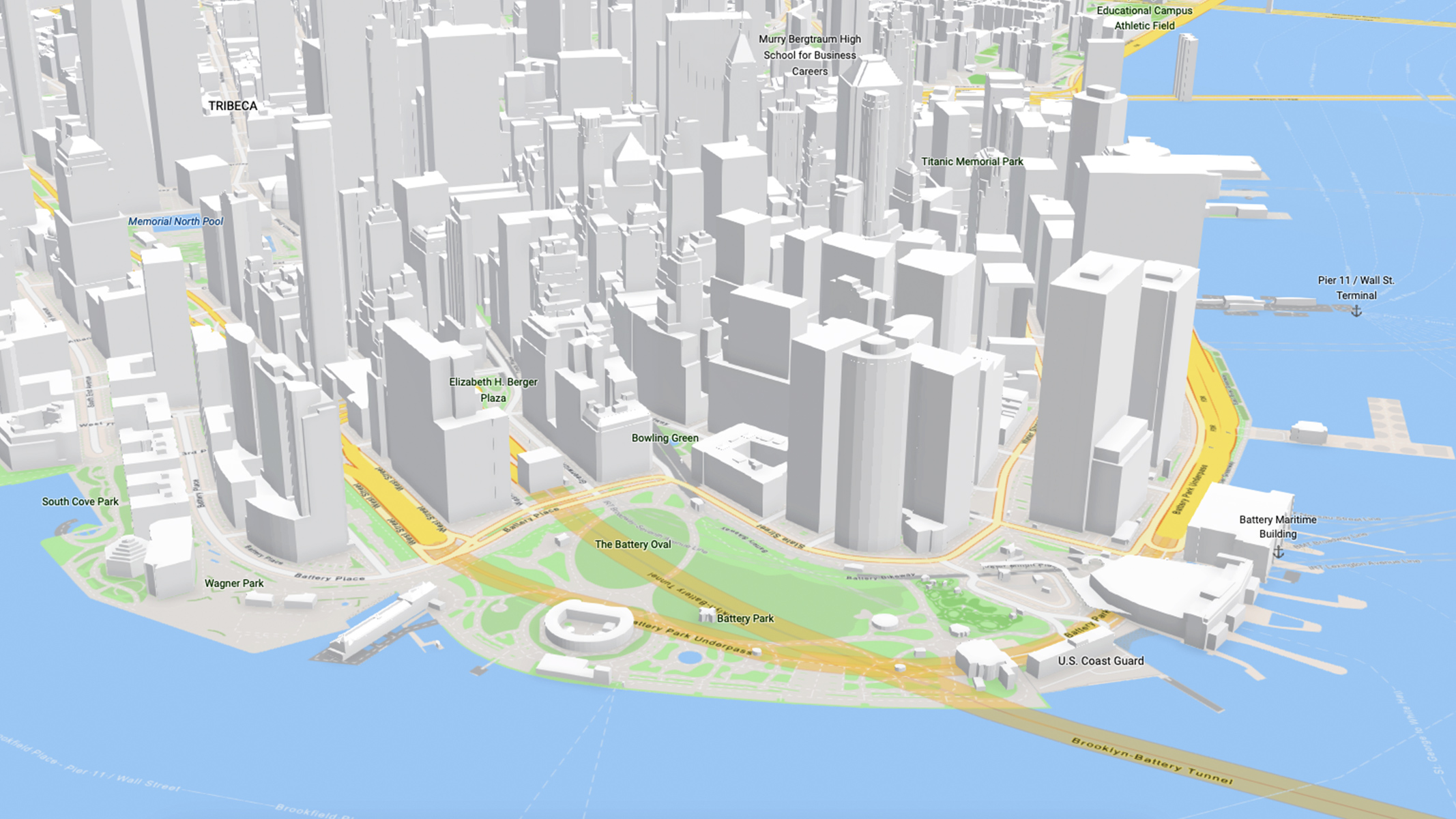
Access ready to use maps
Choose from a diverse range of pre-styled maps authored by a team of professional cartographers, or customize them according to your preferences.
-
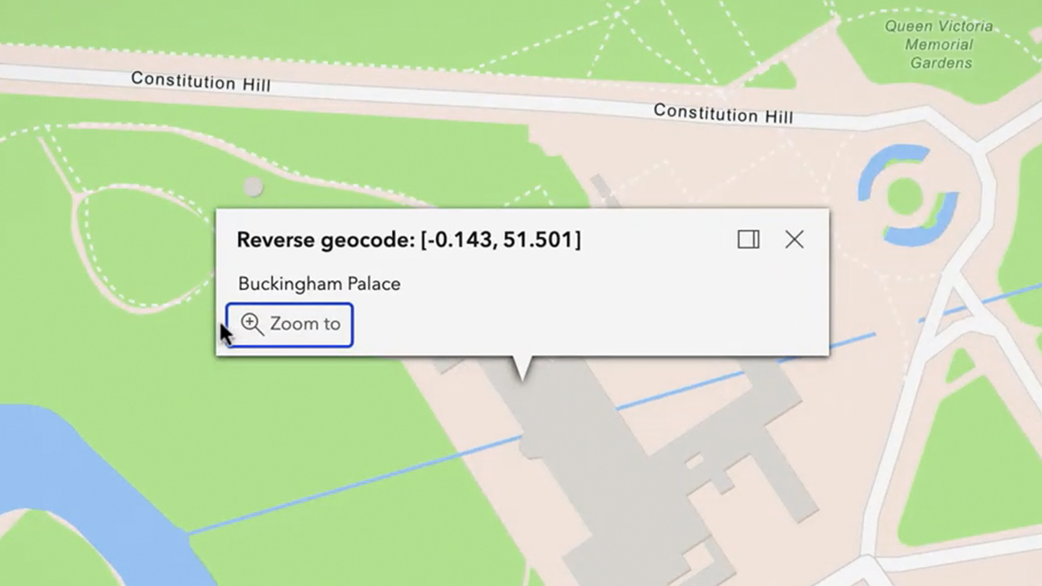
Find locations
Enable your solutions with address search, reverse geocode, address suggestions, and batch geocode.
-
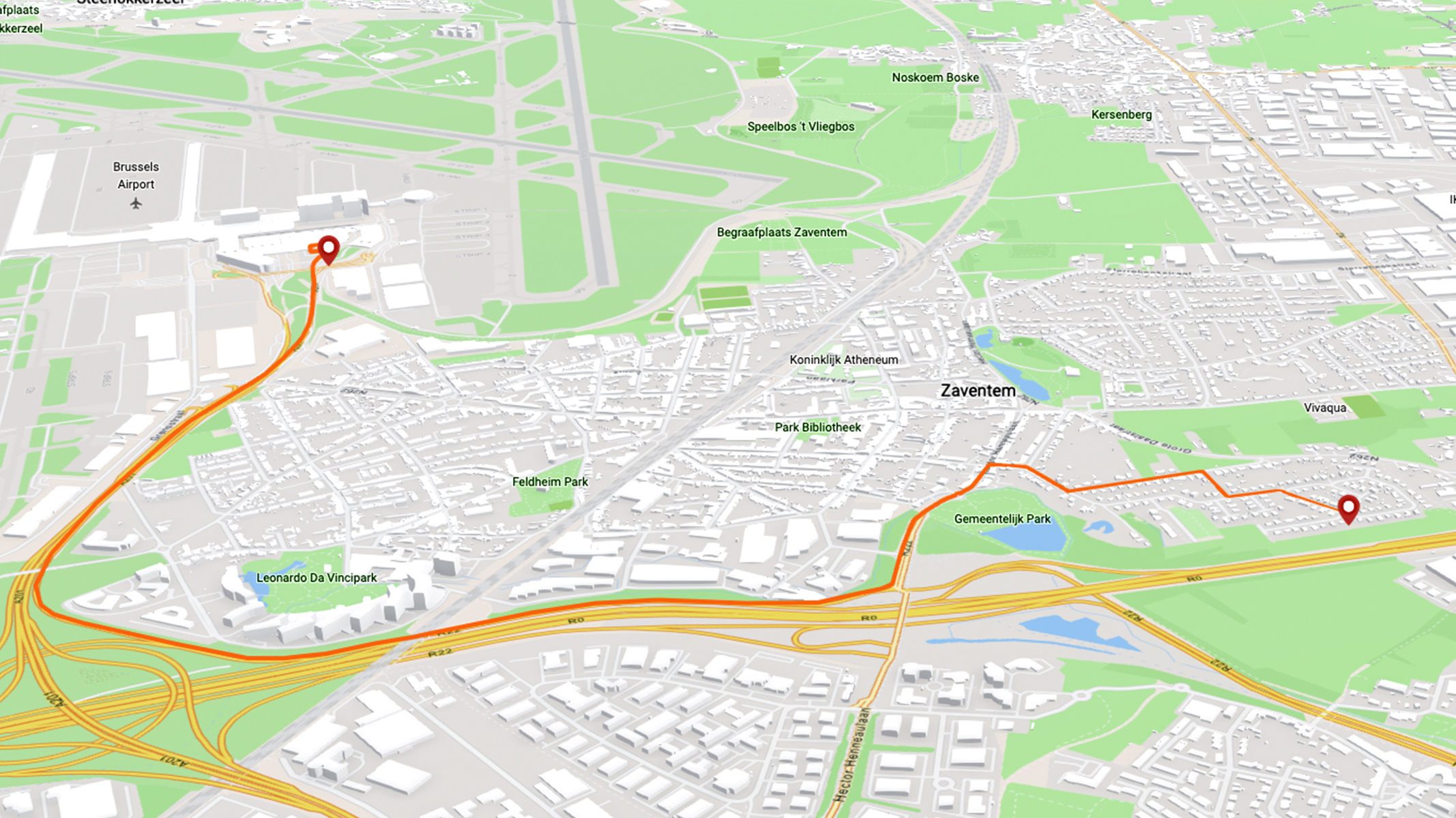
Get routes and directions
Get the capability to solve complex network problems like optimizing routes, finding the nearest facilities, defining service areas, and managing vehicle fleets efficiently.
-
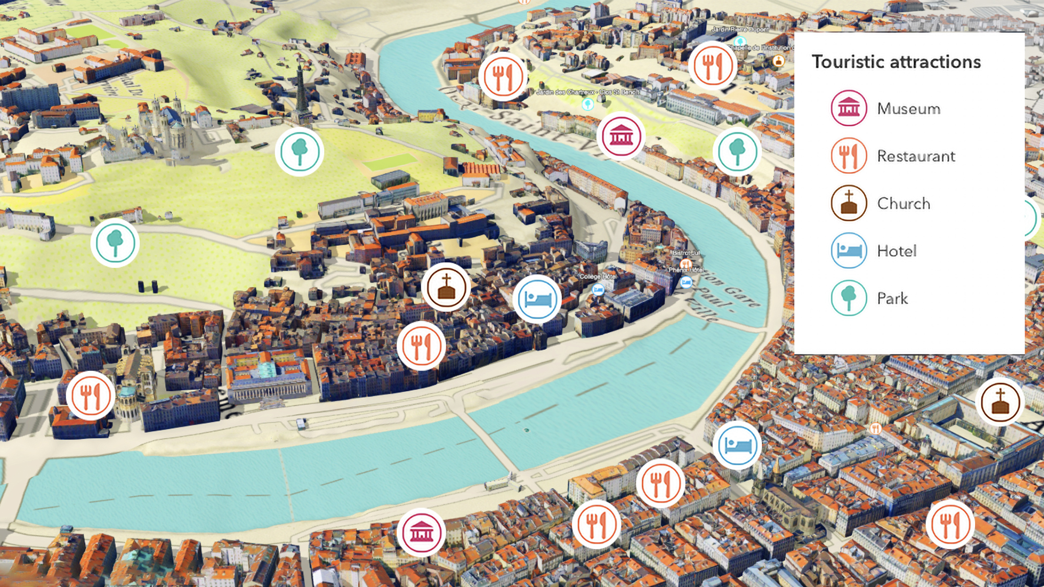
Explore places
Perform mapping and analysis and inform decision-making through a rich collection of global points of interest (POI) describing over 1,000 categories of features in the built and natural environment.
-
Enrich your data
Integrate data describing demographics for consumers and businesses in locations across the globe. Empower users to gain a deeper understanding of the people and places in any given area.
-

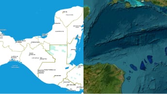
Find elevations for any location
Use Esri’s authoritative, global elevation service to enhance your apps and solutions. Get heights for locations above and below ground level, and sea level.


Previous
Next
Store, manage, and access your authoritative data
Experience a simple and secure solution for managing location-based data. Generate hosted layers and data services from your own data, enabling users to query, edit, and analyze data within your applications. You retain full ownership and control over your data and its use.
-
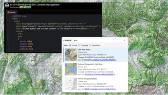
Content management
Leverage easy-to-use tools to create and manage maps, layers, data, and services that are securely stored and ready to scale.
-

Your data as a service
Instantly transform your data into a hosted service to support easy integration into applications that enable your users to execute sophisticated queries, modify data, and perform comprehensive analysis with ease and precision.
-
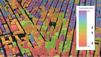
Feature data
Harness the power of feature services to manage, analyze, and visualize geographic data, empowering users to make informed decisions.
-
Vector and imagery tiles
Upload your data and generate vector or map tiles that help you optimize access for performance when visualizing large volumes of data.
Previous
Next
Discover relationships, patterns, and solutions with geographic data
Use spatial analytics capabilities to unravel complexities in your data.
-
Find data
Search for specific features or locations based on your criteria and derive new insights. For example, find all the parks in your city or all the restaurants near your house.
-
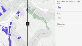
Combine data
Merge, overlay, and join multiple sources of data. For example, combine school and park location datasets to gain insights into accessibility indicators.
-
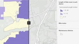
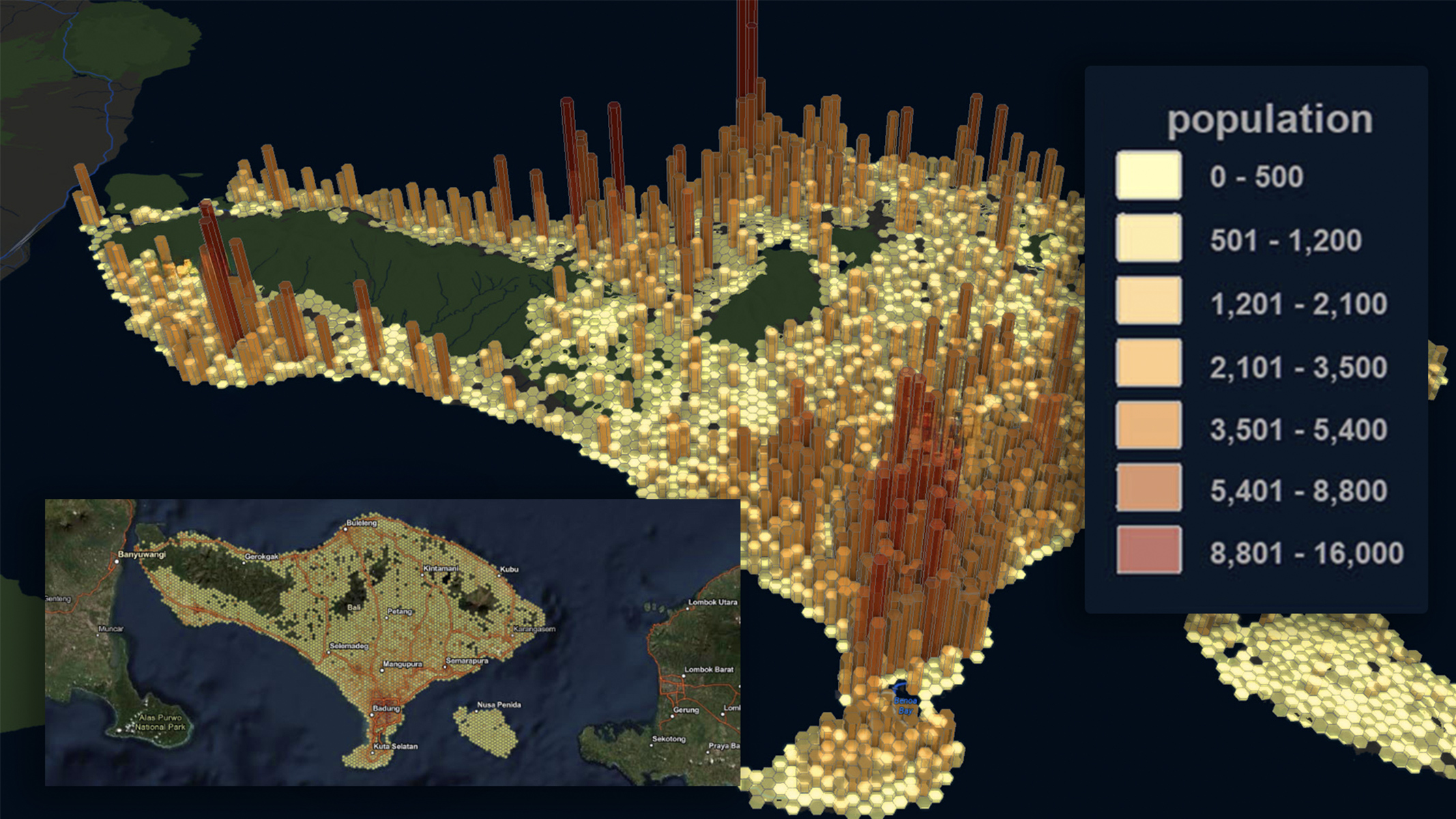
Summarize data
Calculate spatial summaries on your data. Aggregate points, join features to summarize nearby places or calculate centers, and analyze dispersion. For example, create a map of the population in different cities and get the average population density.
-
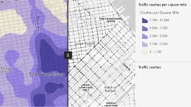
Analyze patterns
Perform analytical operations to identify spatial patterns and relationships. Find feature clusters, detect hotspots, and identify high-density areas.
-

Calculate geometries
Conduct geometric calculations on feature data to determine measurements, shapes, and create new feature data. These calculations are useful for analyzing spatial patterns and understanding feature geometry.
Previous
Next
Unlock the power of ArcGIS Location Platform
Create your account and take advantage of the free tier to access all the features and services of ArcGIS Location Platform. Then, pay only for what you consume with Esri’s pay-as-you-go model.