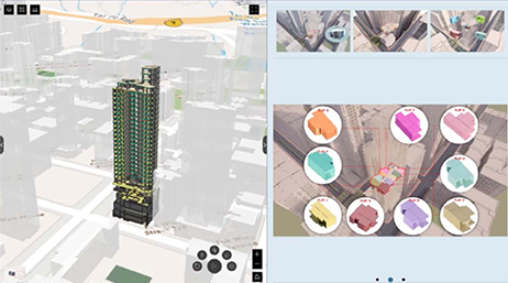
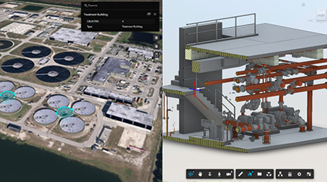
On-Site with a Construction Industry Digital Twin
Construction innovators use digital twins to monitor and predict what’s happening on the ground.
Explore resources for architecture, engineering, and construction organizations and connect with industry experts
Esri GIS heroes use geospatial technology to create innovative solutions, meet challenges, and inspire others to imagine how GIS can help them do their work better. Discover how five Esri AEC GIS heroes first learned about GIS.

On-Site with a Construction Industry Digital Twin
Environmental consulting

HDR improves data sharing with ArcGIS for AutoCAD
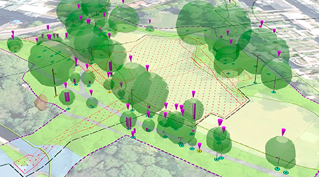
Geoenabling a Land Management Workflow
Key benefits of ArcGIS Living Atlas of the World
Modernize facility operations with ArcGIS GeoBIM
Visit Esri's AEC community site to read the latest product news, ask your questions, and browse the forums.

Stay on top of trends, technology advancements, and industry best practices related to GIS in AEC with our community webinars. The webinar series highlights subjects relevant to your organization's missions, workflows, and operations.

July 13–17, 2026 | San Diego, California
Discover how ArcGIS is being enhanced with AI to automate workflows and accelerate insights—empowering more people to turn complex data into geographic intelligence, measurable impact, and meaningful understanding.

Master ArcGIS software and learn best practices with instructor-led courses and e-learning opportunities.

Esri partners offer specialized solutions built on ArcGIS to solve your real-world challenges.
Speak with a representative.