Skip to Content

Environment

Understand patterns and trends to reduce environmental impacts

A heat map in red and blue on a satellite image of a pale green rural area, overlaid with a photo of an airplane in flight

As aviation continues to grow in all regions of the planet, aviation organizations are seeking ways to grow their capacity in a sustainable way that minimizes and monitors environmental impacts. GIS is contributing to the understanding of the natural environment, enabling evidenced-based decisions, and fostering a more sustainable environment for years to come.

Minimize and monitor environmental impacts

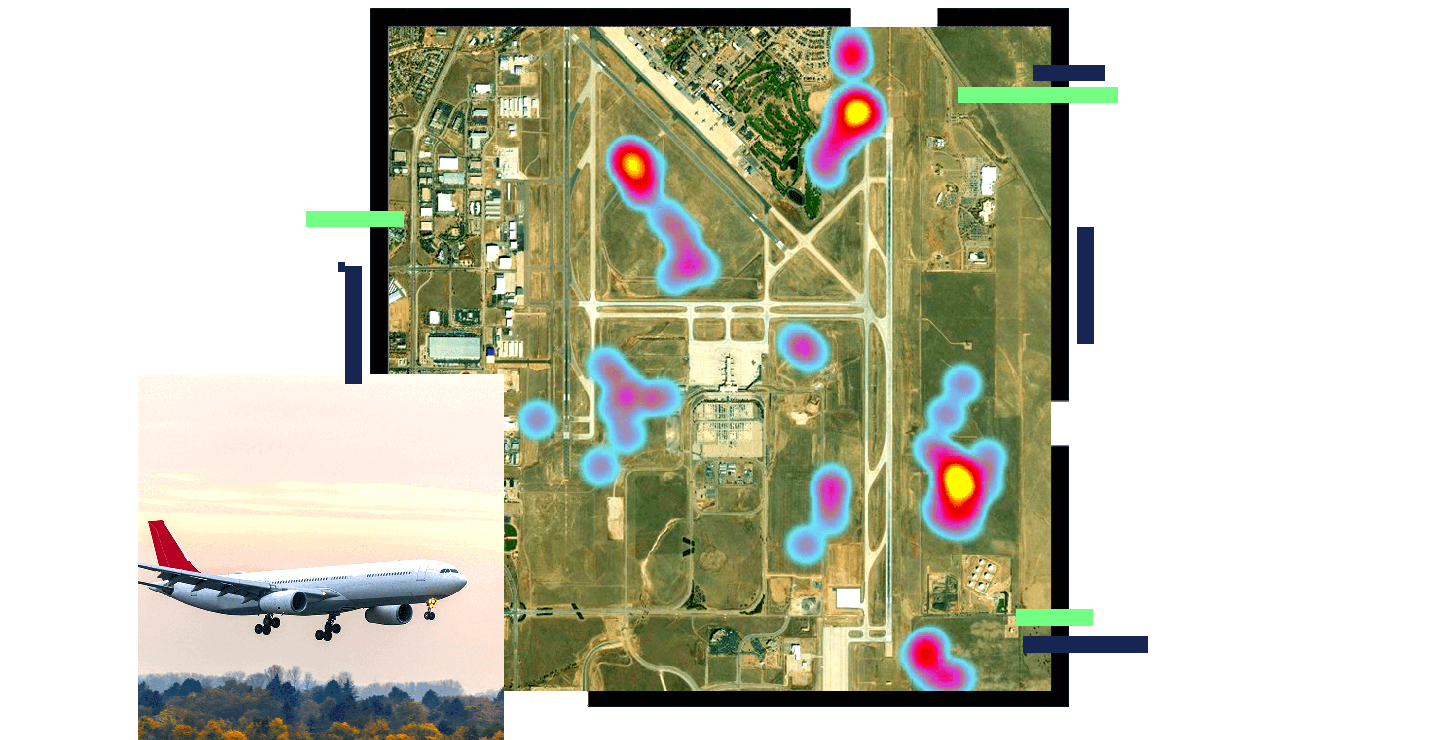
Protect wildlife habitat and maximize safety

Understand and adapt operations to minimize the occurrence of human-wildlife incidents, safeguarding wildlife habitat and ensuring safety. Equip field staff with mobile GIS for efficient field data collection. Analyze and report wildlife incidents to aviation authorities for regulatory compliance.

A photo of an airplane in flight as a flock of birds flies past, silhouetted against a hazy pale pink sky

Analyze and visualize noise impacts

Engage with communities and analyze and visualize the impacts of noise in and around airports to improve quality of life. Integrate noise models into GIS to visualize potential impacts on communities for airport and runway expansion projects.

A photo of an airplane in a bright blue sky, flying low over a tree and a white house with a red roof

Reduce CO2 emissions

Use GIS for historical flight track analysis. Understand how to optimize aircraft movements in airspace and airport sequencing to reduce CO2 emissions. Anticipate and recover from operational delays caused by traffic flow congestion.

A photo of an airport runway dimly lit beneath a heavily hazy yellow sky

Understand weather impacts

Gain insights into weather's impact on environmental challenges. Use GIS to understand how weather influences wildlife activity at airports and conduct damage assessment from weather-related events. Analyze prevailing winds to determine runway orientation for new airports and airport expansion projects.

A photo of a man in a headset watching a computer monitor, while large screens behind him display aerial storm pattern maps

Anticipate and recover from operational delay

Use spatial analytics and visualization to anticipate and recover from operational delays caused by traffic congestion.

A photo of four airplanes parked on a runway in a yellow and brown field beneath a bright blue sky

Products for environmental sustainability

Previous
Next

Contact sales

Contact us

Outside the United States

Connect with the Esri aviation team