With a population of just over 6,000, the City of Starke (Starke), Florida, operates one of the smallest municipal utilities in the state. But that doesn’t mean its tech stack is slight. For decades, the utility relied on institutional knowledge, veteran linemen who knew the power grid by memory, and 35‑year‑old paper maps to manage its infrastructure. Without a modern GIS implementation or digital records, the city faced growing operational risks and limited visibility into critical assets, including poles, attachments and lighting infrastructure. That changed when the city’s newly appointed director of utilities, David Sparks, deployed ArcGIS Online to manage and maintain the city’s grid.
The Challenge
Starke had no formal inventory of its utility poles, only estimates that’s ranged from 2,500 to 3,000 total. With limited internal resources and no prior digital records, the city faced a fundamental problem: how to cost‑effectively collect field data and populate its new ArcGIS instance with accurate, up‑to‑date information. Initial estimates to manually collect geolocated images for each pole, even without attribute or defect data, were drastically overbudget. The cost exceeded the city’s available funds and would not have provided the necessary asset intelligence to justify the investment. To keep costs low, the city tried to train its linemen to collect pole data manually in their spare time. After several months, it became clear that a new approach was needed—one that was fast, accurate, scalable and within budget.
The Partner
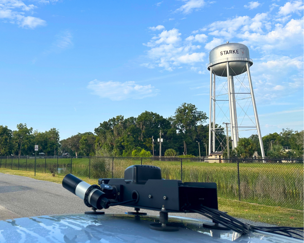
Recognizing the need for a technology‑forward solution, 1898 & Co. introduced the City of Starke to Noteworthy AI. Known for its vehicle‑mounted camera system and AI‑powered collection and analysis of utility asset data, Noteworthy AI offered a turnkey solution that addressed Starke’s needs far beyond simple pole counts. Instead of just capturing photos and locations, Noteworthy AI proposed a collection‑as‑a‑service model that would provide comprehensive field data using its vehicle‑mounted camera systems.
The Solution
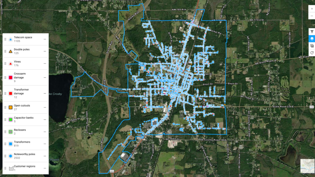
Their solution automatically captured geolocation and high‑resolution imagery for every pole, modeled asset inventories using AI, and detected defects, including structural issues and stubbed poles. Noteworthy AI also provided vegetation growth analytics, lighting audits and counts of joint‑use poles and those with third‑party attachments. All data was delivered directly into the city’s new ArcGIS Online system, furnishing an integrated and immediately actionable digital record of the grid. Over just two days, Noteworthy AI completed field collection across the entire service territory, capturing more than 2,300 utility poles in under seven hours of drive time.
The Results
In total, the project cost 80 percent less compared to traditional manual inspection methods. With its ArcGIS Online data fully populated, the City of Starke staff began making more informed decisions across grid planning, maintenance and storm response. Instead of relying on outdated maps or institutional knowledge, utility employees could access a centralized, searchable GIS with real‑time visibility into pole material, locations and ownership; streetlight status and condition; vegetation encroachment; asset defects; and anomalies like leaking transformers. The joint‑use audit delivered a full account of third‑party attachments across the system, helping the city reconcile billing records and recover missing revenue.
“This project was a big leap forward for our utility. Moving from institutional knowledge and paper maps to a fully digital view of our grid in ArcGIS gives us the tools to better serve our community. Noteworthy AI’s data collection ,ade this transition possible in a way that was affordable and fast.” – David Sparks