The City of Altamonte Springs sought a transformative way to understand, manage, and plan for its growing community’s infrastructure. The goal was to move beyond maps or static models to create a living, dynamic platform capable of evolving with changing needs and supporting smarter, more resilient decision-making.
Challenge
The City of Altamonte Springs needed a more advanced way to understand and manage both its built and natural environments. Existing tools provided limited visibility, making it difficult to view infrastructure in full detail, anticipate potential issues, and make fully informed decisions.
The City sought a solution that would enhance situational awareness, improve resilience, and support long-term planning. The challenge was to design a platform that could evolve alongside the City’s needs, offering a dynamic view of infrastructure and environmental conditions while enabling proactive management.
Solution
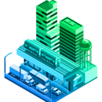
ETM, an Esri Gold Partner, brought its Geospatial Technologies Group to lead the effort. This specialized team combined expertise in GIS, remote sensing, 3D modeling, and data integration with a collaborative approach tailored to the City’s vision. ETM designed and deployed a Digital Twin platform that integrates Esri’s geospatial technologies to deliver unprecedented detail and interactivity.

The solution incorporates high-resolution 3D models, real-time sensor data, and scenario planning capabilities.

Working closely with City staff, ETM ensured the platform would serve not only as a visualization tool but as a decision-support system capable of modeling outcomes, anticipating challenges, and guiding infrastructure investments.
Results
The City of Altamonte Springs now has a powerful digital platform that enhances situational awareness and supports data-driven governance. The Digital Twin allows officials to visualize infrastructure with precision, anticipate environmental and structural impacts, and plan more effectively for the future. This initiative has strengthened the City’s ability to make resilient decisions, improved operational efficiency, and delivered tangible benefits to the community.
The collaboration between ETM, Esri, and the City demonstrates how innovative technology and strategic partnerships can revolutionize local government operations and infrastructure planning.

Learn more about location intelligence for AEC:
GIS for Architecture, Engineering, and Construction.
Stay Connected with Esri’s AEC Team:
Subscribe to the AEC industry newsletter “Esri News for AEC”.