When people talk about digital twins, the focus often starts with visualization. We see highly detailed 3D models, accurate building geometry, and rich design data brought to life on screen. Those elements matter, but they are only the starting point. From an infrastructure life cycle management perspective, a digital twin reaches its true potential when it becomes operational and actively supports the day-to-day reality of operating a building or campus.
That is where indoor GIS comes in.
Moving Beyond Static Representations
An operational digital twin is not just a digital copy of a facility. It is a system of record that reflects what is happening inside a space and helps people plan, make decisions, and respond. Design and construction models capture intent and precision, but operations require context. They require an understanding of how space is used, how people move, how assets are maintained, and how conditions change over time.
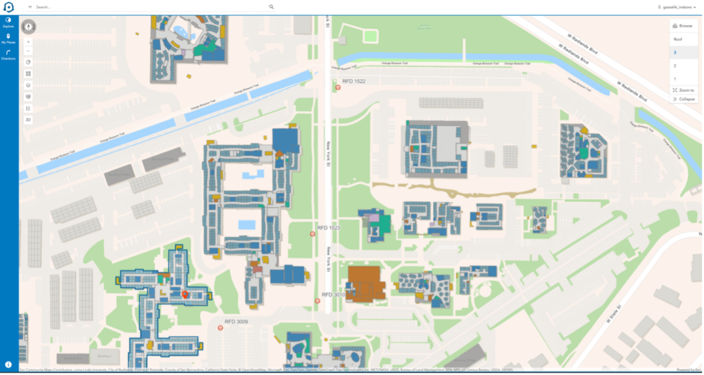
Indoor GIS helps organizations make this transition. ArcGIS Indoors enables indoor map creation from floor plans and turns indoor spatial data into a living system of record that connects buildings, people, and operational data in one place. Instead of relying on static floor plans or disconnected systems, teams gain a shared understanding of indoor space that is accessible across roles and departments.
Why Indoor GIS Matters Once a Building Is in Use
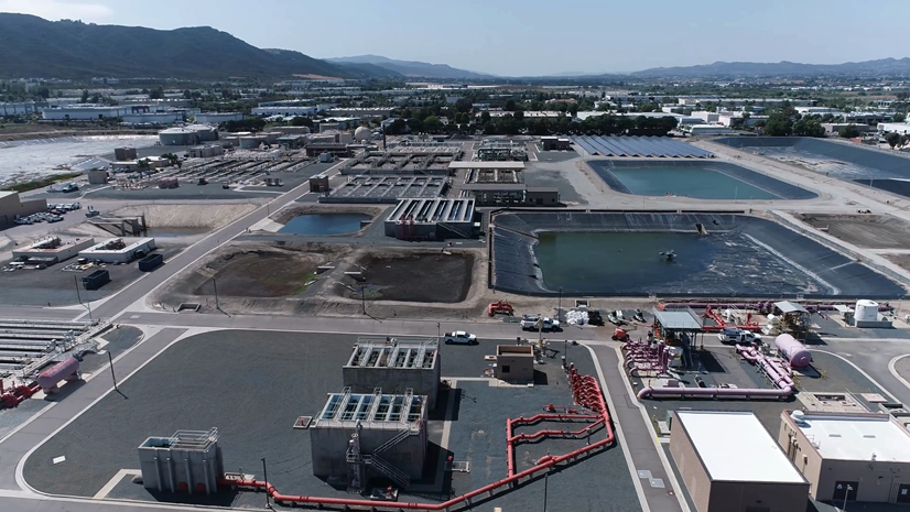
Most of a facility’s cost and complexity occurs after construction is complete. This is when buildings are occupied, maintained, secured, and adapted to changing needs. Decisions made during operations affect safety, efficiency, and the overall experience of everyone who uses the space.
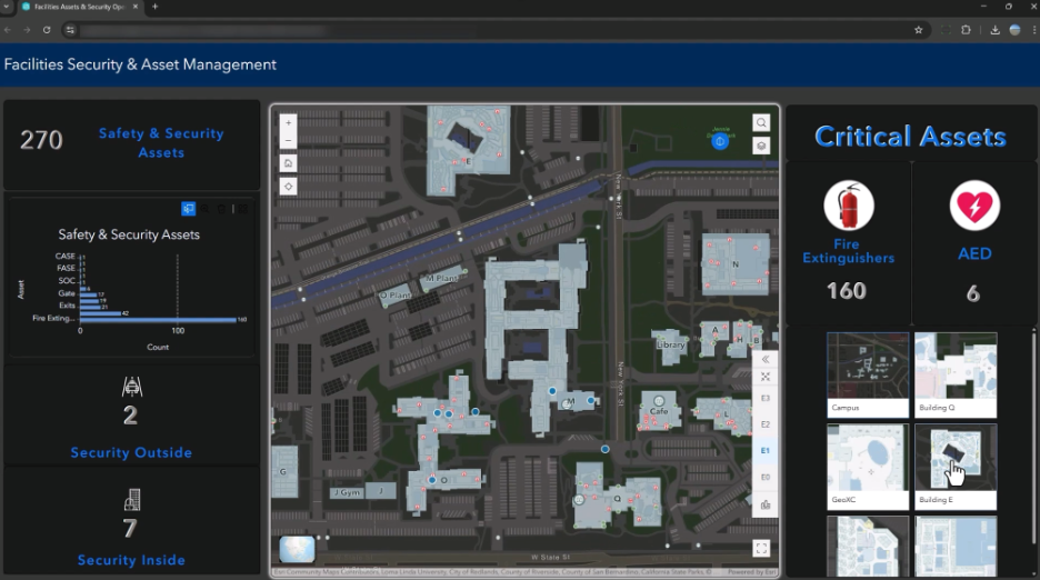
ArcGIS Indoors is designed specifically for powering this phase with floor-aware indoor maps. It enables organizations to understand how space is allocated and used, assets are mapped and maintained, and occupants are supported with wayfinding and workplace experiences. Then, organizations can integrate indoor data with enterprise work order and asset management systems, real-time feeds like occupancy, temperature, humidity, and bring in video streams. All of this contributes to a digital twin that is not just accurate, but living and useful. In an operational context, location matters. Knowing where something is inside a building often determines how quickly and effectively a team can act. ArcGIS Indoors ensures that spatial context is always part of the conversation.
Indoor Space Is Where Operations Become Human
GIS has long helped us manage large systems like cities, transportation networks, and utilities. Indoor space operates at a different scale. Indoors is where people work, receive care, learn, and respond to emergencies. It is personal, time sensitive, and often complex.

An operational digital twin must work at this level. ArcGIS Indoors supports this by enabling accurate indoor mapping, routing, role based maps and apps, and dashboards, and a consistent indoor information model that can scale from a single building to an entire portfolio. The goal is not just to represent space, but to make it understandable and actionable for the people inside it.
Indoor GIS for Integration and Action
One of the most important shifts we are seeing is the move from indoor maps as standalone products to indoor GIS as a platform, that acts as an integration surface where everything is aligned by location – floors, rooms, assets, people, and real-time signals. To construct floor-aware indoor maps and a system of record, Owner/Operators can start with CAD and BIM when available, and PDFs. They can also use LiDAR point clouds from building scans when there is no digital floor plan.

Organizations can then:
- Visualize buildings and campuses in 2D and 3D
- Provide visitors and occupants with indoor navigation with indoor positioning
- Plan and optimize their space use, enable workspace reservations
- Capture and integrate 360-degree photos with indoor maps
- Configure custom indoor mapping experiences with ArcGIS Experience Builder
- Create analytical dashboards
- Support facilities’ maintenance and inspection activities
- Create custom indoor applications with Maps SDKs
- Layer on IoT, building management systems, occupancy and ambient sensors
Organizations can also integrate with facilities, work order and asset management systems, security and emergency workflows, and sensor data that reflect real time conditions.
When these systems come together, the digital twin becomes operational in a meaningful way. It supports decisions instead of just displaying information. It helps teams understand what is happening now and what actions need to be taken next.
What This Means for the AEC Community
For architects, engineers, and construction professionals, operational digital twins create an opportunity to extend value far beyond project delivery. Owners and operators are increasingly looking for solutions that help them run their facilities more effectively over time.
ArcGIS Indoors provides a bridge between design data and operational needs. When indoor GIS is considered early and aligned with BIM and enterprise business systems, the result is a digital twin that continues to deliver value long after a building opens.
Looking Forward
As buildings become more connected and operations more data driven, indoor spatial awareness will only grow in importance. Our goal with indoor GIS is to make indoor environments operationally visible and accessible as the outdoor world has been through GIS for decades.

Operational digital twins are ultimately about people. They are about giving teams the information they need, in the moment they need it, within the spaces where work happens. Indoor GIS plays a central role in making that possible.
For more information, visit the indoor GIS and ArcGIS Indoors websites.