A Customer Spotlight
Wheatland Electric Cooperative (WEC) serves approximately 32,000 meters across a broad service area in central and western Kansas and eastern Colorado. The cooperative operates a complex network of transmission and distribution lines, substations, and other infrastructure. Ensuring the reliability and safety of its service is paramount.
Challenge
WEC faced significant challenges related to its manual inspection processes. The cooperative’s mobile crews used forms and spreadsheets to record inspection data, leading to incomplete information and inefficient data analysis. Sometimes, crews had to make return trips due to incomplete information collected during the initial inspection.
The lack of real-time visibility into inspection and repair progress made it difficult for managers to track the status of work orders. The cooperative needed a more efficient way to manage its inspections and ensure data accuracy. Specifically, it struggled with capturing inspection data in a structured format, analyzing the data, and providing real-time visibility into the progress of inspections and repairs.
Solution
To address these challenges, the cooperative implemented ArcGIS Field Maps and ArcGIS Dashboards, leveraging its Small Utility Enterprise Agreement. Implementing Field Maps and Dashboards was a strategic decision to modernize the inspection workflow.
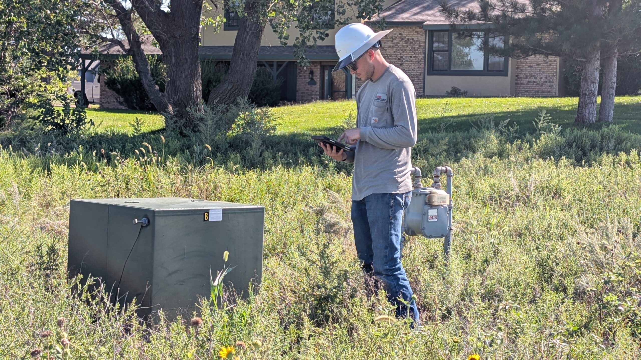
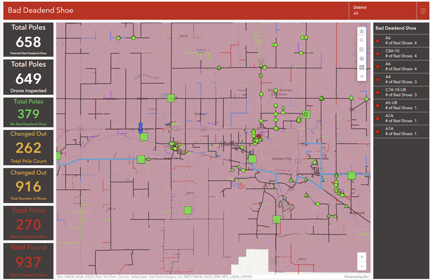
New mobile inspection forms automatically capture location, time, and inspection details. Field Maps allowed crews to access critical information about assets and infrastructure in real time, improving data accuracy and reducing the risk of errors. The utility also used Dashboards to provide real-time visibility into inspection and repair progress for managers. All viewers see consistent color coding and a single source of truth for inspection status and repair types.
The IT team collaborated closely with Esri representatives to design and implement the solution, ensuring a seamless transition from their manual processes.
Results
The implementation of ArcGIS at Wheatland Electric Cooperative yielded significant results, including very positive employee feedback. The main benefits include streamlined fieldwork and reduced time to analyze inspection and repair information.
The cooperative improved documentation, reduced the time required to analyze inspection and repair information, and enhanced managers’ visibility into inspection and repair progress. The cooperative experienced a notable improvement in the accuracy and completeness of its inspection data, enabling more informed decision-making. According to Curtis Peterson, operations manager, the solution brought “increased efficiency and tracking to our operations. The maps are very user-friendly as well.” Similarly, WEC addressed other inspection workflows by placing them on the same map, including meters, pad mounts, and instrument-rated meter examinations.
The cooperative plans to expand its use of Esri solutions, add additional inspection types, and is currently working on a trouble ticket app and a storm app using ArcGIS QuickCapture.
By leveraging these ArcGIS tools, the cooperative improved real-time data sharing, enhanced mobile/offline capability, and integrated with existing systems.

