Every year, Autodesk University brings together the innovators, builders, engineers, architects, and technology leaders shaping the future of the Design and Make industries. It’s where ideas are demonstrated as solutions; it’s where industry trends are proven to be real; and it’s where the technology partnerships changing our industry come to life.
For AEC professionals navigating complex infrastructure challenges, AU 2026 offers something unique: the opportunity to experience the Esri and Autodesk relationship firsthand.
As infrastructure owners and operators look to connect planning, design, construction, and operations, the convergence of GIS and BIM has never been more important. Together, Esri and Autodesk are helping organizations create a shared understanding of projects, assets, and places. At AU, you’ll see how that vision moves beyond theory and into real-world workflows that deliver measurable business value.
This is where geography meets design. Where digital twins become operational. Where disconnected data becomes a living source of insight.
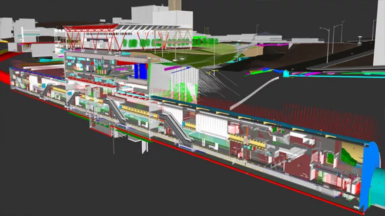
Experience the Esri + Autodesk Vision in Action
For years, Esri and Autodesk have been working together to bridge the gap between geospatial intelligence and design. Today, that collaboration is helping firms and owners create connected, data-driven solutions that improve decision-making throughout the entire asset lifecycle.
Autodesk University is the place to see this partnership at work.
Whether you are involved in architecture, engineering, construction, transportation, utilities, water, facilities management, or asset operations, you’ll discover how GIS and BIM can work together to provide a more complete picture of the built environment.
Visit Esri at Booth #4317 to explore how organizations are:
- Connecting GIS and BIM workflows across planning, design, construction, and operations
- Building living digital twins that continue delivering value long after project completion
- Creating a continuous digital thread across infrastructure assets
- Improving collaboration between project teams and operational stakeholders
- Enabling smarter, more informed decisions with location intelligence
Through live demonstrations, conversations with experts, and examples of customer success stories, you’ll gain real world insight into how a wide range of companies and owner/operators have changed the way infrastructure is designed, built, and managed.

More Than Technology. A Community of Innovation.
One of the most valuable aspects of Autodesk University is the opportunity to connect with the people driving change across the industry.
Throughout the event, Esri experts, Autodesk specialists, customers, partners, and industry leaders work together to share lessons learned from real projects and industry initiatives around the world. These conversations often spark new ideas, uncover new opportunities, and help attendees understand what’s possible within their own organizations.
You’ll see how infrastructure owners, engineering firms, contractors, and facility operators are using connected data to break down silos, reduce risk, improve project outcomes, and better serve the communities that depend on their assets.
Featured Sessions from Esri
This year’s Esri-led sessions showcase how connected GIS, BIM, and digital twin workflows are helping organizations move from isolated project information toward holistic asset intelligence.
Building Operational Twins with Indoor GIS: Where BIM, CAD, and Facility Data Go to Thrive
Technical Deep Dive
Tuesday, September 15 | 11:30 AM – 12:30 PM PDT
Speakers: Gokce Ozcelik, Michael Davidson, William Isley (Esri)
Learn how organizations are building operational digital twins that improve facility management, situational awareness, and decision-making through the integration of BIM, CAD, and Indoor GIS.
AEC Meets GIS: Autodesk Platform Services Viewer and Esri’s MapLibre SDK for Construction and Asset Intelligence
Technical Deep Dive
Tuesday, September 15 | 3:00 PM – 4:00 PM PDT
Speakers: George Owen (Esri), Michael Beale (AWS)
Discover how geospatial technology and construction data come together to provide greater visibility into projects, assets, and operational performance.
When BIM and GIS Stay Connected: Esri and Autodesk’s Path to True Cloud Interoperability
Technical Deep Dive
Tuesday, September 15 | 3:00 PM – 4:00 PM PDT
Speakers: Nora Nanov and Michael Davidson (Esri)
Explore how Esri and Autodesk are advancing cloud-based interoperability and reducing barriers between design and geospatial workflows.
Revit and CAD to Operational Digital Twins: Indoor GIS for Facilities Teams
Technical Deep Dive
Wednesday, September 16 | 4:30 PM – 5:30 PM PDT
Speakers: Adan Banda (Dallas Fort Worth International Airport), Gokce Ozcelik and William Isley (Esri)
See how airport and facilities teams are transforming design information into operational intelligence that supports everyday decisions and long-term asset management.
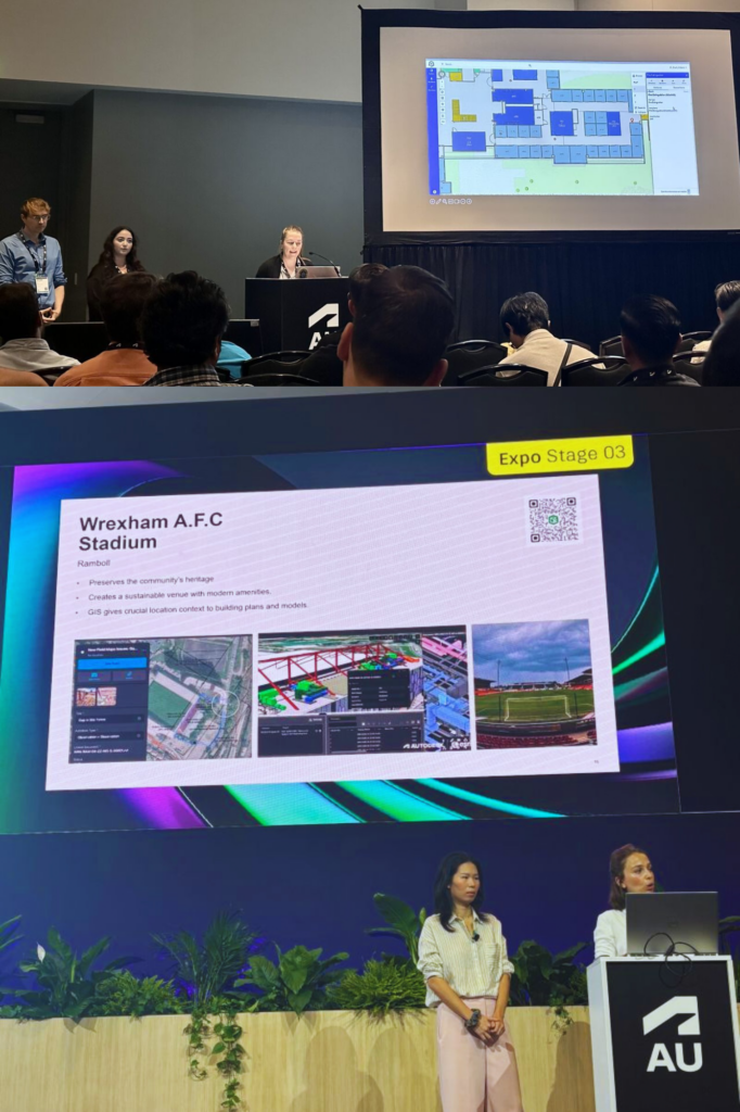
The Future Is Connected
The future of infrastructure will not be defined by a single application, platform, or dataset. It will be defined by how effectively organizations connect information, people, and processes across the entire lifecycle of an asset.
That future is being built today through the combined strengths of Esri and Autodesk.
At Autodesk University 2026, you’ll have the opportunity to see that future firsthand. You’ll discover how GIS, BIM, and living digital twins are helping organizations create more resilient infrastructure, deliver better projects, operate assets more effectively, and make smarter decisions with confidence.
Join us at Autodesk University and experience the Esri + Autodesk relationship in action. See what’s possible when design, geography, and operations come together to create the connected infrastructure of tomorrow.