Challenge
Submarine cables are the backbone of the modern internet. Over 1.5 million kilometers of cable lie on the ocean floor, carrying 99% of all global intercontinental internet traffic. For nearly 30 years, Makai Ocean Engineering has been the leader in software that engineers use to plan and install these cables. Its flagship products, MakaiPlan for route design and MakaiLay for real-time cable installation, are used on 95% of the world’s telecom cable-laying ships and have been used to lay over 1 million kilometers of cable since 2000.
Despite that dominance, Makai’s planning software had a growing problem. Its GIS layer was built on a 32-bit application that had become slow and outdated. Because the GIS engine underpinned the entire product, Makai’s software inherited every limitation: sluggish rendering, constrained memory, limited functionality and a workflow that frustrated users daily.
The old platform also relied on Microsoft Access database files (MDB). Most customers received their geospatial data as shapefiles, which meant they had to convert files in ArcGIS Pro or another tool, load the converted MDB files into Makai, do their work, and then convert everything back for delivery. This round-trip added time and friction to every project.
The performance gap was stark. Designing a detailed cable route that once took a couple of weeks of manual clicking and review could now be envisioned in minutes, but only if the underlying platform could keep up. Makai knew it needed a modern foundation to close that gap.
Solution
Makai committed significant investment to a ground-up rewrite of its planning software, selecting the Esri ArcGIS platform as its new GIS foundation. The move to a 64-bit, GPU-enhanced architecture delivered an immediate and dramatic performance improvement.
The new MakaiPlan is built on the ArcGIS Runtime SDK, giving Makai’s developers a flexible, high-performance framework for their custom application. Key capabilities of the rebuilt platform include:
- Drag-and-drop data loading: Users can pull shapefiles, bathymetry grids, KML, DXF, and geopackage files directly into the map without conversion.
- Live services: WMS layers such as real-time weather maps stream seamlessly alongside project data.
- ArcGIS Enterprise integration: Makai connects to its Azure-hosted ArcGIS Enterprise portal, letting users browse and drop portal content onto the map.
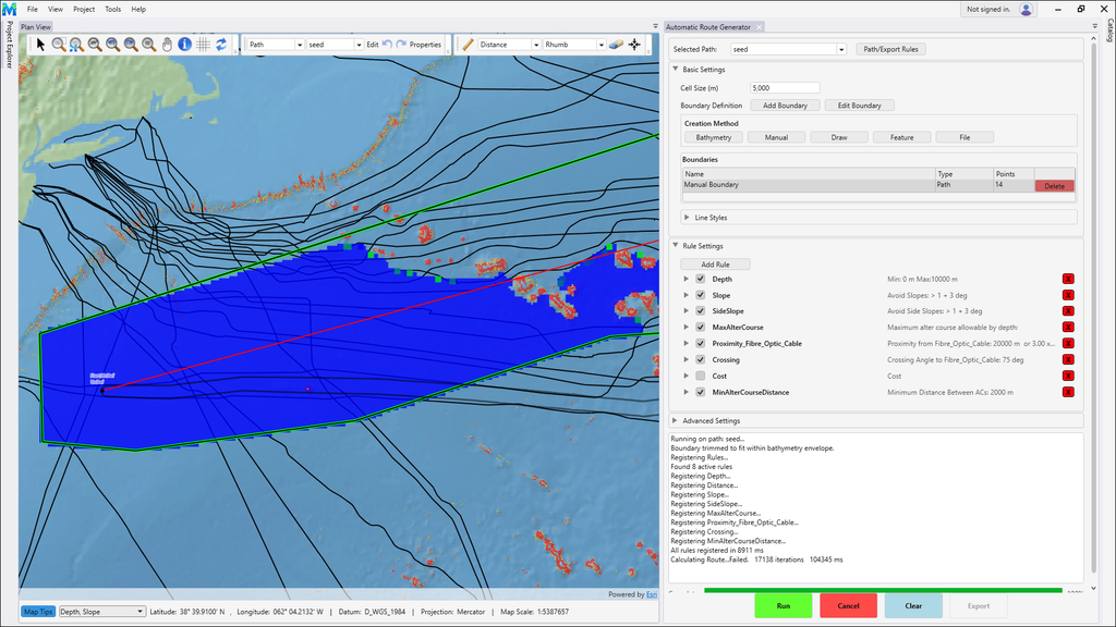
- Automated cable routing: Given a start and end point, the software calculates an optimal cable path automatically based on cost and technical risk rules.
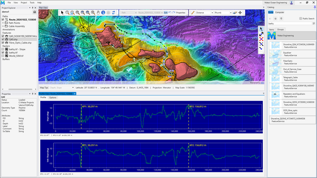
- Rich analysis tools: Users can inspect depth profiles, side slopes, and aspect along any route, with interactive map tips for point-by-point queries.
- Native format support: Routes export directly to KML, DXF, shapefile, and ArcGIS Pro, eliminating the MDB conversion round-trip entirely.
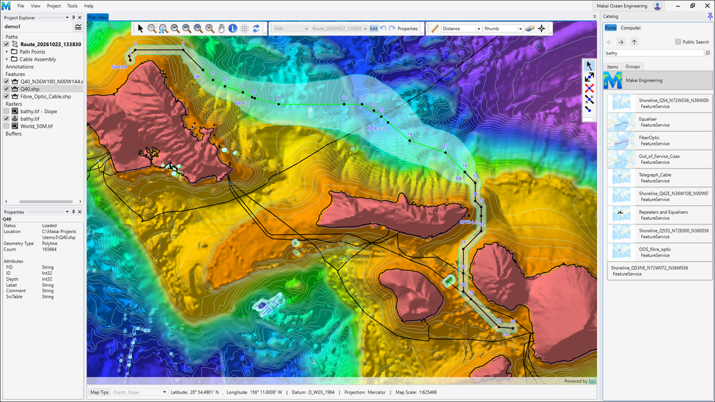
Because nearly every customer already runs ArcGIS Pro, the format alignment means data flows in and out of MakaiPlan without intermediate steps. The Esri SDK also proved easy to adopt. Makai’s development team found the API intuitive and the technical support responsive, which accelerated the rebuild and gave confidence for future work, including a planned 3D visualization mode for cable deployment.
Results
The performance gains from the ArcGIS platform are transformative:
- Route design time reduced from weeks to minutes. A detailed cable route that previously took a couple of weeks of manual effort can now be generated in about 10 minutes.
- No more format conversion. With native shapefile, KML, DXF, and ArcGIS Pro support, the MDB round-trip is gone, saving time on every project.
- A dramatically smoother user experience. Drag-and-drop data loading, live WMS services, and GPU-accelerated rendering make the software fast and intuitive.
Customers are eager for the release. Makai released the new MakaiPlan in October and the firm’s strong reputation and dominant market position, built over decades in a specialized industry, mean the upgrade will reach the vast majority of cable-laying operations worldwide.
With the planning software rebuilt on ArcGIS, Makai is already looking ahead. The next phase includes converting MakaiPlan Pro and MakaiLay, the cable installation software, to the same ArcGIS foundation over the coming two years, and adding 3D cable visualization within the next six months. The ArcGIS SDK’s ease of use gives the team confidence that these next capabilities will come quickly, continuing to push the boundaries of what is possible in submarine cable engineering.
Learn more about location intelligence for AEC:
GIS for Architecture, Engineering, and Construction.
Stay Connected with Esri’s AEC Team:
Subscribe to the AEC industry newsletter “Esri News for AEC”.