Making safety programs more measurable, repeatable, actionable, and compliant
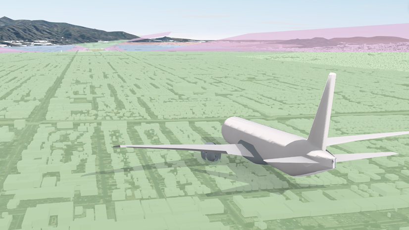
Safety is about Where
If you’ve ever actually listened to the pilot’s pre-flight “Welcome Aboard” PA announcement, you’ve heard the core message: on time performance and customer service matters; however, safety comes first. At airports, that priority expands beyond flight operations into a complex environment of facilities, movement areas, people, vehicles, and changing conditions. In practice, “safety” at an airport includes everything from inspections and incident reporting to hazard identification, risk controls, and environmental factors like severe weather. These are inherently tied to “where” something happened, which is innately why location matters.
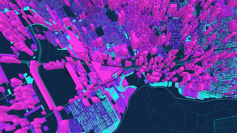
Airport safety is an all-encompassing responsibility (airside/landside operations, passengers, crews, and ramp teams). Location is crucial for safety because understanding exactly where hazards or incidents occur enables airports to be more proactive, respond quickly, identify patterns, and implement targeted risk controls throughout their complex operations. Since safety concerns are inherently linked to their geographic locations, Geographic Information Systems (GIS) is the technology solution perfectly suited for structuring, managing, and enhancing airport safety processes.
Not Just a Good Idea, It’s the Law
Aside from the core expectation that they must be safe places; airports are required by regulations to formalize safety systems for compliance. It’s common knowledge that the FAA is implementing requirements pertaining to Safety Management Systems (SMS), primarily affecting airports certified under FAR Part 139. Compliance timelines begin in 2027, with the possibility of extensions. It is anticipated that these regulations may be expanded to encompass a wider range of stakeholders as the FAA’s SMS Program evolves. FAA guidance encourages airports to see SMS as a top-down, organization-wide approach focused on proactively managing hazards and risk, not just reacting to incidents/accidents. With location at its core, effective and compliant SMS includes systematic procedures, practices, and policies, plus evaluating whether risk mitigations are effective over time.
Safety is About Collaboration
Airport safety is not just handled by one team or program—it’s a comprehensive, collaborative approach that affects everything, from airside and landside operations to passengers, crews, contractors, inspections, and even disruptions caused by weather. When safety is a shared responsibility, maintaining consistency becomes a key challenge. It is essential to identify safety issues quickly and uniformly, assess them using standardized criteria, and demonstrate the effectiveness of mitigation measures over time. That’s exactly why GIS fits so naturally as a foundational technology for intelligent airport safety management.
SMS is not just about reacting to incidents and accidents; it also focuses on:
- Identifying hazards proactively
- Assessing risk consistently
- Identifying causal factors
- Putting mitigations in place
- Monitoring the effectiveness of risk controls over time
- Auditing and iterating best practices
SMS transforms safety from a collection of unrelated activities into an organized information management system. For many airports, it is closely associated with regulatory compliance requirements, timelines, and audit processes, rather than solely relying on voluntary safety initiatives.
GIS Becomes an SMS Force Multiplier
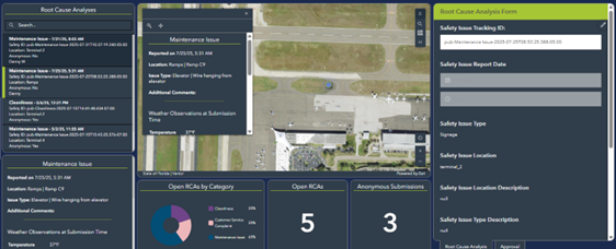
Airport operations are inherently location-based: runways, ramps, taxiway segments, gate areas, terminals, parking garages, access roads, work and inspection zones, and more, which is why location intelligence is key to supporting an airport’s SMS. GIS helps by making “where” a decisive part of the safety workflow.
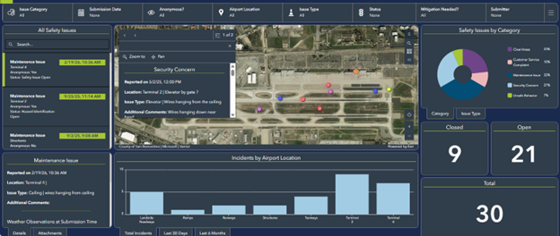
With GIS in place, airports can easily:
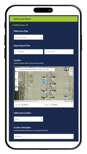
- Standardize how hazards and observations are recorded (with consistent locations)
- See patterns that aren’t obvious in spreadsheets (hotspots, clusters, repeat issues, and trends)
- Connect safety events to assets, work orders, inspections, and maintenance history
- Communicate risk visually across teams (maps facilitate shared understanding)
GIS delivers a unified, collaborative operational view that helps maintain safety and compliance.
What Airports Can Do Now (Practical First Steps)
If your airport is just starting the SMS and GIS integration to modernize safety and compliance, these steps can help rapidly build momentum:
- Inventory current safety workflows (inspections, reporting, corrective actions, audits)
- Identify the location-based data you already collect (even if it’s informal)
- Standardize simple hazard/event intake forms/surveys and make location a required input
- Start with one high value map (e.g., hazard hotspots or inspection findings over time)
- Define “effectiveness checks” so mitigations can be measured, not just logged
Key Takeaways
Airport safety is a multifaceted responsibility that extends across all operational areas and is fundamentally tied to location, making GIS the ideal technology for structuring and enhancing SMS. As regulatory requirements increasingly mandate formalized safety procedures, airports must adopt systematic approaches to hazard identification, risk assessment, and mitigation.
- Airport safety is broad, complex, and inherently location driven.
- SMS is about managing risk systematically, not just documenting incidents.
- GIS inherently aligns with SMS, as it structures safety information based on “Location/Where” which corresponds to actual operating environments.
- Standardizing inputs and producing simple, repeatable location-based outputs result in the quickest wins and return on investment.
GIS empowers airports by standardizing safety data, visualizing patterns, connecting incidents to assets, and facilitating collaborative risk management. Integrating GIS with SMS allows airports to proactively manage risks, demonstrate compliance, and measure and visualize the effectiveness of their safety initiatives. GIS is transforming safety at airports into an organized, actionable system focused on continuous improvement. Safety happens by design, not by accident.
To Set the Foundation of Your Own Intelligent Airport: Download our guide to understand how you can shape your airport’s strategic approach.
I’d rather be flying. . .