Picture this. You have a $40 million drilling program ready to roll. The permits look solid, the geology is exciting, and your team is fired up.
Then someone in the land department makes a phone call. A surface access agreement expired six months ago. A neighboring claim overlaps your eastern boundary by 200 meters. And the county just reclassified a wetland buffer that cuts right through your planned haul road.
Everything stops.
Here’s the frustrating part: every one of those problems was sitting in plain sight. The data existed. The dates were recorded. The boundaries were drawn in someone’s system. What was missing was a workflow that connected the dots and raised a flag before that phone call.
That’s what this piece is about. Not GIS as a tool for making exploration cross-sections, but GIS workflows in land management: the repeatable spatial processes that tie your mineral rights, permits, surface agreements, compliance deadlines, and financial obligations into something you can actually manage.
Ten of them matter most. They follow the life of a mine from staking your first claim to final reclamation. If you’re missing even two or three, you’re carrying risk you probably can’t see yet.

Tenure and Mineral Rights Administration
This is the foundation. Everything else in mining land management sits on top of your tenure data, so if it’s messy, everything downstream is messy too.
The workflow is simple to describe and hard to execute well: keep an authoritative, spatially referenced record of every claim, lease, permit, and title you hold, with status, ownership, obligations, key dates, and linked documents all tied to real geometry.
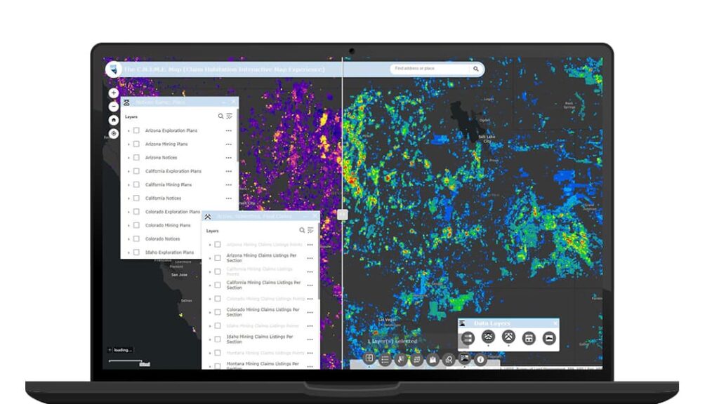
Once that data is clean, you can map active versus lapsed ground instantly, run overlap detection against neighboring claims before boundary conflicts turn into legal fights, and see which tenements have renewals due in the next 90 days.
I know of a mid-tier gold producer that lost an entire claim block in Nevada because a renewal deadline slipped through a spreadsheet. A competitor staked over the lapsed claims within weeks, and the legal battle cost more than re-staking ever would have. Automated date tracking tied to the map would have flagged it months out.
Get this one right first. Nothing else on the list can make up for it.
Land Acquisition and Opportunity Screening
Before you spend a dollar on new ground, you need to know what you’re really buying. That takes more than a geological report.
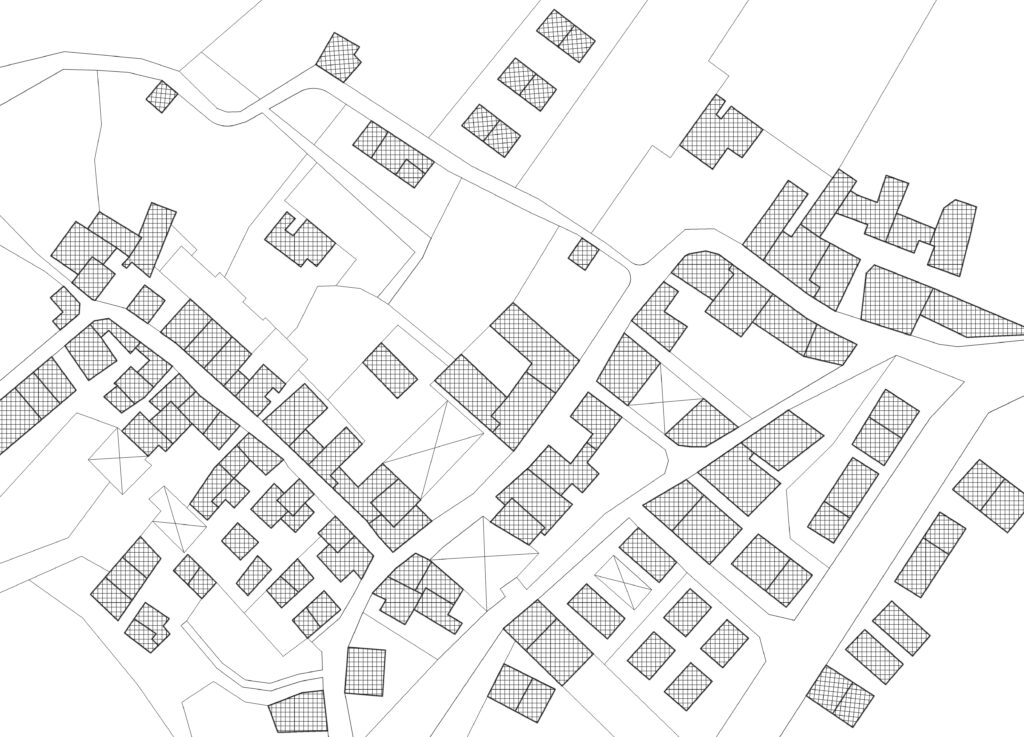
This workflow scores parcels or claims by layering criteria: prospectivity, proximity to infrastructure, road access, environmental constraints, nearby communities, water availability, and regulatory complexity. The result tells you which targets are worth chasing and which will eat you alive in permitting costs.
The output matters as much as the analysis. Strong teams produce due-diligence map books and stakeholder-ready summaries straight from GIS. When a board is weighing a $10 million land package, clear constraint maps and ranked alternatives lead to faster, more confident decisions.
These teams are running multi-criteria decision analysis, even if they’d never call it that. They aren’t guessing which claims to pursue. They’re scoring them.
Stakeholder, Surface Owner, and Community Mapping
This is where land management gets personal. Behind every polygon are people who live on, work on, or care deeply about that land.
This workflow tracks surface owners, land users, Indigenous communities, and key contacts for every parcel and project area. It also maps engagement history: who your team talked to, when, about what, and who needs a follow-up before a drill can mobilize.
Social license to operate gets talked about a lot, but it’s real. It’s the difference between a project that moves forward and one tied up in public opposition for three years. Companies that manage community relationships well almost always have a spatial piece. They know exactly which landowners border active operations, and they see that picture on a map instead of in a list buried in a CRM.
I think this is the most undervalued workflow on the list. If your land and community teams work in separate systems with no spatial link, you’re flying blind in the one area where a single misstep can kill a project.
Permitting, Compliance, and Obligations Calendar
This is where land management gets personal. Behind every polygon are people who live on, work on, or care deeply about that land.
This workflow tracks surface owners, land users, Indigenous communities, and key contacts for every parcel and project area. It also maps engagement history: who your team talked to, when, about what, and who needs a follow-up before a drill can mobilize.
Social license to operate gets talked about a lot, but it’s real. It’s the difference between a project that moves forward and one tied up in public opposition for three years. Companies that manage community relationships well almost always have a spatial piece. They know exactly which landowners border active operations, and they see that picture on a map instead of in a list buried in a CRM.
I think this is the most undervalued workflow on the list. If your land and community teams work in separate systems with no spatial link, you’re flying blind in the one area where a single misstep can kill a project.

Land Constraints and Setback Management
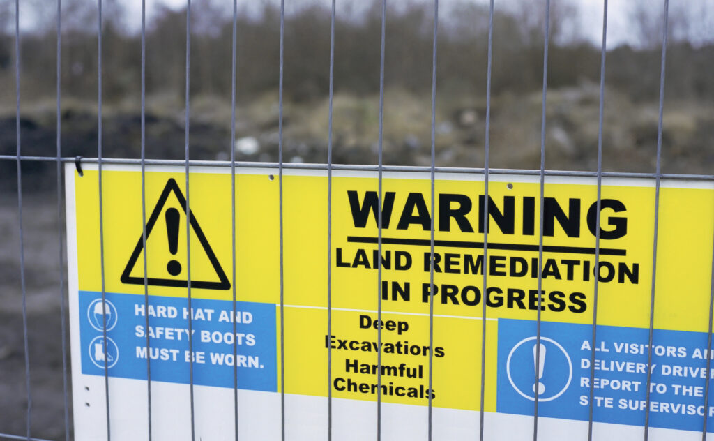
Every mine operates inside a web of restrictions most people outside the land department never see: waterway buffers, wetlands, critical habitat, heritage sites, community setbacks, utility corridors, and protected areas.
This workflow manages those buffers spatially and produces “no-disturb” and “conditional access” layers that field teams and contractors can use on the ground.
The real issue is constraint stacking. A 100-meter waterway buffer is manageable on its own. Overlap it with a heritage exclusion zone and a utility easement, and a big share of your planned disturbance area is either off-limits or needs three separate approvals.
Teams that get this right build constraint layers before designing the mine plan, then hand engineers a developable-area polygon that already accounts for every restriction. Teams that don’t find out when a regulator arrives with a violation notice, or when they’re redesigning a haul road at ten times the original cost.
If your constraint data lives in different departments or systems, there’s a good chance someone in the field right now doesn’t know about a restriction that applies exactly where they’re working.
Access, Right-of-Way, and Easement Management
The best mineral rights in the world are worthless if you can’t physically reach them.
This workflow inventories every road, trail, gate, right-of-way, easement, and crossing your operation depends on, including ownership, terms, expiration dates, and seasonal limits. It uses that inventory to optimize routes and flag where new agreements are needed before they become a bottleneck.
Gaps show up fast. A delayed access agreement halts a drill program. An expired easement cuts off your primary haul route. An unplanned seasonal closure strands equipment for weeks.
Seasonal constraints are where the map really earns its keep. A road that works in July may be impassable from November through April. A creek crossing that’s fine at normal flows becomes a major obstacle during spring runoff. Those patterns are invisible in a spreadsheet, but on a map linked to temporal data, operations can plan around them instead of scrambling.
Survey, Legal Descriptions, and Boundary QA/QC
Nobody thinks about this workflow until it lands them in a boundary dispute.
Its core job is reconciliation: making sure survey plans, coordinate geometry, legal descriptions, and physical monuments all agree inside your GIS. Spoiler: they almost never do.
The usual suspects are legacy surveys in different datums, 1960s hand-drawn plats digitized with questionable accuracy, legal descriptions referencing monuments that no longer exist, metes and bounds descriptions that don’t close, and coordinate transformations done wrong decades ago.
Every mining GIS professional has boundary war stories. The best have built QA/QC routines that run overlap detection, closure analysis, and datum comparison as standard practice, instead of waiting for someone to notice two claims crossing on a map.
It isn’t glamorous, but it quietly protects every other workflow that depends on knowing where your boundaries actually are. Which is all of them.

Reclamation and Disturbance Footprint Tracking
Regulators want to know exactly how much ground you’ve disturbed, where, when, and what you’re doing about it. “Approximately 200 acres” won’t hold up when your bond calculation is on the line.
This workflow tracks disturbance by permit unit and phase, comparing planned against actual as the operation evolves. It produces the defensible maps your reclamation team needs for bond calculations, progressive reclamation reporting, and regulatory submittals.
The financial stakes cut both ways. Over-bonded, you’re tying up capital for no reason. Under-bonded, you’re out of compliance and at risk of being shut down. Both are avoidable.
More sophisticated operations now use drone and satellite imagery with change detection to verify disturbance boundaries and track reclamation over time. When a regulator asks what an area looked like two years ago versus today, you want an answer backed by spatial data, not someone’s memory.
Land Valuation, Taxes, and Payments (Spatial Finance)
This one is my favorite, because it takes GIS into territory most mining spatial teams haven’t explored yet: finance.
The workflow ties every parcel to its valuation, tax status, payment schedule, and cost center, then maps cost exposure and forecasts payments by area, asset, or project stage. Instead of squinting at tables of parcel numbers, finance sees exactly where the money goes.
A large operation may hold hundreds of parcels across multiple counties, each with different tax rates, payment schedules, and valuation methods. On a map, patterns jump out that a spreadsheet hides. Maybe 60% of your tax burden sits in three parcels. Maybe a cluster of lease payments all lands in the same quarter and nobody planned for it. Maybe you’re still paying taxes on a fully reclaimed parcel that should have been released two years ago.
Spatial finance is still new in mining, but the teams trying it are finding blind spots that have quietly cost them real money for years.
Document Management and Land Records System
This workflow ties everything together, and it’s the one most mining operations do worst.
Every parcel and claim has a paper trail: deeds, agreements, permits, amendments, correspondence, survey plats, title opinions, and maps. Linking those documents to their spatial footprint means that when someone asks who owns a parcel, what the terms are, and where the original agreement is, the answer takes seconds instead of hours.
Doing this poorly adds up fast. Lost agreements get renegotiated from scratch. Title searches get duplicated. Audits fail because documents can’t be found in time. And in the worst case, you can’t produce what you need during a transaction or dispute because it’s buried in a desk drawer or a shared-drive folder called “Misc 2.”
With spatially linked records, you click a parcel and see everything tied to it. Simple in concept, and in practice it’s the difference between a land department that’s always putting out fires and one that operates with confidence.

How These 10 Workflows Connect Into a Unified System
If you’re thinking there’s no way you can build all ten, you’re right, at least not all at once. Please don’t try.
What matters is that these aren’t isolated projects. Tenure data feeds acquisition screening. Constraint layers inform permitting. Access inventory connects to stakeholder mapping. Disturbance tracking drives reclamation bonding, which feeds spatial finance. And document management is the connective tissue holding it all together.
The technology doesn’t need to be exotic, either. Most mining operations already run ArcGIS. The workflow layer sits on top, connecting your spatial platform to your land management software, ERP system, mobile data collection tools, and cloud-based databases.
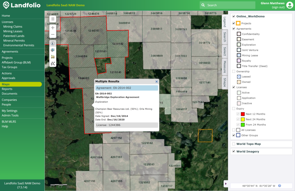
For a look at what it takes to build a platform around these workflows, check out Landfolio from Spatial Dimension, an Esri Gold Partner. It’s purpose-built for the extractive industry to safeguard mining tenure and your right to operate. Mineral title lifecycles and obligations, environmental and infrastructure permit compliance, surface rights, commercial agreements like joint ventures, and stakeholder engagement across multiple jurisdictions are all spatially integrated from the ground up, giving you a single source of truth.
I bring them up because they clearly understand these aren’t ten separate problems. Landfolio runs on the ArcGIS technology stack and extends into field-based workflows with ArcGIS Survey123. If you’re serious about closing the gaps on this list and breaking down the walls between your land, legal, and technical teams, they’re worth a conversation.
The bigger challenge, though, isn’t technology. It’s people. These workflows require land, legal, environmental, operations, and finance teams to actually work together. That’s hard, but once it clicks, the benefits compound.
It also positions you for what’s next. AI-assisted land analysis, real-time compliance monitoring, and digital twin integration all build on these foundations. Without the basics in place, you won’t be ready.
Where to Start
You don’t need all ten running perfectly by next quarter. You do need to know where your gaps are.
Walk through the list with your team and ask three questions. Which workflows do we have in some form, even informally? Which are missing entirely? And which are causing us the most pain right now? The answers to the last two tell you where to focus first.
In my experience, most operations get the biggest immediate return from three: tenure administration (workflow 1), permitting and compliance (workflow 4), and document management (workflow 10). Together they form a foundation that makes everything else easier to build.
Your priorities may differ. If you’re in active acquisition mode, workflow 2 might be your most urgent gap. If you’re facing community opposition, workflow 3 could be the one that saves your project.
GIS workflows in land management aren’t a nice-to-have anymore. They separate operations that react to problems from ones that see them coming. The companies that figure this out first don’t just avoid risk. They move faster, spend less, and build institutional knowledge that compounds year after year.
The spatial data is already sitting in your systems. The question is whether you’ve built the workflows to make it work for you.
You probably know the answer. That’s why you’re still reading. If you have more questions, stop by the Spatial Dimension Landfolio Americas User Summit on September 15-16 in Vancouver to discuss Land Management GIS with my colleagues, Darin Bryce and Ryan Farmer.