Across nine facilities and 2,288 assets, BIM, GIS, and work orders now speak the same language.
“It looks so great and this is what we were looking for! Seeing how it interfaces with Cityworks is calming fears for a lot of the team.” — Jane Kopstad, Water Treatment Facility Manager, City of Concord, North Carolina
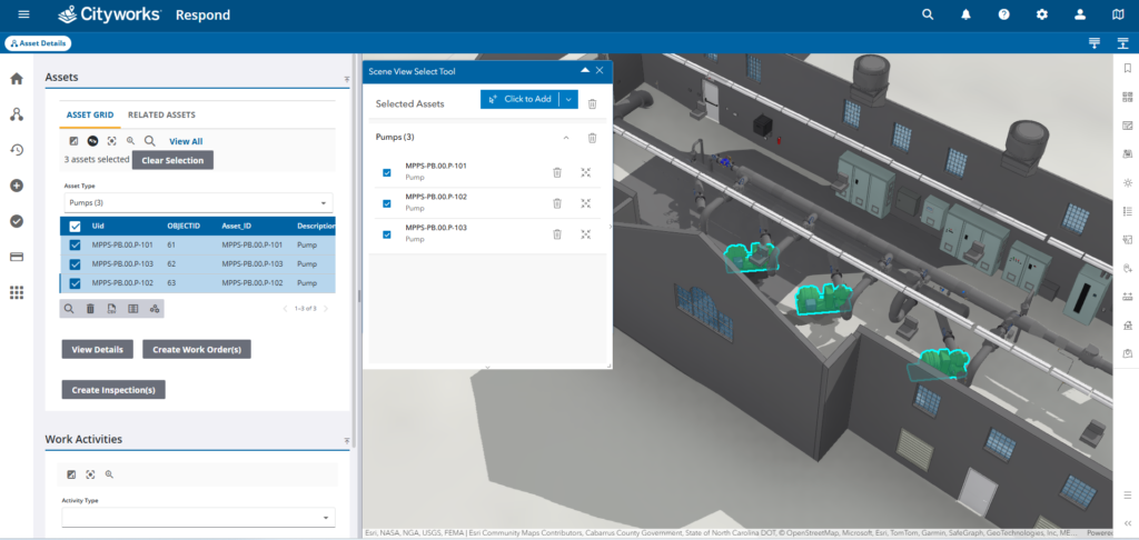
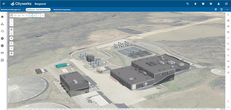
The reaction above came from the first time Concord’s utilities staff saw their new operating environment in action. For the team on the ground, the relief was practical. For the industry, the moment carried different weight: The Concord environment is the world’s first Cityworks implementation in a fully 3D-integrated asset management environment with multi-asset selection capability—nine facilities, 2,288 selectable assets, and 62 asset types, all operating as one connected system instead of three neighboring ones.
The Challenge
Concord’s asset information lived everywhere: spreadsheets, paper-based work orders, institutional knowledge, BIM models, GIS layers, and Cityworks. Each captured a piece of the picture; none shared a common vocabulary. Routine maintenance planning consumed hours as staff hunted across systems for the same asset in different forms. The technology was not the problem. The lack of connection was.
Working with Crystal Allman, Concord’s engineering director for the water treatment facility, consultants at NV5 designed a repeatable workflow that moves data from a physical facility to an actionable work order:
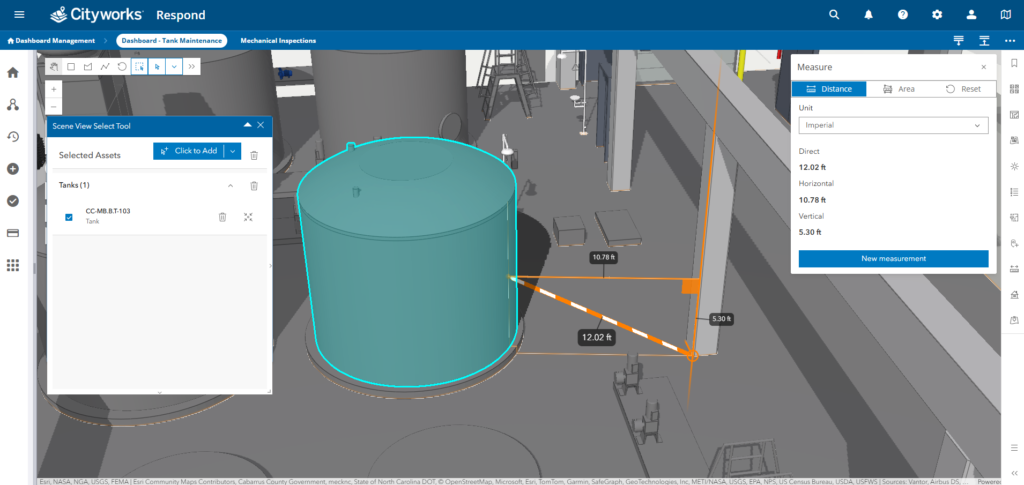
1. Reality capture: Sub-centimeter lidar produces digital twins of each facility.
2. BIM modeling: Point clouds become Autodesk Revit models with COBie attributes and a unified asset ID convention.
3. BIM to GIS: FME translates BIM into ArcGIS through JSON schema mapping, preserving 3D geometry and every attribute.
4. GIS to Cityworks: Assets and attributions conveyed to 3D Cityworks for Concord’s Asset Management tools.
5. 3D multi-asset selection: A custom tool lets users select multiple assets directly in the 3D model and generate consolidated work orders in a single action.
The Partner
NV5 partnered with the municipality at this pivotal stage to move beyond disconnected tools toward a unified operational environment. The goal was not just integration, but transformation. NV5 approached the challenge by treating data governance, schema alignment, and workflow connectivity as first-class deliverables from the outset. By proactively addressing BIM-GIS alignment, standardized asset naming, and conflict-free data updates, NV5 helped establish a digital foundation that could scale across the city’s entire facilities portfolio. This partnership enabled the municipality to move from manual, spreadsheet-based tracking to a modern, connected asset management approach in a matter of months.
The Solution
NV5 developed a structured workflow that connects reality capture, BIM, GIS, and work order management into a single operating framework. The process begins with high-accuracy lidar and 3D laser scanning to create a detailed digital twin of facilities, providing sub-centimeter precision as the foundation for all downstream systems. Point clouds are transformed into intelligent 3D models using Autodesk Revit and COBie standards, with structured asset attributes such as manufacturer, model, installation date, specifications, and expected service life. A standardized naming convention ensures consistent asset identifiers across platforms. Using FME, the NV5 team implemented a repeatable BIM-to-GIS data transformation workflow that preserves attributes and 3D geometry through JSON-based schema mapping. API integrations enable bidirectional updates between GIS and asset management systems. A custom 3D multi-asset selection tool allows users to select multiple assets across facilities and create consolidated work orders in a single workflow, transforming maintenance planning from a fragmented task into a streamlined process.
“What the team has provided here is truly fantastic.” —Michele Pearman, GISP, Senior Customer Success Manager, Trimble
The Result
Maintenance planning that used to take hours now takes minutes. Asset identification is nearly instantaneous. Multi-asset work orders have replaced one-by-one entry. New staff onboard faster because the 3D environment carries visual context that used to live only in the memory of senior technicians.
What does it mean? For utilities operating within an aging infrastructure, the shift is from reactive to predictive. For the integrator community, it is a template: data governance first, connectivity second, capability third. And for the people doing the actual work, it is something simpler: The systems finally help them instead of slowing them down.