When it comes to mine closure, guesswork isn’t good enough. You need data, insight, and precision—and that’s exactly what GIS delivers.
Closure Isn’t the End—It’s the Beginning of Accountability
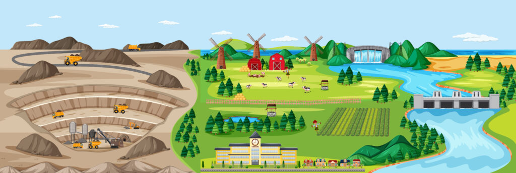
In today’s mining landscape, closure isn’t just a checkbox. It’s a proving ground for a company’s commitment to environmental responsibility, long-term stewardship, and community trust. But planning and executing sustainable reclamation is no small task. It demands clarity, collaboration, and complete control over complex environmental data.
Why ArcGIS is a Game-Changer for Mine Closure
That’s where GIS comes in. Esri’s ArcGIS platform empowers mine professionals to plan intelligently, act confidently, and report transparently. If you want your closure strategy to succeed and stand up to scrutiny, you need GIS on your side.
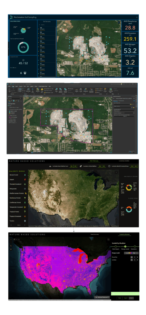
Reimagine Post-Mining Land Use with Precision
Don’t leave land use planning to chance. GIS helps you make informed, defendable decisions that align with environmental, legal, and community priorities.
With GIS, you can:
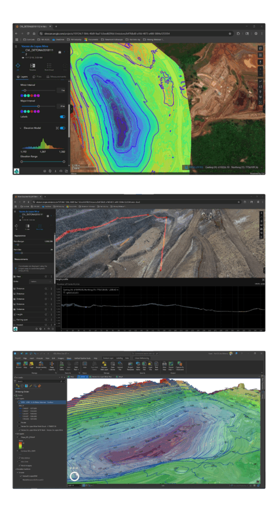
- Visualize terrain and model future landscapes using ArcGIS Pro and ArcGIS 3D Analyst.
- Overlay zoning, environmental buffers, and land ownership to identify constraints before they become roadblocks.
- Bring stakeholders into the process through interactive web maps and StoryMaps that foster transparency and trust.
Why it matters: When communities and regulators can see your plan in action and how it benefits them, they’re far more likely to support it.
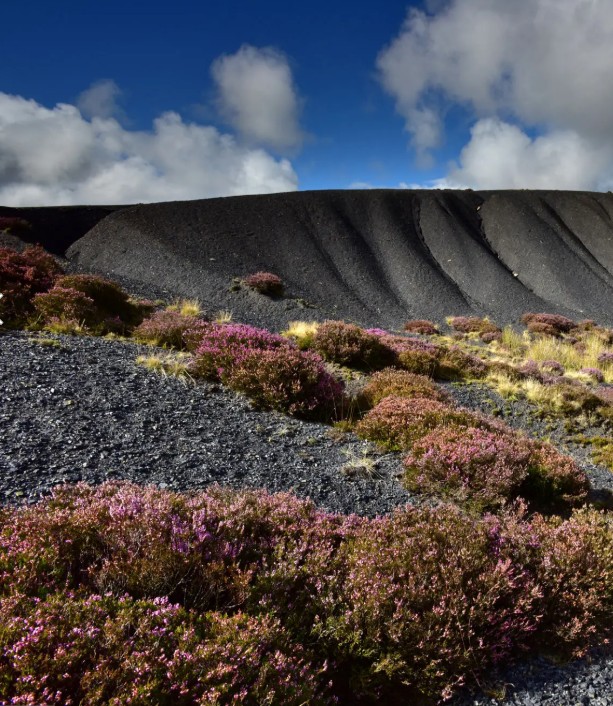
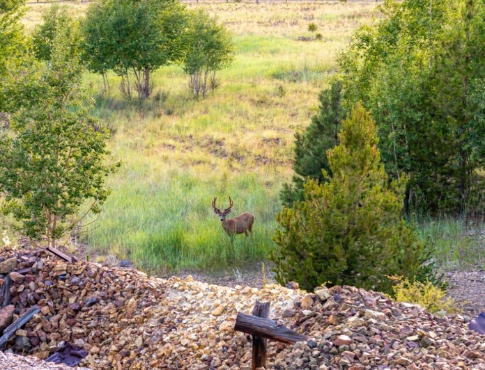
Prove Your Progress: Track Revegetation with Confidence
Revegetation isn’t just a best practice, it’s often a legal obligation. GIS makes it easier to show you’re making measurable, meaningful progress.
Credit: Michael Roberts, Getty Images
How ArcGIS gives you the edge:
- Leverage satellite and drone imagery with ArcGIS Image Analyst and Site Scan to monitor regrowth in stunning detail.
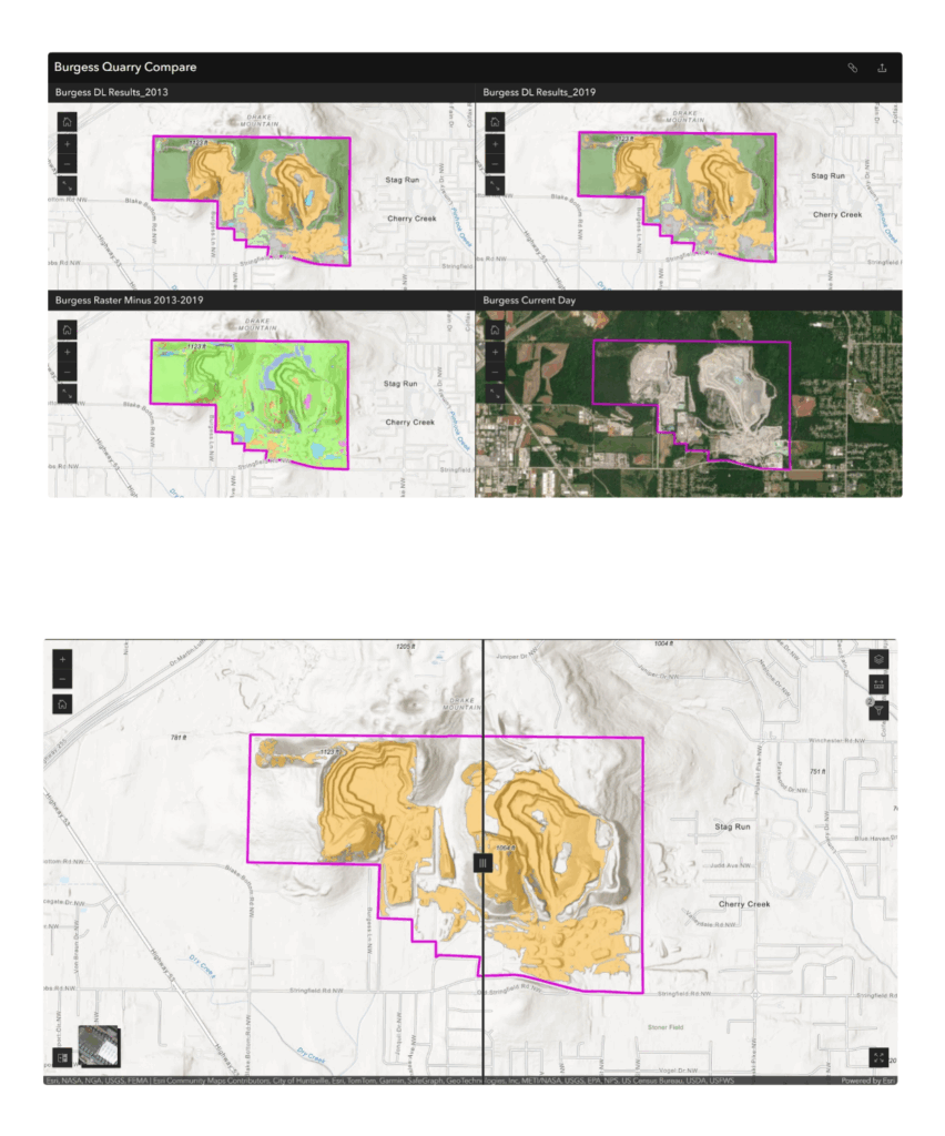
- Use change detection tools to identify trends and target problem areas early.
- Enable real-time field reporting with ArcGIS Field Maps and Survey123 for accurate, up-to-date ground truth.
- What’s at stake: Failure to track and document revegetation can derail your closure timeline. GIS ensures you stay ahead of the curve.
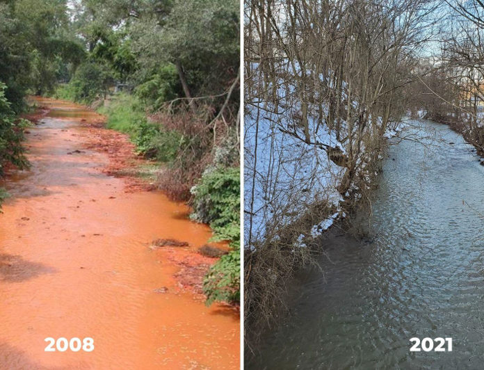
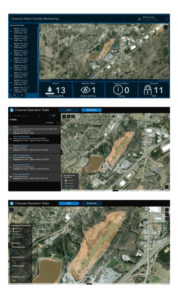
Stay Ahead of Regulations, Not Behind Them
Regulators don’t just want reports. They want proof. ArcGIS equips your team to automate compliance workflows, eliminate data silos, and provide transparent, defensible reporting.
ArcGIS makes it easy to:
- Create real-time dashboards to monitor and share closure KPIs.
- Centralize your data in ArcGIS Online or ArcGIS Enterprise to simplify audits and reduce risk.
- Demonstrate historical compliance with time-enabled maps and geospatial archives.
Bottom line: Regulatory reporting doesn’t have to be a burden. With GIS, it becomes a strategic advantage.
Go Beyond Compliance: Lead with Sustainability
Closure is your company’s chance to go beyond the bare minimum. GIS empowers you to lead with nature-based solutions that leave a positive legacy.
GIS helps you implement sustainable practices like:
- Hydrologic restoration using Arc Hydro to design wetlands and reestablish drainage.
- Biodiversity mapping to maintain and improve habitat connectivity.
- Carbon tracking across reclaimed and reforested zones.
Credit: Office of Surface Mining Reclamation and Enforcement
https://www.facebook.com/USInterior/posts/the-office-of-surface-mining-reclamation-and-enforcement-osmre-has-been-assistin/4256848887702093/
A better story to tell: Sustainable closure isn’t just good ethics, it’s good business. Show investors, regulators, and the public that you’re doing it right.
If You’re Not Using GIS, You’re Already Behind
The old way of doing closure, paper maps, disconnected spreadsheets, and guesswork, is no longer acceptable.
ArcGIS gives you:
- A unified platform to visualize and manage closure data
- Tools to analyze, predict, and communicate with clarity
- A competitive edge in meeting ESG goals and public expectations
- Companies that embrace GIS for closure and reclamation are reducing costs, accelerating approvals, and gaining trust.
Can you afford not to be one of them?
Ready to Lead the Future of Mine Closure?
- Let’s talk: Speak with an Esri mining expert about how GIS can transform your closure strategy.
- Explore what’s possible: Visit our site for real-world examples of GIS success in mine closure.
- Be the next success story: Share your closure journey and inspire others in the Esri Mining community.
Don’t just close a mine. Close the loop on responsibility—with GIS.