Crime Analysis with ArcGIS Pro Video Blog Series—Part 4
In Part 4 of our Crime Analysis with ArcGIS Pro blog series, we examine problem location analysis and show you how to use the 80-20 Analysis and Summarize Incident Count tools. These tools support the identification of problem locations and areas that are causing disproportionate amounts of crime and disorder. These types of analyses can help a police agency prioritize where to proactively focus resources and support long-term crime reduction efforts.
Choosing the Right Tool
Problem location analysis typically starts when command staff members identify a specific problem they would like to address (such as street robberies, residential burglaries, drug offenses, and noise complaints). The identified problem will predicate the data used and analysis performed. Once the type of problem and data are identified, it is the analysts’ job to pinpoint which locations or areas are the primary attractors for the identified calls for service or crime types. The geographic units used will determine the appropriate tool to use. If crime or incidents are occurring at specific locations, such as bars, construction sites, or parking garages, you would use 80-20 Analysis to identify high-risk facilities, but if the criminal activity is clustering around city blocks or on specific streets, you would use the Summarize Incident Count tool.

80-20 Analysis
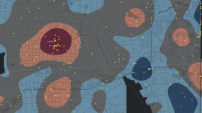
The 80-20 rule, also known as the Pareto principle, is based on the theoretical concept that the majority of incidents occur at a small number of locations (i.e., 80 percent of incidents occur at 20 percent of locations). Though the 80-20 rule can be applied to almost any phenomenon, it has been found to be particularly useful for understanding crime patterns. Though incidents likely won’t exactly equal an 80/20 ratio, a relatively small number of risky facilities will almost always account for a larger percentage of incidents in any jurisdiction. As an initial step in problem identification, the 80-20 Analysis tool can help you assess if the 80-20 rule applies and identify the repeat call locations that are contributing to the problem.

Summarize Incident Count
Crime and disorder can also be measured in small geographic areas even if incidents are not occurring at specific address locations. According to criminologist David Weisburd’s “Law of Crime Concentration”, crime hot spots cluster at the micro-place level and can be measured. Micro-place analysis focuses on examining these incident patterns at relatively small geographies such as street junctions and street segments. The Summarize Incident Count tool supports micro-level analysis and can be used to aggregate and summarize incident counts by street segment and help police understand crime and other incidents (i.e., crash locations, quality of life issues) that are occurring in these micro-places.
Used together, these tools can help your agency identify those specific addresses and streets with high incidents of crime or disorder. This output can in turn help your agency prioritize and direct police and other resources where they are needed most. Now let’s join Chris Delaney for a closer look at how these tools work.
Additional Resources
Thanks for joining us for this installment in the crime analysis blog series. To learn more about crime analysis theory and the practical application of GIS and crime mapping, we recommend these books from Esri Press:

To learn more about the Crime Analysis solution, check out the following resources:
- Getting to Know the Crime Analysis Solution
- Crime Analysis Solution
- Getting Started with Crime Analysis
- Crime Analysis with ArcGIS Pro Blog Series Video Playlist
If you have questions or feedback about the Crime Analysis solution or any of the tools in the upcoming blogs, you can connect with the following:
John Beck, Director, Law Enforcement Solutions, jbeck@esri.com
Chris Delaney, Product Owner, Law Enforcement Solutions, cdelaney@esri.com