Customer Spotlight Story
The United Illuminating Company (UI), an Avangrid company, has provided electric service to the Greater Bridgeport and New Haven, Connecticut areas since 1899. Today, UI serves more than 347,000 customers across 17 towns and cities in southern Connecticut, covering 335 square miles along and near the shoreline of Long Island Sound. As part of Avangrid Networks, which includes eight electric and natural gas utilities across New York and New England, UI is committed to the well-being of its communities and to delivering safe, reliable, affordable, and innovative energy solutions.
CHALLENGE
UI faced the challenge of modernizing its municipal outage dashboard to support towns and cities with timely, actionable information. UI needed a cost-effective, Esri-based solution that would deliver real-time outage data by jurisdiction, meet Avangrid’s security standards, and remain simple enough for municipal coordinators to use without technical expertise.
Additional challenges included establishing a reliable data pipeline from Avangrid operational systems into RAMTeCH‘s Amazon Web Services (AWS) environment to produce GIS-ready data to support ArcGIS Experience Builder Developer. That upgrade surfaced several technical obstacles, including SSL certificate issues, mismatched internal URLs, open authorization (OAuth) errors, and authentication failures. Addressing these problems required manual reconfiguration of system files, replacement of internal references, removal of conflicting Client ID values, and close coordination across system configuration, network infrastructure, and security policies to ensure secure and stable access for municipal users.
SOLUTION
The solution had to be secure, publicly accessible, and user-friendly for non-technical municipal coordinators. Leveraging expertise in GIS, cloud integration, and dashboard design, RAMTeCH developed a solution that connected outage data pipelines to a cloud-hosted environment and configured ArcGIS Enterprise with ArcGIS Experience Builder. Critical tasks included establishing secure web connectivity, designing a data pipeline from Avangrid processes into the RAMTeCH AWS environment, and upgrading ArcGIS Enterprise to support new Experience Builder functionality.

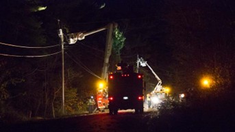
Outages are tracked using ArcGIS Dashboards
The solution is a cloud-hosted GIS system that helps UI provide real-time visibility into power outages across its service area through a modern, map-based outage viewer. The dashboard was designed to provide clear, easy-to-use tools for tracking outages, including outage summaries by municipality, repair-time filters, and municipal-priority views.

In addition to the outage maps, the solution produces extensive reports.
RESULTS
The solution streamlined UI’s outage data into a secure AWS environment and modernized its ArcGIS Enterprise platform with ArcGIS Experience Builder, creating an interactive, map-centric dashboard. The solution addressed complex integration, security, and connectivity challenges through careful configuration and troubleshooting to ensure stable performance and reliable data delivery, while giving Avangrid a flexible platform that can grow with future needs. By combining intuitive design with robust data management, the outage viewer enhances transparency and improves communication.
The solution provides municipalities with transparency during restoration processes.
PARTNER
RAMTeCH led the design, build, and hosting of UI’s ArcGIS-based solution, leveraging Avangrid’s Esri licensing and RAMTeCH’s AWS-hosted infrastructure to minimize IT overhead. RAMTeCH configured two secure AWS environments for production and development, installed and managed ArcGIS Enterprise, and implemented ETL processes to update outage and conductor data automatically.
Esri, RAMTeCH, and United Illuminating (UI) represent a partnership in which RAMTeCH provided specialized GIS services and solutions to manage complex infrastructure, data, and operations. RAMTeCH led requirements workshops, configured the ArcGIS Experience Builder web application with custom widgets, and led testing and user acceptance testing. A train-the-trainer program was implemented to empower UI staff, while RAMTeCH ensured a smooth go-live and ongoing maintenance through an annual subscription service.
RAMTeCH’s outage dashboard enhances how UI shares and manages outage information, increasing transparency and providing municipalities with a reliable, continuously updated GIS viewer. Its purpose-built tools reduce manual coordination and provide a scalable platform that strengthens communication and supports future innovation.” – George Porto, Sr. Manager / IT / GIS Applications at Avangrid.
RAMTeCH combined US-based management and technical expertise with offshore development to understand requirements, design, develop, and implement UI’s GIS outage viewer dashboard, working hand-in-hand with Avangrid IT, executives, and GIS operations.
BENEFITS
The final solution delivered a reliable, easy-to-use outage dashboard that provided municipalities with near-real-time updates every 10 minutes. Designed with custom, reusable widgets for outage summaries, repair-time filters, municipal priorities, and intuitive legends, the platform significantly reduced manual coordination between UI and the municipalities while streamlining outage reporting and summaries. This scalable solution improves transparency with stakeholders, supports faster, data-driven decision-making, and strengthens UI’s ability to communicate outage impacts during service disruptions.
By offering clear outage summaries, filterable repair times, and priority-based views, the dashboard provides a foundation for future enhancements by seamlessly integrating additional datasets and features.

