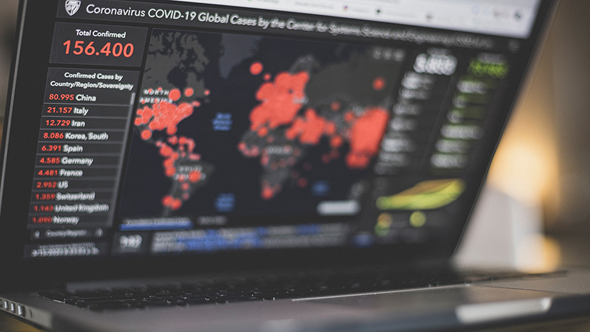
COVID-19 has presented a challenge to global development like few other crises have done in recent history. It has laid bare the deep interdependencies between social, economic, and environmental health and well-being. It has shown that pandemics do not respect national borders: We are all connected from village to city, from nation to nation, and to the entire planet. And of course, it’s not just COVID-19. Climate change and its attendant sea-level rise and extreme weather cycles, deeply entrenched social and racial inequities, and ongoing conflicts and acute food insecurities, just to name a few of the epic challenges we all face, reveal the fragility and interconnectedness of our systems.
However, this is also a time of enormous opportunity, and we have made great advances as a global community. We have the opportunity to further innovate and invent, to collaborate across borders, and to not just rebuild systems and infrastructures after crisis strikes, but to build for a resilient and sustainable future for all.
Geospatial Thinking Provides a Holistic, Collaborative Approach
Geospatial thinking plays a critical role in building resilience and sustainability. Leveraging the power of GIS (geographic information systems), development professionals and community leaders are looking at their communities holistically using geography as a common reference point. They are integrating social, environmental, and economic information in a way that enables them to gain greater insight into complex situations, make data-driven decisions on where to act and apply resources, and collaborate across organizations and around the world.
Leadership Discussions on GIS and Building a Resilient, Sustainable Future
Join Esri President Jack Dangermond, Esri executives, and industry leaders as they discuss how geospatial thinking and GIS are transforming our world and providing a foundation for building more resilient and sustainable infrastructure and systems.
Esri President Jack Dangermond speaks at the opening of the UN High-Level Political Forum on Sustainable Development and discusses using data across systems.
Esri’s Dr. Carmelle Terborgh, and other leaders, discuss timely data for the SDGs with the United Nations Sustainable Development Solutions Network.
Esri President Jack Dangermond speaks with Jeffrey Sachs, President of the UN Sustainable Development Solutions Network, UN SDG Advocate, and Director of the Center for Sustainable Development at Columbia University, about Global Sustainability at the Esri UC 2020.
I spend day and night on them [the Sustainable Development Goals] because I regard them as really our only hand-hold on this steep incline that we’re on. Why? Because if we don’t have shared goals, how are we going conceivably to work together to change in a way that we absolutely need to change.
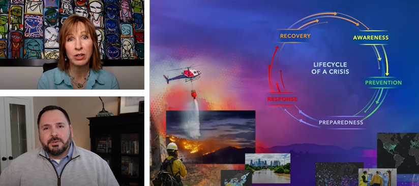
Esri Chief Medical Officer Estella Geraghty and Director of Public Safety Ryan Lanclos host a session on COVID-19 and crisis management with a GIS approach.
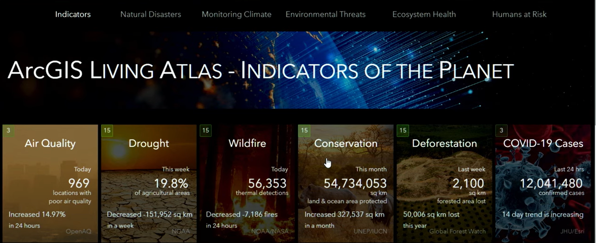
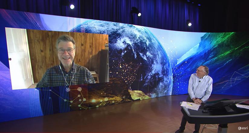
Stefan Schweinfest, Director of the United Nations Statistics Division, and Esri President Jack Dangermond discuss a Global GIS. Esri Product Development Manager Bernard Szukalski introduces ArcGIS Living Atlas – Indicators of the Planet.
To manage the COVID-19 crisis, we need data. To manage the inevitable serious socio-economic impacts of the COVID-19 crisis, we need data. To manage the long-term United Nations 2030 Sustainable Development Agenda, we need data.

Inter-American Development Bank President Luis Alberto Moreno holds a conversation with Esri President Jack Dangermond on using GIS to fight COVID-19 and climate change.
A GIS Platform Supports Data-Driven Decision-Making, Performance Monitoring, and Stakeholder Engagement
From questions of labor resources, mobility, and access to resources and livability, to securing social protection, food security, and economic development, sustainability and resilience will require holistic thinking and collaborative, integrated ways of working.
ArcGIS, Esri’s GIS solution, integrates social, economic, and environmental data into a complex, multi-dimensional view, to support:
- Better visibility into operations
- Improved data to understand context and support decision making
- Transparency of funding allocation relative to need
- Performance monitoring dashboards of policy impact on community
- Rich stakeholder engagement with collaboration and storytelling tools
Additional Resources
- Find out more about COVID-19 maps, resources, and solutions for response and reopening
- Explore Esri Sustainable Development Solutions
- Explore ArcGIS solutions for building resilience
- Learn to use ArcGIS tools via ArcGIS Learn Lessons and MOOCs