Sulphur Springs Valley Electric Cooperative (SSVEC) is a not-for-profit, member-owned distribution cooperative providing electricity to more than 60,000 services. The cooperative invests in modern inspection tools like drones and tablets, but valuable imagery often goes unused. SSVEC has engaged AerialSphere’s team to convert these photos into ArcGIS native content using their XPGEO Studio web app, extracting maximum value from their investment.
Challenge
SSVEC’s commitment to reliable service includes detailed and frequent utility pole inspections. They utilize in-house and third-party services to capture high-resolution imagery, but the current workflow only flags and generates a report of the immediate problem areas. As a result, nearly 80,000 valuable images end up in storage after the initial analysis. This imagery data remains inaccessible to other departments and lacks integration with their primary GIS system, creating a loss of potential asset intelligence. SSVEC needs a fast, simple, and scalable way to integrate this high-volume imagery and metadata into ArcGIS to unlock cooperative-wide value without overburdening their small, savvy GIS team.
Partner
The utility has engaged AerialSphere’s professional services team to leverage XPGEO Studio solution for the rapid and easy creation of Oriented Imagery (OI) data. AerialSphere provides technical expertise and a platform for utilities to process, manage, and integrate large volumes of imagery data, from drones and 360 cameras to tablets, into the native ArcGIS environment as OI datasets.
Solution
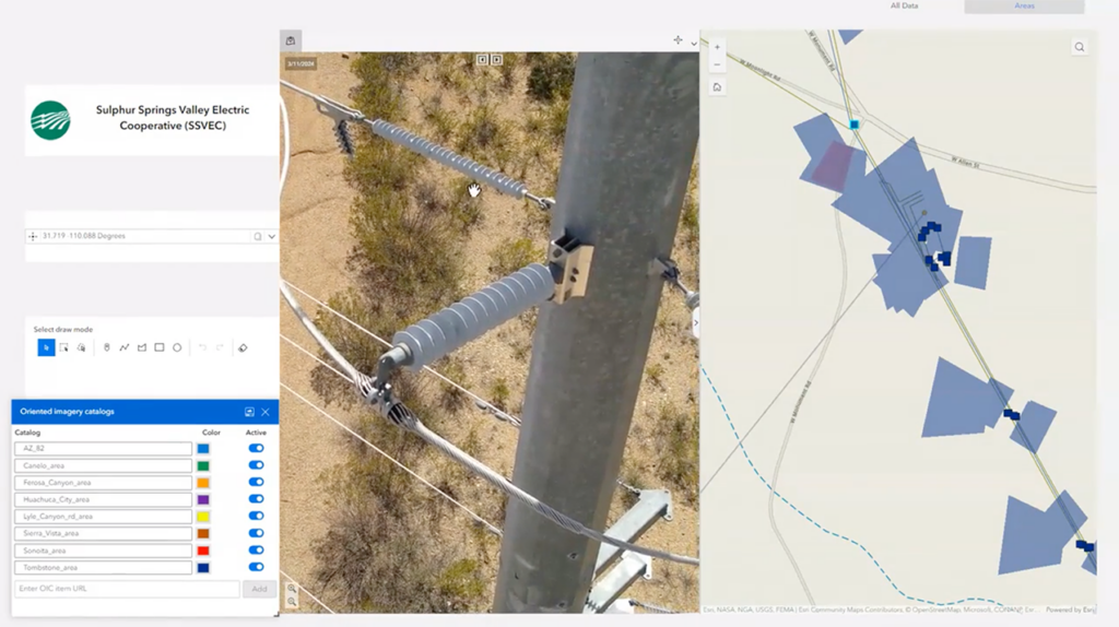
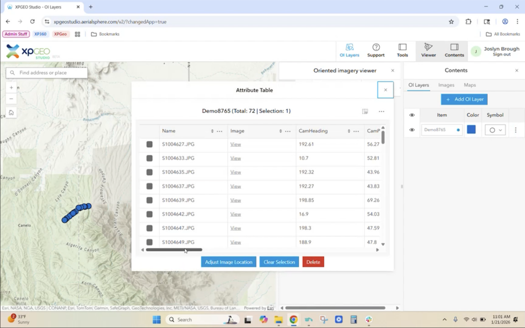
SSVEC will implement XPGEO Studio in a pilot program led by Enterprise Systems Manager Kurt Towler. This pilot aims to efficiently convert 80,000 utility pole inspection images into ArcGIS native Oriented Imagery datasets. XPGEO’s highly automated workflow will allow large amounts of non-orthographic imagery to be incorporated without demanding valuable time from GIS specialists and it will process imagery five times faster than a manual click through workflow. This data will be saved in their Enterprise system and used to build a series of useful dashboards. By leveraging XPGEO Studio, the cooperative will incorporate all future and past captured imagery, creating a powerful, living history of their utility network.
Results
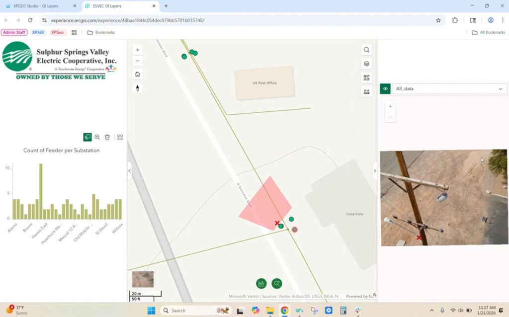
A preliminary effort by AerialSphere easily converted a sample of 2500 images into content that was used to create examples of 2D and 3D dashboards. This proof of concept paves the way for a larger pilot program that will provide SSVEC with new value from their inspection investments by moving data out of storage and into a usable format. Easy access to pole inspection imagery, capture dates, and locations will be a huge advantage for the cooperative. Other departments, including construction, warehouse, and legal, will benefit from access to this photo evidence. This is not simply a drone imagery solution; it works for all imagery data, enabling them to integrate new captures and historical data. This will provide a living history of the network, empowering the team to make more informed decisions across the cooperative.
“This is a big deal for us. We anticipate a large improvement for a relatively small investment. The ROI will continue to increase over time; it will continue to grow.“-Kurt Towler, Enterprise Systems Manager, Sulphur Springs Valley Electric Cooperative

