Marc Goldman
Marc Goldman is the Director of AEC Industry at Esri. He works with a global team to define and deliver the strategy for Esri’s solutions serving architecture, engineering, and construction. He is a leading expert in BIM, GIS, Digital Twins, and their impact on the industry. Marc began his career in the first days of CAD, he led some of the earliest BIM efforts, and he has contributed over thirty years defining, developing, and delivering services and technologies for design, engineering, manufacturing, and construction. He works with an international network of AEC executives creating joint ventures, partnerships, and customer relationships. He was the Vice Chair of the NIBS Digital Twin Integration Subcommittee, the co-Chair of the Digital Twin Consortium AECO group, and supports buildingSMART International on the Steering Committee for the Infrastructure Room and the OGC+bSI Working Group. Many years ago, Marc studied Architecture and Civil Engineering at Tulane University. Currently, when not immersed in the technologies of architecture, engineering and construction, you’ll find him biking, skiing, or flying small aircraft as he’s working on his private pilot license.
Posts by this author
GIS, AI, BIM and the AEC Industry – Delivering Beyond Expectations
Marc Goldman will be sharing this week insights on the latest GIS, AI, BIM developments at three significant events in the AEC industry.

A tale of two sessions – Digital Twins large and small
Marc Goldman penned a summary of his recent participation in a webinar and a live panel discussion on digital twins.
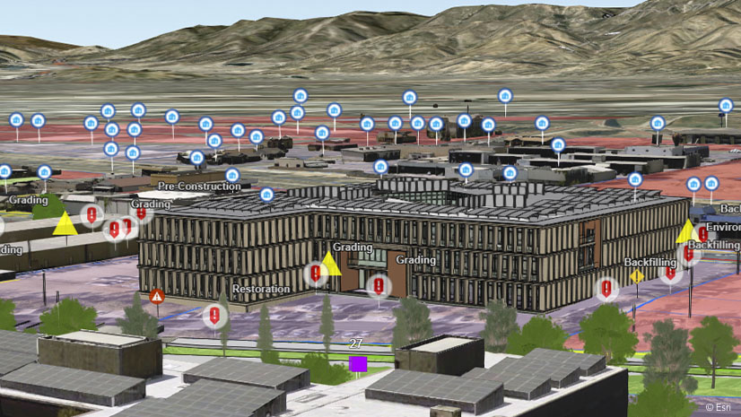
It All Comes Together or All Falls Apart at the Site
AEC projects are complex due to the need to track materials, contractors, tools and equipment, and coordinate construction activities.
AEC Firms Commit to Deliver Process Improvements and Technical Excellence
AEC industry leaders seek technology solutions that help them deliver projects efficiently and sustainably.
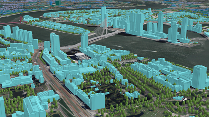
VolkerWessels Integrates BIM and GIS into All Infrastructure Projects
VolkerWessels has made the GIS office central to all its projects, the integration of BIM and GIS happened completely organically.
Join me at the Esri Infrastructure Management & GIS Conference
Creating the connected & sustainable infrastructure of the future with water, electric, gas, telecom, transportation, and AEC GIS professionals.

BIM My GIS – 3 Approaches and a Few Tips Along the Way
BIM in GIS is BIG! The line is blurred - firms are getting the most from the power of both. Learn a few approaches, tips & best practices.
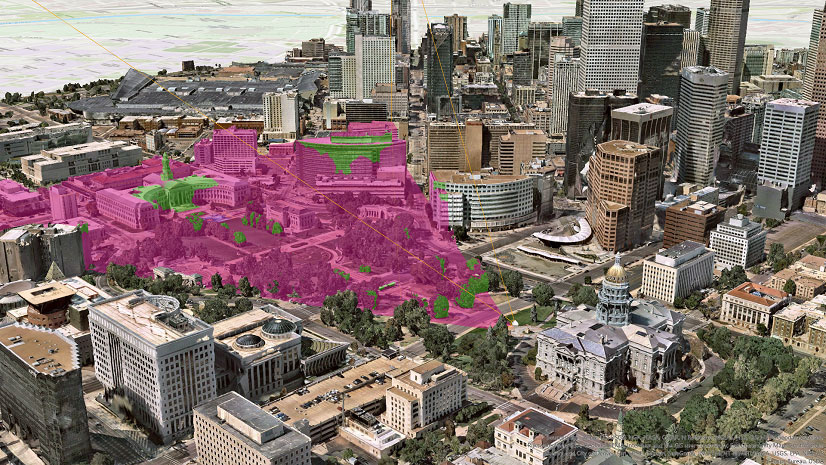
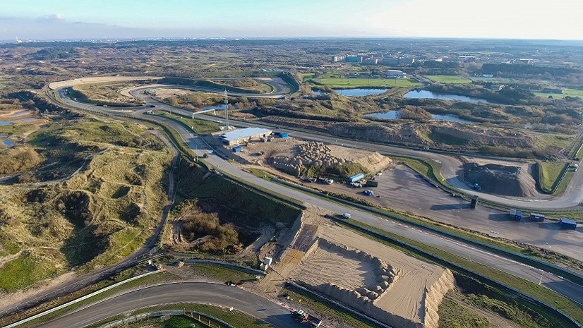
View from above: the critical value of reality capture
The potential for orthorectified aerial photographs and 3D textured meshes to help answer infrastructure challenges is considerable.
AEC industry connects at the Infrastructure Management & GIS Conference
A unique opportunity to bring planners, designers, engineers, owners, and operators from infrastructure industries together in one event.