Most recent
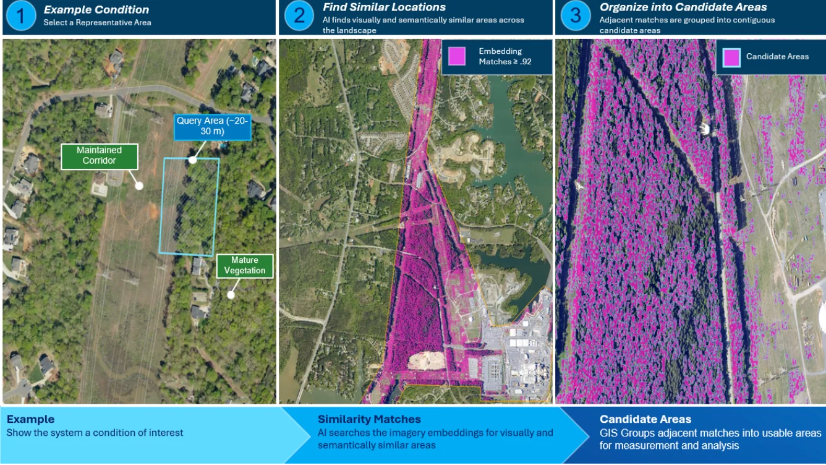
From Similarity to Priority: Combining imagery, GIS, lidar, and geospatial AI for infrastructure
Discover how ArcGIS combines imagery, lidar, GIS, and geospatial AI to identify, measure, and prioritize infrastructure conditions for action.