Skip to Content

Integration and Dissemination

Satellite imagery of a waterway and brown land with green and pink shaded areas on it and A graphic of a cloud and layers of information

Intelligence analysts, teams, and organizations use Esri ArcGIS software to effectively collaborate on intelligence integration in real time. ArcGIS supports a collaborative model for the dissemination of intelligence and raw information. Collaborations can be distributed across multiple organizations and even taken into the field for disconnected operations. Intelligence leaders can then use dynamic services to integrate the latest intelligence into their decision-making cycles.

Integrated intelligence solutions for integration and dissemination

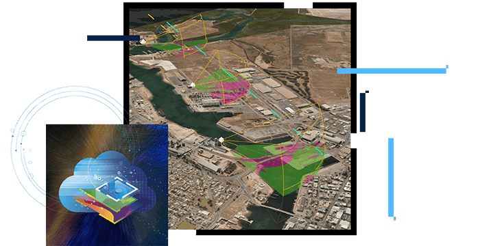
Communicating the analysis

Modern intelligence products are dynamic and interactive. ArcGIS provides tools for communicating analytic results through simple applications like the following:

  • Situational awareness dashboards
  • Story maps
  • Analytic dashboards
  • Intelligence briefings
  • Apps that are integrated into Microsoft Office

Using this approach, integrated intelligence products are always up-to-date. These products maintain their relationship to the source data and tradecraft, so reproducing and integrating the intelligence are streamlined.

Computer screen with map and metrics

Supporting policy making

Intelligence professionals use ArcGIS to create long-term intelligence estimates and daily briefings. With dynamic access to data and simple analytic tools, staff can quickly answer unanticipated questions from decision-makers. The collaborative tools in ArcGIS make it possible for teams and shift workers to assemble products rapidly, using the best available intelligence. When estimates and briefings are shared, the link to the original data and analysis is preserved, making it easier for subordinate commands to incorporate the official estimates into their workflows.

Computer screen dashboard with US map and charts

Supporting situational awareness

Intelligence analysts can use ArcGIS to integrate intelligence data into the common operational picture. In addition to providing the status and location of an adversary, analysts can produce running estimates based on recent activity. Threat analysis based on capabilities and tactics all provide key information to commanders and staff when conducting operations. These dynamic layers of information can be queried to aid in understanding threats' impacts on operational plans.

Computer screen with map and video feeds

Supporting planning

Intelligence data provides the context and framework for the intelligence planning process. ArcGIS has robust tools for performing intelligence preparation of the operational environment. Instead of producing static products, ArcGIS turns intelligence into easily shared dynamic information layers. Intelligence professionals attain greater knowledge of the battlespace and adversaries and can share it with all commanders and staff.

Learn more about planning
Platform for IPB diagram. Cloud surrounded by circles with icons

Foster cross-functional collaboration

ArcGIS provides a collaboration framework for teams that want to create and share intelligence information products throughout the intelligence cycle. ArcGIS also supports cross-organizational collaboration to unite key intelligence from multiple agencies. Intelligence analysts are often organized by geography, topic, or area of specialty. To develop integrated intelligence and decision-making products, analysts need to effectively collaborate with their teams and across organization boundaries.

BLOG

US Navy puts tactical tools to the test

Warfighters use GIS to integrate information inputs from sensors and drones. A common operational picture tracks locations and movements.

Read the article

Products for integration and dissemination

Previous
Next

Contact sales

Connect with the Esri intelligence team