Skip to Content

Operations

Streamline port operations

Smart ports understand that creating a collaborative information sharing environment is critical to improving productivity and increasing competitive advantage. That starts with having a comprehensive, real-time view of all activities within port facilities, allowing managers to reduce bottlenecks and maximize throughput.

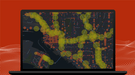
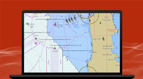
Situational awareness

Having a comprehensive, real-time view of port activities and facilities, both water and landside, is a prerequisite for operational excellence. Organizations worldwide use GIS to get this common operational view and improve performance. With the ability to integrate real-time data about vessel movements, weather and tidal changes, land-based transport movements, berth occupancy, and port business systems, ArcGIS provides a location-based platform that gives port operators a port-wide view of all current activity.

Real-time operations

Ports are increasingly becoming hyperconnected and sensorized to provide comprehensive information and operate at peak performance. GIS technology integrates all those disparate data sources into a single, comprehensive view to provide greater operational control of port infrastructure.

Collaboration and optimization

Leaders have come to recognize that collaboration between the various port entities can lead to significant performance improvements. GIS provides a common information-sharing platform to power greater port community collaboration and optimization.

Case study

Seamless solutions for Flinders Ports

Flinders Ports creates a class-leading, comprehensive view of data for land and sea operations using GIS and port management solutions from SAAB.

Read the case study

Products for port operations

Previous
Next

Contact sales

Connect with the Esri transportation team