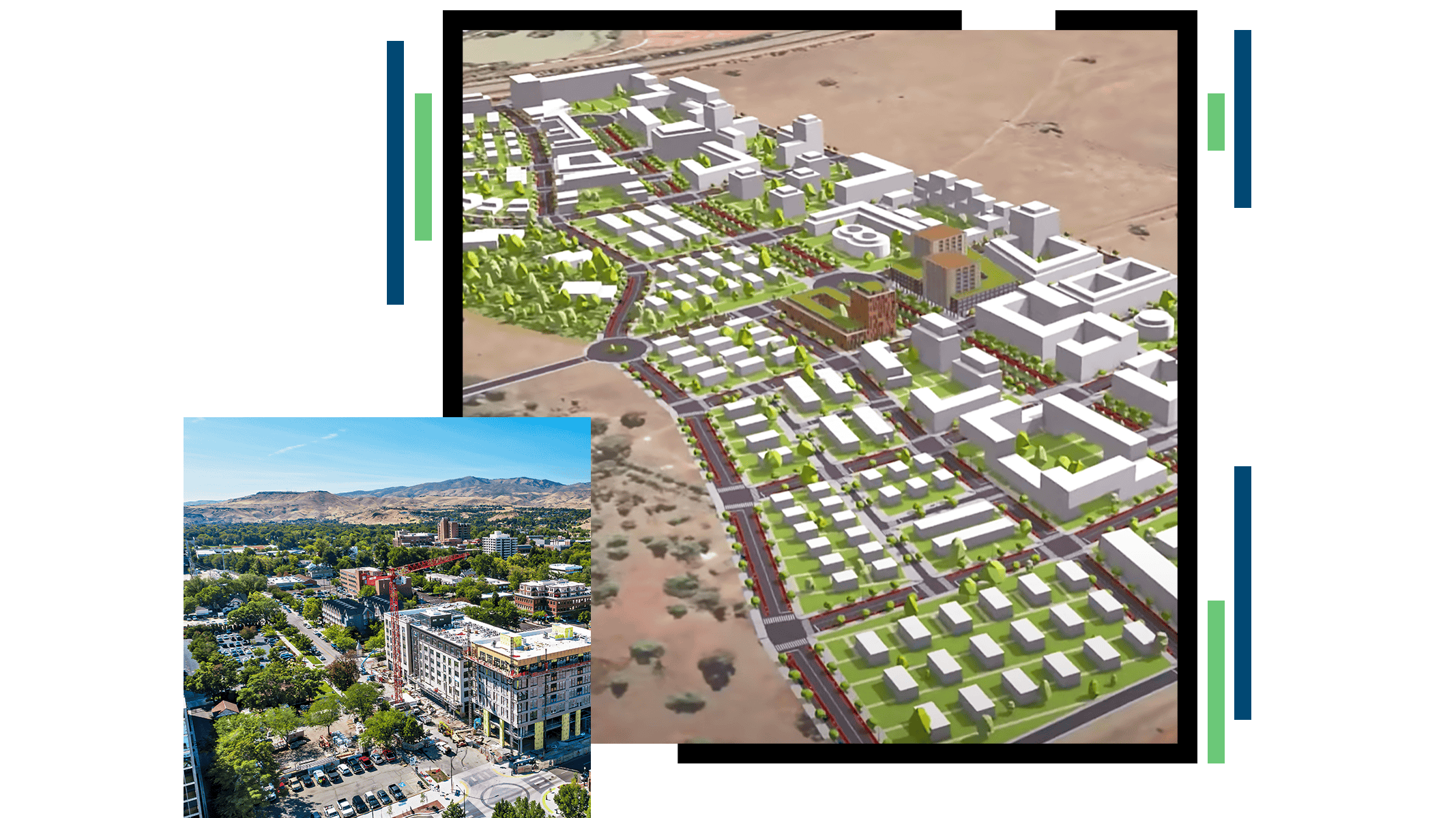
ArcGIS Pro
Planners have the obligation to create a path of sustainable and equitable development that leads to opportunities every resident deserves. To achieve this, it is essential that planners understand, incorporate, and analyze location and make it the focal point of their long-range planning. Practices such as geodesign have long embraced using location-based analysis to find the right balance between the built and natural environments. ArcGIS provides the platform for an agile and data-driven approach to sustainability, equity, and public input in comprehensive planning.
Create multiple 2D and 3D development scenarios according to existing or proposed zoning parameters in a secure web environment. Measure the demographic, economic, and environmental impacts of these developments to take a data-driven approach to future growth.
ArcGIS allows planners to understand, analyze, and report on the environmental impact of a proposed development and change in land use. These maps can be shared with administrators and stakeholders across the web and on mobile devices.
Planners think in 3D, so they should work in 3D. Using ArcGIS in a web browser, planning professionals can create building footprints, architect realistic landscapes, analyze the impacts of development in 3D, and perform line of sight and shadow impact analyses.
As a community's needs evolve, planners may need to consider updating zoning parameters for development. The ArcGIS platform allows planners to propose new zoning classifications and examine their potential impact before documents are modified.
ArcGIS allows you to easily standardize data used for long-range planning, including future land-use and zoning data. You can also regulate how plans for future development are submitted digitally by developers and other stakeholders.
Location is at the center of assessing the status, wants, and needs of neighborhoods. ArcGIS provides the tools to assess resources and constraints and unveil opportunities to improve the quality of life for a community.
INDUSTRY BLOG
As planners are impacted by an increase in counter-urbanization, GIS can help them prepare for the short and long term.
CASE STUDY
Planning and Development Services of Kenton County, Kentucky, uses visualization and storytelling to deliver services for growth and development.
VIDEO
Morrisville, North Carolina, used a 3D model that allowed local officials to explore the site from a pedestrian's perspective.
ArcGIS Pro
ArcGIS Urban & Policy Validation Application
ArcGIS CityEngine
ArcGIS Hub
ArcGIS Survey123
Esri Maps for Public Policy
ArcGIS Community Analyst
ArcGIS Solutions