Stakeholder Engagement

Bring communities into the conversation with maps and apps that make planning personal

3D city model with a red-highlighted building, alongside two people viewing content on a laptop

Build confidence and consensus with maps

ArcGIS turns complex planning data into clear, interactive maps that help stakeholders understand proposals and see the impact of decisions. Planners can foster transparency with citizens, consider more perspectives, and invite meaningful feedback that leads to evidence-based and trusted outcomes.

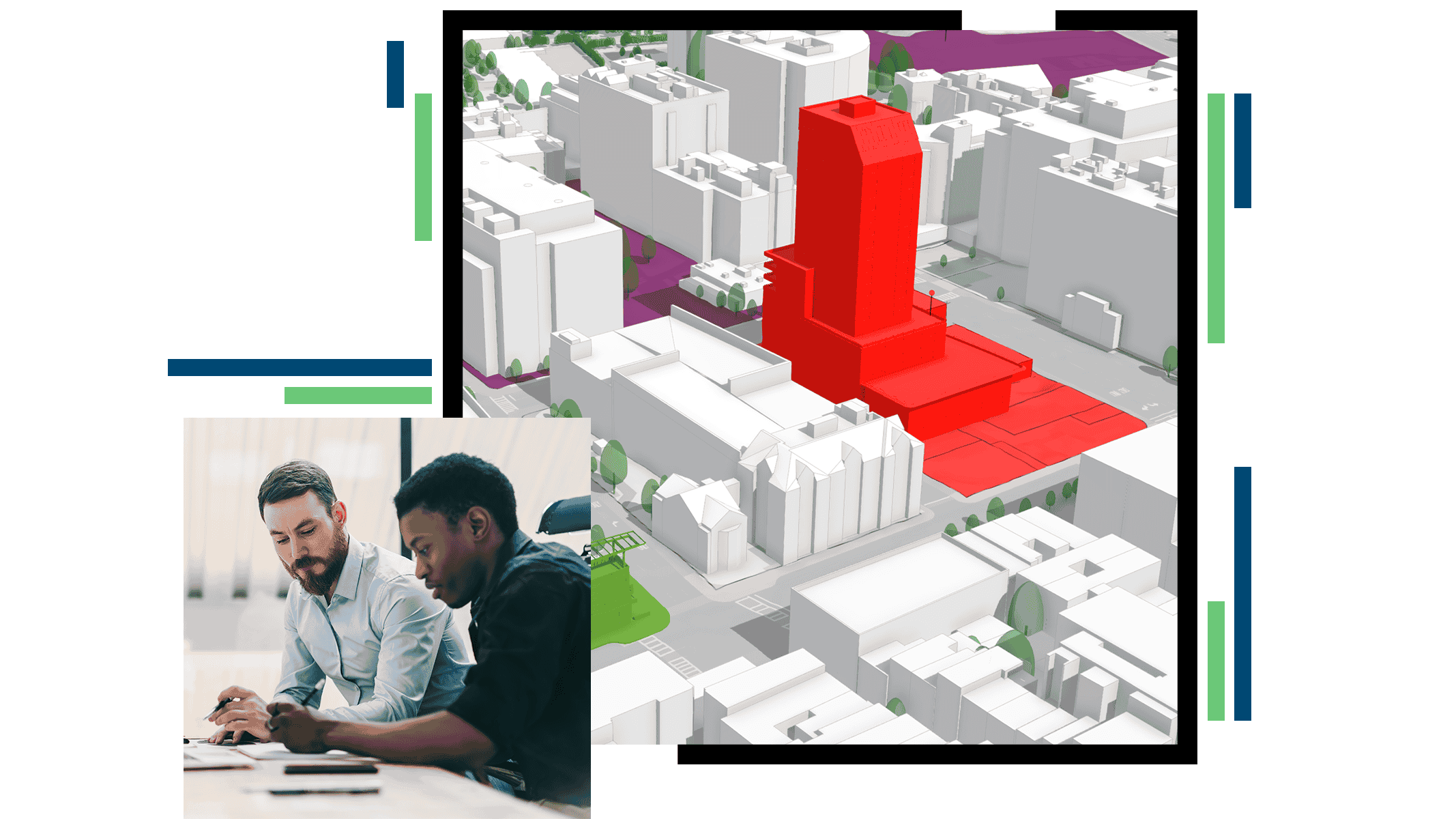
Add transparency to planning reviews

Automate workflows like data collection and feasibility studies, track progress, and increase transparency with a geoenabled permitting and review system powered by ArcGIS.

This makes it easier for developers, agencies, and citizens to stay informed and engaged throughout the planning process.

Permit lookup interface with project details and a map showing permit locations in West Fargo, North Dakota

Harness spatial insights to get buy-in

ArcGIS enables planners to back proposals with straightforward, data-driven analysis.

Whether it’s showing the impact of a new transit line or the implications of a zoning change, this transparency helps earn the confidence of officials, developers, and community members.

Map with colored pins for urban projects and an inset showing a 33-unit multi-family housing plan

Visualize new developments in context

Create compelling visualizations of proposed developments, zoning changes, or infrastructure projects in ArcGIS.

These visuals help residents and stakeholders quickly grasp complex ideas, leading to more informed feedback and stronger community support.

3D urban model with a highlighted modern building showing how it fits within surrounding structures

Foster collaborative decision-making

Facilitate virtual and in-person engagement with interactive maps, mobile apps, and online platforms.

This allows planners to meet everyone where they are—whether at a town hall or on their phone—broadening participation and making citizen engagement more inclusive.

Aerial view of a neighborhood with a comment bubble noting the need for a crosswalk at an intersection

CASE STUDY

A geographic approach to growth in Colorado

El Paso County uses GIS to plan the future of a community that includes urban and rural areas, military installations, and natural landscapes.

Read the case study

Products and solutions for stakeholder engagement

Previous
Next

Contact sales

Please share your information and our sales team will contact you soon. We look forward to communicating with you.