The Headlines
-
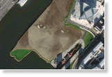
What's generating the most buzz in Esri ArcGIS Marketplace? To ring in 2014, we did some digging and created a list of the top 10 apps and data services that have you talking—and shopping the Marketplace. Read the article.
-
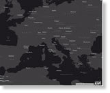
If you like Esri's light gray canvas basemap, check out the new dark gray canvas basemap, now in beta. Your map data will look brighter than ever. Read the blog.

-
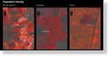
Riverside County, California, uses ArcGIS Online to open up GIS resources such as maps, apps, data layers, and web services, to its entire organization. While GIS professionals develop web maps and apps, maintain data, and perform analysis, non-GIS staff members can quickly access that information using cloud-based ArcGIS Online. Read the article.
News Bytes
-
Philadelphia Fire Department's new mobile GIS app provides potentially lifesaving info: building sizes, inspection data, floor plans, fire truck locations, and more. Read the article at nbcphiladelphia.com.
-
The new ArcGIS for Electric and ArcGIS for Gas products will geoenable your utilities in short order. Get the details.
-
San Francisco Public Utilities Commission uses GIS for sewer operations. The staff uses the technology to monitor odor issues and flooding after rainstorms. Read the article.
-
This story map profiles the 50 most populous United Nations refugee camps in the world. See where 1.9 million displaced people have fled.
-
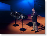
What does location and geospatial analysis bring to the table when working with big data? Watch this presentation by Esri's Marwa Mabrouk at AWS re:Invent 2013.
-
The latest version of Esri's urban design software is out, and its software developer kit makes it easy to use in other popular 3D software including Autodesk Maya and Google SketchUp. Learn more.
Centerpoints

-
You celebrated GIS Day in the United States, Brazil, Canada, India, Afghanistan, Australia, and everywhere in between. Read this article about five special events that made GIS and geography come alive.
-
Urban Observatory creates an interactive museum experience that uses digital maps and geospatial analytics to bring cities to life. Read the article and learn how to participate.
-
GIS users in the Czech Republic find many inventive ways to use geospatial technology, from analyzing elections to better serving electric customers. Read this report from the Czech Esri User Conference.