Technical Talk
In ArcGIS Online, you can use groups to better deliver access to maps and apps to others in your organization. Read the blog post about how to work in groups, and watch the video.
-
Esri's Jeremy Bartley and several developers at the Esri International Developer Summit talk about Esri resources for building web maps and apps. Watch the video.
-
Scanning historic maps at a high resolution is just one of seven best practices for georeferencing historic maps and data.
-
On GitHub, you will find 10 open-source projects to get JavaScript mapping apps out the door.
-
This short tutorial will teach you how to accept an invitation to an ArcGIS Online organizational subscription and set up a user account.
-
Take this three-minute tutorial to learn how to turn a map template into an app using ArcGIS Online.
-
Devon Humphrey from Waypoint Mapping talks about the benefits of using unmanned aerial vehicles (UAVs) to capture GIS data. Read the article.
Et cetera
-
Watch this video to find out how to use the tools in the Military Aspects of Weather template in Portal for ArcGIS and get started evaluating the impact of weather on missions and creating weather map products.
-
Esri's SpatiaLABS lessons are free and now easy to download. The GIS lessons cover topics related to health, weather, water, business, forestry, and more. Read the blog post from Esri's Angela Lee.
-
GIS technology can be used to teach almost any topic. Take the free web course, Teaching with GIS: Introduction to Using GIS in the Classroom.
-
Esri's Joseph Kerski walks the talk, using ArcGIS Online to map data from his fitness app, Runkeeper. Read his blog post to learn how mapping enhances understanding, whether you are at work or play.
Endpoints

-
Esri is on Instagram! #Geogeeks unite and share your geophotos, learn about Esri events, and more. Reposted photos will be featured in Esri story maps. The call is now out for vintage Esri T-shirt pictures. Follow us @esrigram.
-
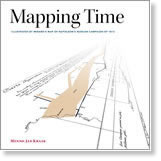
New from Esri Press, Mapping Time: Illustrated by Minard's Map of Napoleon's Russian Campaign of 1812 explores the challenge of visualizing a period in time, using a map of France's invasion of Russia as an example. Buy the book in hard cover.

-
Esri offers Cutting Edge servers preinstalled with ArcGIS for Server on both Windows and Linux. These offers include optional database servers preloaded with Microsoft SQL or PostgreSQL.