Technical Talk
Try the New Geodesign App
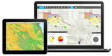
Create, analyze, and report on alternative planning scenarios using the new GeoPlanner for ArcGIS. This web app brings the power of geoscience to planning professionals, giving them the tools they need for their land-based planning workflows and geodesign projects.
-
ArcGIS Pro, now in beta, gives GIS professionals the ability to work with geospatial information in both 2D and 3D. Read the blog post and
watch this video.
-
Plan to go to the Esri User Conference in July? Stop by the Training and Certification Island and enter your name to win a free Esri Technical Certification exam voucher.
-
Learn to
choose different symbols to represent the features you've added to your map in ArcGIS Online.
-
You can now find ArcGIS solution symbols in a GitHub repository. Read the blog post for details.
-
This set of templates will help you get started making your own disaster-related maps.
-
ArcGIS Online now includes a way to mark items as favorites, helping you to quickly find and retrieve frequently used items such as maps and layers. Read this tip about how to use My Favorites.
Et cetera
-
Familiarize yourself with the members of the 2014 World Cup team from the United States and their hometowns using this Story Map. The tournament in Brazil ends July 13.
-
This latest update provides great detail for planning trips and making your way through the busy streets of Copenhagen. Read the blog post.
-
What could your organization achieve if decision makers knew what was possible with enterprise GIS? Tell them about Exploring Enterprise GIS: A Workshop for Leaders.
-
Take a virtual tour of the National Zoo and see where some of the youngest animals such as lions, tigers, and gazelles live. Another map shows where you can find the same animals in the wild.
Endpoints
-
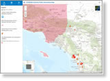
Many agencies use Esri technology to create online maps that show fire perimeter and evacuation shelter locations. View this map with information about last month's wildfires in San Diego County and this general wildfire public information map.
-
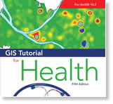
Learn how spatial analysis can help you manage health services and support decision making in GIS Tutorial for Health, Fifth Edition. Electronic resources for self-study and course instruction are available, and it's ArcGIS 10.2 compatible. Buy the book.
-
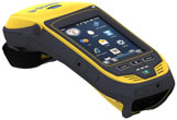
Both the GeoCollector for ArcPad and GeoCollector for ArcGIS for Windows Mobile high-accuracy data collection solutions have been updated to include Trimble's new Geo 7X handheld with an optional range finder module. Learn more about all Esri and Trimble offers.