Tech Time
Street data for 52 countries in the Asia Pacific region, including India, Indonesia, Hong Kong, Australia, New Zealand, and Malaysia, are now in StreetMap Premium for ArcGIS. Read the article.
-
The ArcGIS Earth beta is available to take out for a spin. Esri's new desktop-based app gives you the ability to explore 2D and 3D data. Read the blog.
Download the beta.
-
Thousands of coders. More than 300 tech sessions. Good things will happen when the Esri Developer Summit returns to Palm Springs, California, March 8–11, 2016. Register today.
-
Esri’s spatial analysis development team demonstrates a series of spatial statistics tools in ArcGIS, including Central Feature, Standard Deviational Ellipse, and High/Low Clustering. Watch the video.
Maps & More
-
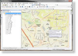
Your city can use GIS to analyze its public transit service, including finding out where the people underserved by the system live. Read the blog. View the Story Map Journal.

-
Esri's Joseph Kerski used ArcGIS Online and ArcGIS Pro to map the altitude and other data from a student-launched weather balloon named Spartacus. Read the blog.

-
Esri offers cost-effective solutions to US customers that want to configure or upgrade their GIS. Esri's server, desktop, mobile, and data products are prepackaged with ArcGIS. Search for a solution.
The Last Word
-
Bet you have a remarkable GIS Day story to tell! Did you make mapping apps, create a story map, or have a blast taking part in the Ashcloud Apocalypse megavolcano exercise? Send in your story and photos.
-
Follow scientists as they conduct biodiversity research on the Ogooué River in Gabon, Africa, using a Story Map Journal created by The Nature Conservancy. The scientists collected data about fish, the habitat, and the water.
View the Story Map Journal.
Watch the video.