
Grassroots Geography Sets Tone for 21st User Conference
GIS Communities Are Poised to Take the Pulse of the Planet
For 21 consecutive years, Jack Dangermond has stood before a crowd of Esri users and spoken about his vision for GIS. During those years, his enthusiasm for geography and 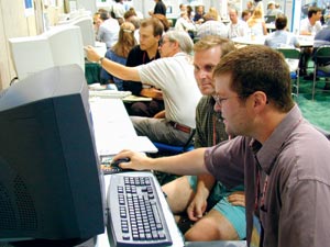 GIS has not waned. On the contrary, his passion is growing and his optimism about the future of GIS is contagious. Each year, the crowd gets bigger.
Right: Conference attendees gathered from different parts of the world, all sharing a common belief in the potential for GIS.
More than 11,000 GIS professionals packed the San Diego Convention Center July 9, 2001, to hear Dangermond, president of Esri, open the 21st Annual Esri International User Conference and talk about how geography creates communities with GIS technology as its framework.
"GIS is getting easier, becoming more standards-based, and fitting in with the rest of the IT infrastructure," he said. "GIS will no longer be specialized and proprietary, it is becoming pervasive, and it's our responsibility to be involved and conscious of what we are doing."
Conference attendees, who are working in a variety of disciplines gathered from more than 100 countries sharing a common belief in the potential for "GIS to assist us in achieving our various goals," Dangermond said. "This is in fact a definition of community. Communities come together for a sense of purpose, to share common experiences."
Dangermond explained the creating communities concept. "Each of us belongs to some kind of community--where we live, where we work--but we also belong to a larger community, a natural community that is coevolving and operating as part of a larger organism.
"What we do and how we do it during the next few years will set the course for our planet. What is required of us as human beings is a greater awareness or consciousness  regarding our environment. I believe that, in the future, GIS will evolve into a kind of nervous system for our planet. GIS will be able to take the pulse of the earth." He said that GIS technology can provide a large framework for coordinating activities to work on common problems such as population, resource consumption, and pollution, more efficiently and effectively, and it enables those activities to be more sustainable and more participatory. "Its visual language lets more people in your communities make more conscious decisions."
As different disciplines with different requirements become successful at building common data for sharing, the consciousness of the value of spatial data will bring about standards for gathering data throughout the world. And, Dangermond predicted, there will be a greater need for GIS professionals to support this technical infrastructure.
The g.net Model
Dangermond explained how the g.net architecture will serve as a foundation for connecting and sharing information services. As more and more  people understand the value of using geographic thinking for structuring organizations, solving problems, and communicating the broader context of issues through a visual language, the need for easy access to geographic information will continue to rise; the Internet is seen as the best way to meet this demand. Esri's Geography Network represents the first major implementation of Web services into that area with the g.net emerging as a global architecture of systems, he said.
This new, network-based architecture is multiparticipatory and collaborative and enables organizations to openly share and directly use GIS information from many distributed sources at the same time. Working with any scale of implementation in any size organization, it promises to leverage the work of GIS professionals while radically enlarging the use of GIS in the world. "I want you to take these services and build services for your communities," he said.
During his talk, Dangermond also elaborated on the direction and focus of Esri. "The purpose of Esri is to advance the use and capabilities of GIS technology. A critical aspect of this goal, in addition to the continued development of our software products, is to serve our users and grow the GIS professional workforce."
 With more than 100,000 users and one million licensed software seats, Esri's efforts are directed at improving its core GIS products, strengthening its partnership program, and supporting its GIS in Society programs such as conservation and the spatial data infrastructure. Esri's education programs are expanding in learning centers and on the Virtual Campus.
"We now have more than 20,000 educational programs in K-12 schools working toward building the global GIS workforce," said Dangermond. Esri's first independent conference for educators was held just before the User Conference, July 6-8, 2001, in San Diego. More than 400 educators attended workshops, presentations, and discussions about the use of GIS in the classroom.
A Single, Integrated GIS
The spotlight was on ArcGIS 8.1, Esri's next-generation software platform, during the opening day plenary session. Dangermond said the new release of ArcGIS articulates Esri's interconnected strategy as it weaves a fabric of services for GIS professionals such as ArcSDE, ArcReader, and ArcIMS. Built with common component technology and rich in functionality, its goals are the same as g.net--open, interoperable, and distributed.
"ArcGIS is an important technology and one that we've been committed to for more than a decade to give you a framework for building your own geography network," Dangermond said. "It takes an information-centric approach and will save you enormous amounts of time."
The ArcGIS 8.1 release contains updated versions of ArcView and ArcInfo desktop software products and ArcSDE spatial database server. All share a common user interface,  include new or enhanced performance, and are built on a single, common architecture. ArcGIS 8.1 also introduces new software products including ArcEditor and a set of extensions--ArcGIS Spatial Analyst, ArcGIS 3D Analyst, ArcGIS Geostatistical Analyst, ArcGIS StreetMap USA, ArcPress for ArcGIS, and MrSID Encoder for ArcGIS.
The common user interface along with the shared architecture make ArcGIS and spatial data accessible to a host of new users with various GIS needs enabling users to share scripts, custom tools, applications, and extensions. ArcGIS 8.1 users can integrate data from Internet map services with local data sets and use the Geography Network (www.geographynetwork.com) for searching, viewing, and accessing public and commercial map services.
David Maguire, director of products, outlined Esri's product and technology strategies and introduced live demonstrations for ArcGIS and the Geography Network.
Maguire said that Esri research and development is targeted to support all types of end users and developers. Conscious of various industry standards and looking toward increased Web services and location-based services, Esri is committed to developing scalable, open, and interoperable technologies.
Esri staff presented sample applications from a range of industry sectors including local government, planning, transportation, and resource management. Along with the ArcGIS platform, attendees saw demonstrations of ArcGIS Geostatistical Analyst, ArcGIS Spatial Analyst, and ArcGIS 3D Analyst.
With an ongoing commitment to users' needs, Esri's new projects feature advanced functionality in geodata management, maximum quality, increased performance, and better documentation. Dangermond said that the goals of future releases of ArcGIS are to extend geoprocessing functionality, add cartography, and deploy a lightweight reader. "These new things are helping to advance the fundamental science, and that's what makes it so exciting," he said. www.esri.com/arcgis
ArcReader Lets You Read and Work with Live Maps
New to the ArcGIS family, ArcReader made its debut to an applauding audience. ArcReader will enable GIS users to publish electronic maps and make them available locally and over networks. Similar to the relationship between Adobe Acrobat Reader and Portable Document Format documents, ArcReader goes one step further by enabling the electronic maps to contain live data access to sources such as geodatabases, coverages, shapefiles, and ArcIMS services (see cover article). www.esri.com/arcreader
State-of-the-Art GIS Data Visualization
ArcEditor 8.1 gives users tools for integrating and visualizing a range of data formats, data exploration, spatial query, and spatial data analysis. It also supports  basic geographic and metadata creation, modification, organization, and management. With functionality common to the ArcGIS suite of applications, the new release of ArcEditor adds complete editing capabilities for ArcInfo coverages and personal and enterprise geodatabases, and it enables users to read and use database features such as geometric networks, relationships, and subtypes. www.esri.com/arceditor
World's Most Popular Desktop GIS
With more than a half million copies in use worldwide, the 8.1 release of Esri's ArcView mapping software promises even wider use. ArcView 8.1 maintains the base functionality of ArcView 3.x with added features such as a catalog for browsing and managing data, on-the-fly coordinate and datum projection, metadata creation, customization with built-in Visual Basic for Applications, new geographic editing tools, support for static annotation, and enhanced cartographic tools. ArcView 8.1 is an exceptional stand-alone GIS or can be the entry point to ArcGIS. ArcView 8.1 users can integrate Internet map data with their local data. www.esri.com/arcview
Major Update for ArcIMS
Now part of the ArcGIS software family,ArcIMS 3.1 features full integration with ArcView, ArcEditor, and ArcInfo. The 3.1 release makes the software more appealing to international users. Messages and menus have been placed in resource bundles for easy localization, and the software supports code pages for all languages for shapefiles and database files. Security enhancements and new Java connectors are also included in the release. www.esri.com/arcims
The Latest in Mobile GIS
Esri's ArcPad continues to grow as a mobile client in the ArcGIS family of products and makes data collection in the field easy and efficient. ArcPad 6 features a new custom development tool, enhanced form controls, and support for internationalization and localization. Data can also be accessed from the Internet via wireless technology, and for direct data capture, GPS receivers can be added. Data is now immediately available and validated in the context of an actual map. www.esri.com/arcpad
Announcing ArcLogistics Route 3
ArcLogistics Route is a fully interactive and easy-to-use desktop routing and scheduling software application that helps Businesses and organizations deliver goods or services more efficiently, reduce costs, and improve customer service. Version 3 creates new flexibility by enabling users to set a grace period for delivery and adds a second time window for service. Another new feature, second day routing, is helpful for users who need to route their vehicles past midnight. Orders can be prioritized so that high priority orders always are sent when routing all orders is impossible. Additional enhancements include an improved architecture for customization and new application framework features. www.esri.com/arclogisticsroute
Recognizing GIS Achievements
Dangermond presented the President's Award to representatives of the International Centre for Integrated Mountain Development (ICIMOD), 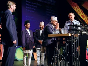 a special unit of the United Nations Environment Programme. Located in the Hindu-Kush Himalayan region, ICIMOD has established a GIS community for sustainable development in agriculture, forestry, and land use throughout this fragile ecosystem. "They have created 120 relationships in a geography network. The 2000 User Conference theme 'Geography--Creating Communities' came from my experience with these people," said Dangermond.
The Making a Difference Award went to CBS, producers of The District, and its stars Lynne Thigpen and Craig T. Nelson. Thigpen, who plays Ella Farmer, director of crime analysis in the Washington, D.C., Metro Police Department, on The District, accepted the award. She said, "GIS has helped us make a difference by sharing geographic knowledge and educating the public about national problems."
This year, Esri's Lifetime Achievement Award went to Dr. Michael Goodchild for his work as a foremost GIS scholar. It was presented to Goodchild by Dr. Roger Tomlinson (see article on page 2), who said, "He has put GIS firmly in place as a subject for teaching at the university level."
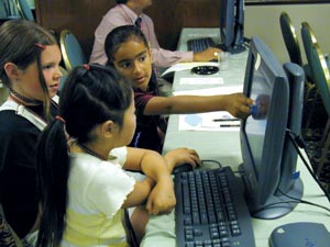
 Students from Stillwater Area High School in Oak Park Heights, Minnesota, and their teacher were all smiles during the opening session as their Smart Growth in Action project was named the 2000-2001 Esri Community Atlas Model Project winner. Teacher Sara Damon and students Jordan and Tyler Bagley and Nik Costello studied urban expansion and its impact on Washington County, Minnesota. As part of their award, the Eastman Kodak Company donated a digital camera and printer to the school (see photo on left).
A Week of GIS Activities
The keynote speaker for the 2001 User Conference was Dr. Michael Fay, who had just returned from an exploration of an uninhabited, remote forest corridor in Africa. It took Fay 460 days to walk the entire area, which spans two countries--Gabon and Congo (see "Rescuing the Earth's Most Remote Gorillas and Giant Forest Elephants").
He systematically surveyed trees and plants, wildlife, and human impacts on the area and gathered data with a digital video camera, digital audio recorder, GPS, and 50 rainproof notebooks. The National Geographic Society and the Wildlife Conservation Society funded Fay's Megatransect.
The first day of the User Conference offered a glimpse into the future, and it promised more detailed information sessions in the following days. There were many opportunities for GIS users to exchange ideas and lay the foundations for their own geography networks in numerous disciplines.