Fall 2005
Fall 2005 |
|||||||
|
|
|||||||
GIS Helping Manage Our World |
|
|
by Jack Dangermond
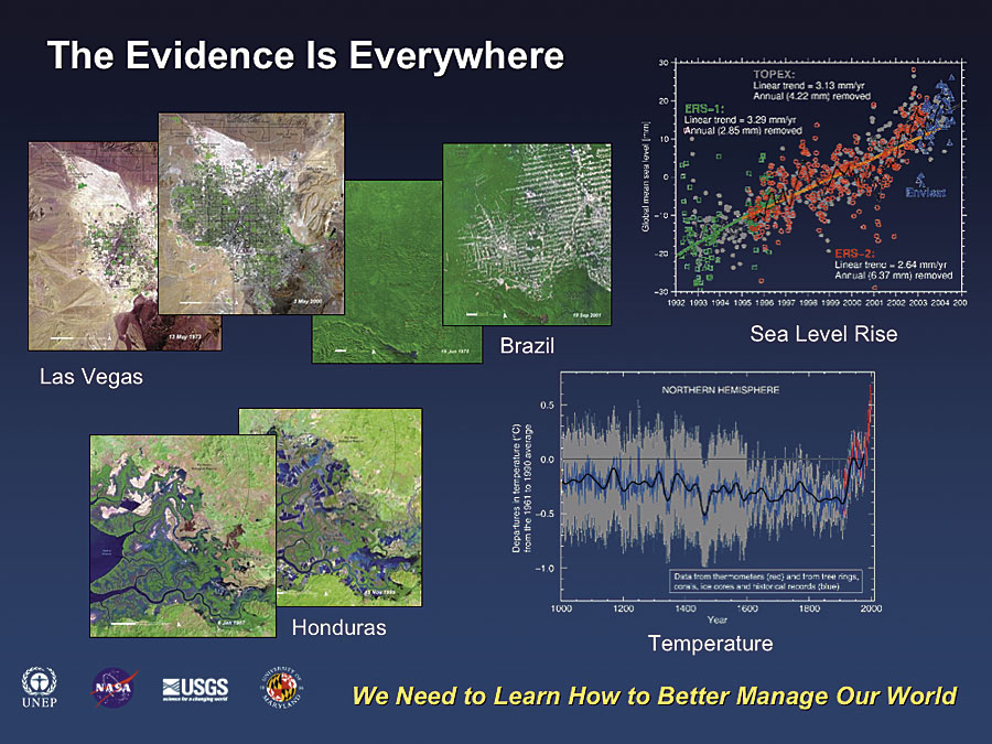
Today, our world is evolving rapidly, increasingly influenced by millions of independent human activities. As a result of these activities, our world is becoming more populated and urbanized; more technical and specialized; more connected, globalized, and informed; and, some people would suggest, more fragile. These human activities are impacting our environment, earth's natural places, biodiversity, and the availability of natural resources that support civilization as we know it. Many people believe these activities are not sustainable and that, without more intelligent planning and management, they will negatively affect our future.
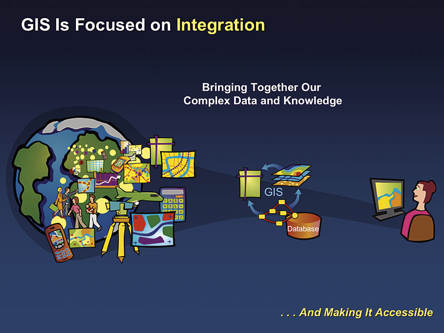
These trends suggest that we need to take responsibility for better managing our world. The Growing Role of Geography and GISGeography is the science of our world. It involves the study of the earth and all the contents and processes that are evolving around us. GIS builds on geographic science by providing an information system for organizing, managing, and integrating complex scientific data and knowledge. GIS is also a framework for making this knowledge accessible to scientists, planners, decision makers, and the public.
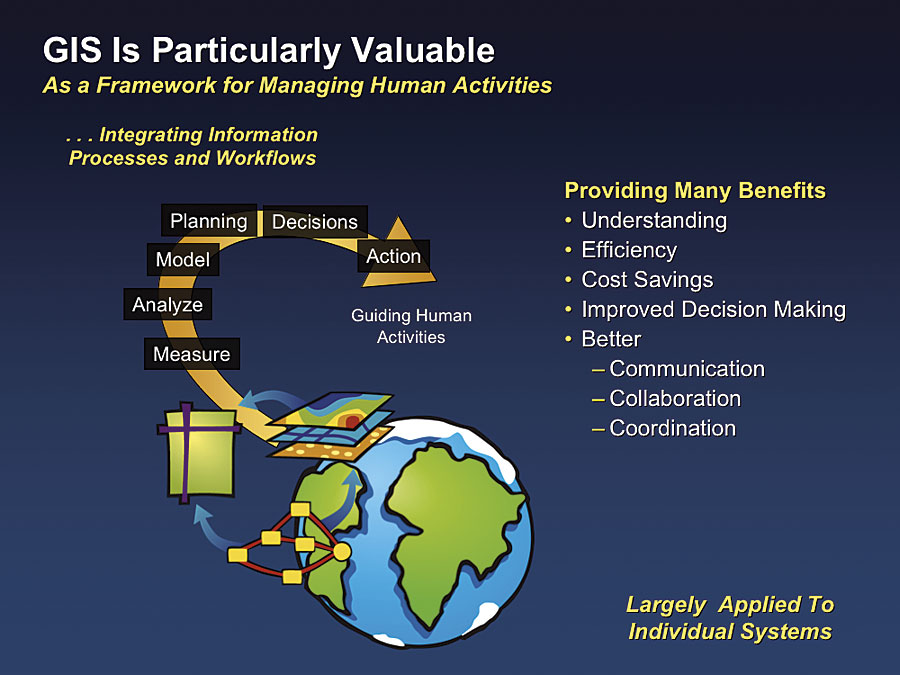
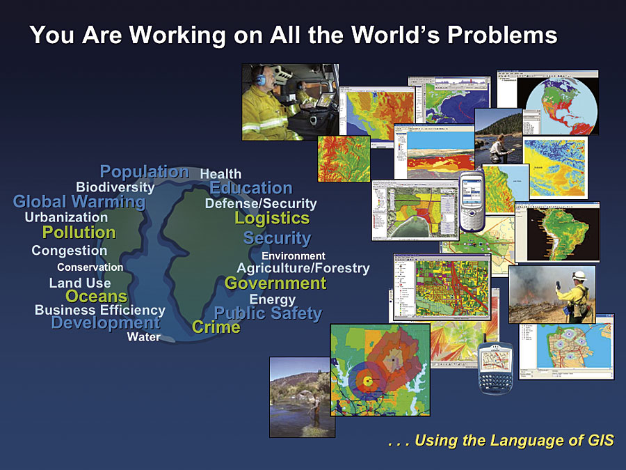
GIS is particularly valuable for managing human activities. The tens of thousands of successful GIS applications provide evidence of this. GIS brings our geographic measurements together with powerful tools for visualization, analysis, and modeling. These technologies are increasingly being integrated into the planning and decision-making operational workflows of our organizations. GIS and this geographic approach are providing a new opportunity for reorganizing our methods and approaches to consider all the factors. The implication of this is vast and will eventually affect the planning, design, engineering, and management activities of nearly every profession. GIS Users Are Making a DifferenceOur users' work benefits many areas. At the level of basic science, GIS users are improving understanding of how the planet works at all scales. At the application level, GIS users are analyzing complex situations, visualizing problems, and creating geographic plans and solutions; they are also increasing efficiency, reducing costs, and helping people make faster and better decisions that consider all the geographic factors necessary to create a sustainable future. And GIS users are improving the processes of communication and collaboration, helping to better coordinate work across organizations.
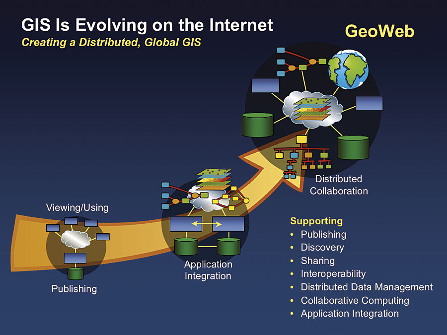
All the hundreds of thousands of individual GIS efforts are clearly making huge contributions toward better management of our planet. Nevertheless, there is much more to be done. Current technology is evolving in such a way that, for the first time, all our individual efforts can be connected and integrated to provide a basis for all of society to benefit from the power of GIS. The Vision of a System of Systems—The GeoWebDeploying GIS on the Internet can lead to a distributed and multiparticipant GIS. While still in its early development, we are already using this as a platform to publish maps and share geographic data. But with appropriate Web services standards, it is also possible to link and connect GIS Web sites to integrate our individual datasets into new applications that model geography and support a multitude of applications. This type of GIS will evolve into something I like to call the GeoWeb—a wide network of distributed GIS services that describe and model everything known about our planet: the sum of our geographic knowledge. This framework already supports map and data publishing, metadata cataloging, and the discovery of geospatial services. Over time, it will expand to support the dynamic connection of a whole host of distributed GIS services, including data management, modeling, GIS analysis, and advanced visualization. This can provide a platform for us to look at bigger problems that depend on cross-organization and cross-discipline collaboration.
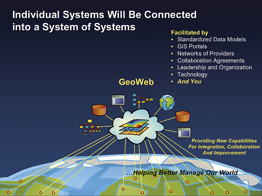
The notion of a system of systems for geospatial information was first suggested by the National Academy of Sciences Mapping Science Committee and was referred to as the National Spatial Data Infrastructure. More recently, this architecture has been adopted by the National Oceanic and Atmospheric Administration and others as part of their architecture for the Global Earth Observation System of Systems (GEOSS). GEOSS will serve as a framework for integrating the large number of global remote-sensing systems into a loosely coupled network available to many participants. We are now seeing how this same architecture will serve as a framework for the GeoWeb. The GeoWeb "system of systems" will be used for a whole range of applications and purposes, supporting regional, national, and even global applications. This new working environment will provide many benefits beyond what we are doing in individual systems and organizations; it will help us better manage our world. This multiuser, distributed GeoWeb will require GIS services-oriented technology, leadership, sharing policies, and GIS professionals who have the knowledge and experience, as well as an interest in sharing their efforts as part of a larger network.
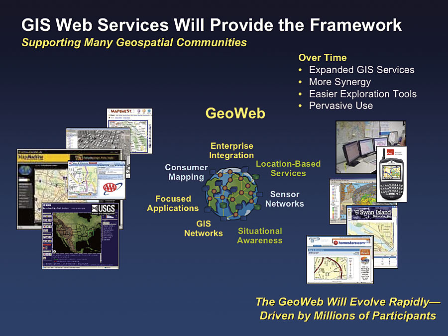
This GeoWeb will be constructed using standardized spatial data models, with GIS metadata portals for organization and discovery, and will be implemented by various collaborative agreements to share and contribute knowledge and information. GeoWeb CommunitiesThe GeoWeb will support a multitude of GIS services with participants organized loosely into various geospatial communities.
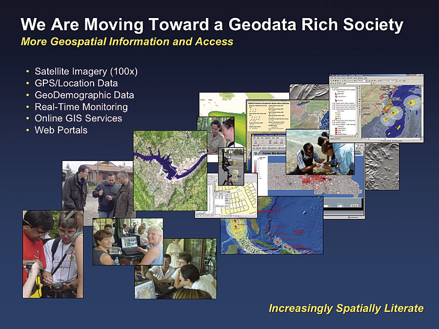
These communities will range from consumers who are interested in finding or navigating to a location or looking at maps, images, and visualizations to professionals focusing on sophisticated logistics, real-time situational awareness, geospatial modeling, decision support, and integration of GIS services into enterprise environments. GIS knowledge will permeate virtually all our government and business enterprises, providing better geographic awareness of what is happening, improving decision making regarding all levels of human activity, and delivering many benefits. Over time, these communities will expand, interoperate more, and become increasingly synergistic. This will be fueled by increasingly easy-to-use GIS technology. The GeoWeb will evolve rapidly, not driven by a few thousand, or even a few hundred thousand, but by millions of participants. We already see evidence of this in the popularity of consumer mapping and visualization Web sites from Google, MapQuest, and Microsoft. Geodata-Rich SocietyWe are moving into a geodata-rich society, with more geospatial information and more access to it. It has been suggested that within the next six years we will have a hundred times more satellite imagery available. GPS location data and the real-time monitoring of various geographic phenomena will be increasingly available in consumer, as well as professional, applications. These measurements will be served on the Web and available as GIS application building blocks in GIS portals designed for geospatial knowledge discovery. Together, all these patterns will cause an increase in spatial literacy among virtually all our social institutions and the citizens who support them.
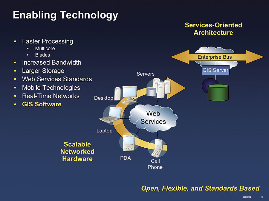
Enabling TechnologyThe evolution of GIS is being supported by powerful enabling technology that includes faster (multicore) processors, inexpensive data storage, high-performance networks, standards for open/interoperable protocols (e.g., XML, SOAP), and more locationally aware wireless devices for accessing GeoWeb services. At the same time, GIS software is evolving new capabilities and services-oriented architectures that will make GIS use more productive.
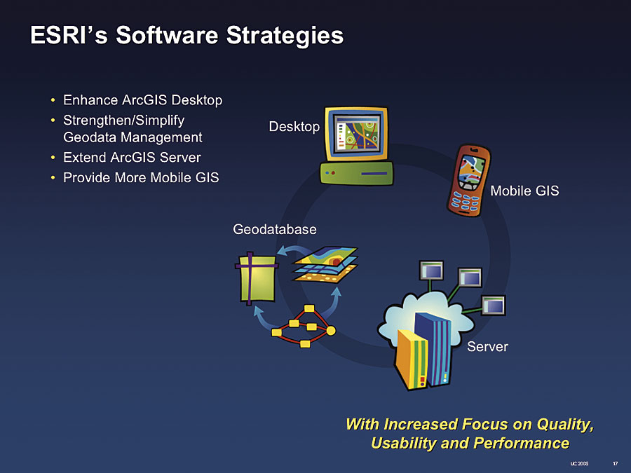
Esri Software StrategyThe fundamental goal of Esri's software development is to help users solve their problems. We are doing this by investing in four fundamental software areas:
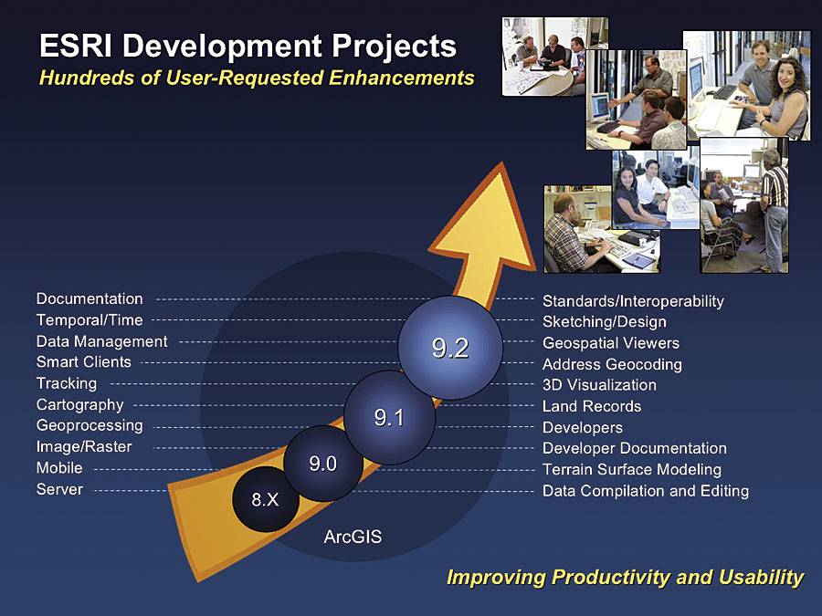
These individual strategies are being realized in an integrated network architecture that leverages the multiple ways our users deploy our tools (e.g., mobile, desktop, client/server, and networks). ArcGIS 9.2—Responding to Users' RequestsThe current Esri development focus is on the ArcGIS 9.2 release, which is targeted to be available in the first half of 2006. This release is large and responds to literally hundreds of user requests for additional functionality.
This release also focuses on making major improvements in user documentation, quality, and the usability of our software. ArcGIS DesktopThere are major enhancements in all four ArcGIS Desktop products (ArcReader, ArcView, ArcEditor, and ArcInfo) and their extensions. Improvements include areas such as data compilation, geoprocessing, data management, interoperability, cartography, charting, and animation.
Data Compilation and EditingData compilation/editing will be enhanced to include a full suite of COGO construction tools for supporting land records data entry inside ArcEditor and ArcInfo. There will also be many improvements in CAD integration, including better annotation support, native rendering, and improved tools for georeferencing. There will be improved raster-to-vector conversion tools for better feature recognition and extraction. In addition, ArcGIS Survey Analyst will implement a complete workflow for cadastral data management.
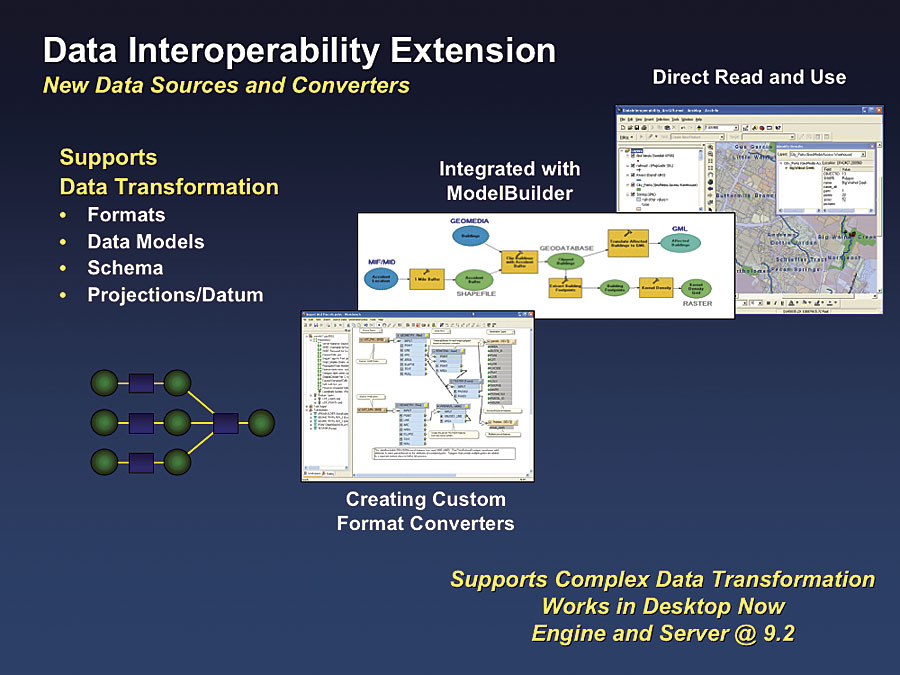
InteroperabilityArcGIS 9.2 will extend and improve support for standards-based interoperability and will also add new data sources to the ArcGIS Data Interoperability extension, providing new direct read/conversion capabilities. This extension will support "transformations" of complex data from one set to another—not just the data format conversion but also the underlying schema reorganization necessary for semantics translation.
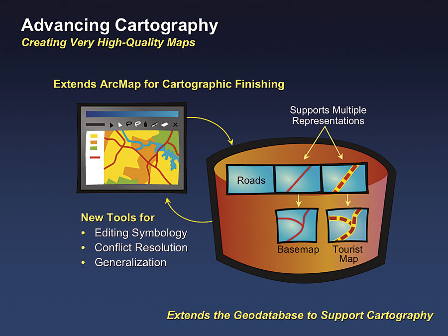
This Extract, Transform, and Load type of interoperability procedure is particularly important for interoperability between and among systems on the Internet. Examples of large users in the United States already doing this include the Bureau of Land Management, Department of Homeland Security, and the U.S. Geological Survey. In addition, hundreds of local governments, such as Sacramento County, California, and Salt Lake City, Utah, are using this extension to dynamically support their data transformation remapping for all types of datasets. CartographyArcGIS 9.2 will offer many new advancements in cartography, particularly for creating high-quality maps. Perhaps the largest of these is in the area of cartographic editing and finishing (i.e., being able to edit and persist map symbology in a geodatabase). The editing capability is similar to that supported with graphics packages often used for cartographic finishing. This means cartographers can use advanced rules-based technology for automatic, computer-generated mapping and interactive graphic tools to apply an artistic touch to the design and finishing of maps.
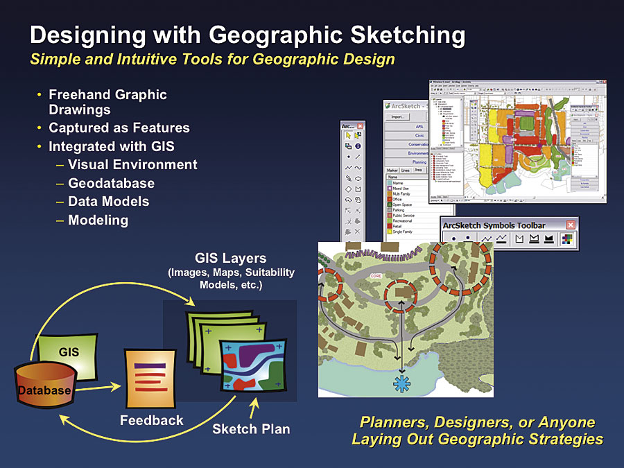
ArcGIS 9.2 will support the ability to store multiple graphic representations for a single feature in a geodatabase. This means that a single set of features can be used to support multiple types of map products at different scales, while at the same time maintaining a single set of features for "one-touch" editing. ArcGIS 9.2 will also have a series of cartographic generalization tools that performs a variety of geometric operations of GIS features, including line simplification, aggregation of polygons, and simplifying buildings. Design SketchingThis year, ArcGIS will introduce a new sketching tool for geographic information. This tool will support many fields of geographic design, such as landscape architecture, city and regional planning, forestry, military planning, and other types of strategic designs in which sketch visualization is important. The idea is that a user can create one or more design sketches using a drawing tool that displays fully rendered geographic features. As the user is sketching, the software stores these features in a geodatabase. This means a user can see the features in symbolized form as they are being sketched and immediately perform GIS analysis of these features using the full set of GIS analysis and modeling tools. For example, a planner can create a design and immediately understand the impacts of this plan on various factors (e.g., flooding, pipe pressure, and the environment). This tool will be available for download from the Web site for use with ArcGIS 9.1 and ArcGIS 9.2.
Continued on page 2 |