Summer 2008
Summer 2008 |
|||||||
|
|
|||||||
ArcGIS 9.3 Improves Entire GIS WorkflowIngl�s / Espa�ol |
|||||||
Highlights
ArcGIS 9.3, which began shipping in July 2008, offers a complete suite of software that improves organizational workflows, as well as the benefits of an established and active user community, instructor-led and online training, and new online resource centers. The numerous enhancements to
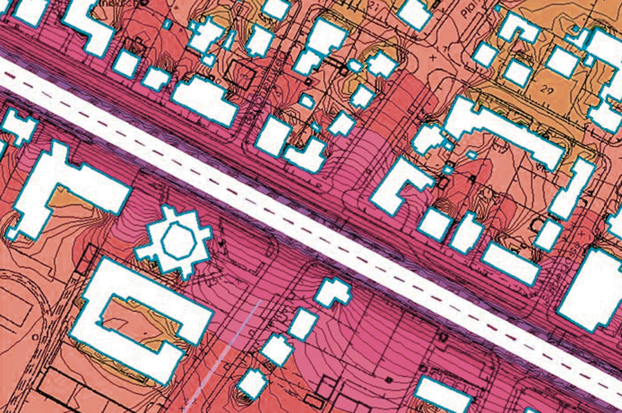
Data ManagementWith ArcGIS 9.3, Esri offers more options to access and manage data within an organization. Enterprise geodatabases can now be implemented on the popular open source DBMS PostgreSQL, as well as Microsoft SQL Server 2008. ArcGIS 9.3 will support the spatial types available in each DBMS for vector data storage: PostGIS for PostgreSQL and Geography and Geometry for SQL Server 2008. This will enable users to perform SQL queries and operations on spatial data directly within the DBMS. ArcGIS 9.3 also enables clients to connect to previous-release enterprise geodatabases (e.g., version 9.2, 9.1, and 9.0) via direct connect backward compatibility. It also provides new version management features, enhancements to geodatabase replication, and better geocoding. A new image service within ArcGIS Server and the addition of ArcGIS Image Server as an ArcGIS Server extension also advance any organization's data management capabilities. Better MapsArcGIS 9.3 includes many enhancements that make it easier than ever to create and share production-quality maps. A new Disperse Markers tool allows users to spread out representation markers when they coincide. All legend symbols now simulate transparency to more closely match transparent layers in maps. Feature attributes can be included in exported Adobe PDFs and accessed interactively by Adobe Reader users with the Object Data tool. Group layer and data frame hierarchies are now reflected in Adobe PDF layer lists. Enhancements in Maplex for ArcGIS include better contour labeling and more control over where labels are placed inside and around polygons. Mobility
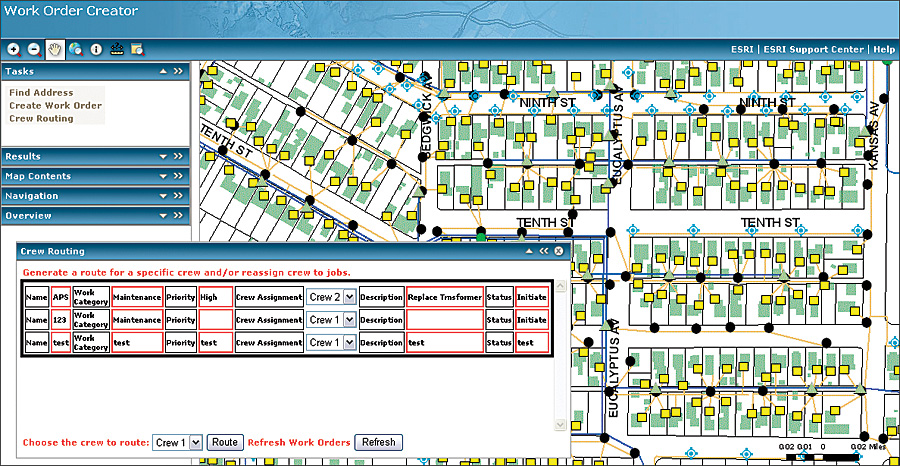
The new ArcGIS Mobile application, which is included with ArcGIS Server 9.3 Advanced Enterprise, is configurable out of the box via the ArcGIS Server Manager. This application improves efficiency and productivity of mobile field personnel by increasing data accuracy and enabling real-time decision making in the field. This is done via wireless access to GIS data and the use of GPS to capture critical geographic information. Esri has also made improvements to the ArcGIS Mobile Software Developer Kit (SDK) at 9.3. These improvements include enhanced map control rendering to support multiple data sources and graphic layers, improved data storage capabilities with support for large compressed basemaps, and expanded projections for non-grid-based ArcGIS projections. Dissemination of InformationArcGIS 9.3 makes dissemination of geographic information much easier. For example, ArcGIS Server 9.3 has new tools to facilitate map cache management. ArcGIS Server users can now publish a map service with an incomplete map cache, rather than having to build a full map cache. Users can selectively build a map cache for the areas that are the most popular and enable on-demand caching (a new property of map services) to let the map cache grow as end users access the map service. This new workflow allows maps to be published more quickly. ArcGIS Server 9.3 also includes a series of JavaScript APIs for mashup-style development. These new APIs allow JavaScript developers to easily embed ArcGIS Server Web mapping applications into any Web site. The ArcGIS API for JavaScript take advantage of the new REST interface that has been added to ArcGIS Server services. Planning and Analysis
In ArcGIS 9.3, many modeling tools have been enhanced, and some entirely new tools have been added to help users get more answers from their data. Geoprocessing error messages are improved and now link to a full description of the problem, allowing for even greater confidence in analysis results. A new scatterplot matrix graph lets users explore relationships between sets of related variables. The Near tool has been improved to work with points, lines, and polygons and can find multiple feature classes. New, advanced Ordinary Least Squares and Geographically Weighted Regression tools help users understand how processes vary over space. Also new are tools to create spatial weights matrices that show spatial relationships in feature classes and network datasets, as well as a vehicle routing problem (VRP) solver in ArcGIS Network Analyst that generates routes for fleets of vehicles. Support for StandardsArcGIS Server 9.3 provides enhanced support for the three leading Open Geospatial Consortium, Inc. (OGC), Web standards: WMS, WFS, and WCS. With the recent announcement from OGC that KML 2.2 is now an official OGC standard, ArcGIS Server 9.3 also complies with the OGC specification for Keyhole Markup Language (KML). ArcGIS 9.3 also includes support for the Collaborative Design Activity (COLLADA) file format. ArcGIS users are able to leverage COLLADA files for a variety of purposes in ArcGIS Desktop and ArcGIS Server, as well as display more realistic 3D models. Resource CentersWith the release of ArcGIS 9.3, Esri is introducing a series of online resource centers. These offer a unified location from which users can access online help, documentation, support, a user community, and content. More InformationTo learn more about ArcGIS 9.3, visit www.esri.com/whatsnew. Related PosterSee also ArcGIS 9.3—Improving Our Entire GIS Workflow [PDF] |