Winter 2006/2007
Winter 2006/2007 |
|||||||
|
|
|||||||
Energy Companies Worldwide Benefit from GIS
GIS Powers Electric Industry |
||||
|
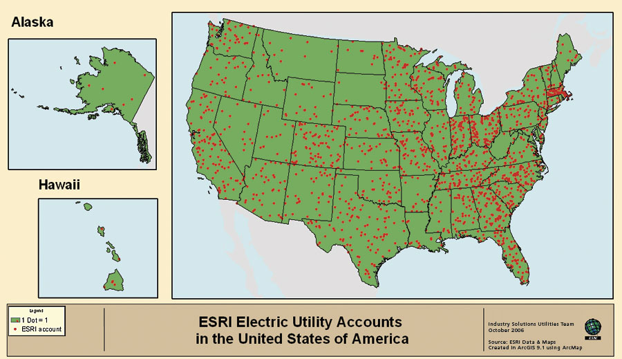
GIS is about discovery. It is about visualizing trends for better decision making. It is about finding weaknesses in electric utility infrastructure before disaster hits. GIS is most powerful at a utility when it is integrated into the IT infrastructure. This allows electric companies to visualize data in the form of intelligent maps in systems such as customer, supervisory control and data acquisition (SCADA), work management, and financial and human resource systems. Worldwide, the majority of electric utilities have selected the Esri platform, many through Esri's outstanding electric utility business partners. In 2006 alone, Esri added more than 50 new electric utilities to its customer base. One of the advantages of the Esri solution is its scalability. While huge utilities continue to implement Esri solutions, electric cooperatives and municipal electric departments are also benefiting from their systems. Small utilities can implement a very comprehensive GIS that is well within their budgets. In the United States, nearly 400 electric co-ops have adopted Esri technology as their GIS (see "Power Cooperatives and Municipals in U.S. Are Better Equipped with GIS"). Reasons to Migrate from Legacy SystemsElectric companies are migrating from their outmoded legacy systems used for facility management to Esri's GIS software for many reasons. Legacy systems are typically proprietary and closed. Attempting to integrate closed systems requires customer workarounds and additional effort to transport data from one system to another. Esri's GIS software is built with standards and interoperability in mind so that it can be integrated within the overall IT framework. This means electric utilities can import data from a variety of sources with ease. CAD files can be incorporated while maintaining the properties and attributes of the data. ArcGIS software allows all employees in the electric company to benefit from using a single consistent user interface and set of functionality and data formats. This minimizes the need to learn and deploy several different software systems.
Utilities want to go beyond merely replicating their existing operating maps. They find that file-based systems are difficult to navigate and do not give employees the ability to query company data when and where they need it. ArcGIS is used to create, import, edit, query, map, analyze, and publish geographic information. It is critical for utilities to be able to communicate asset information across the enterprise. ArcGIS software can be centralized in application servers to deliver GIS capabilities to large numbers of users over networks. Enterprise GIS users connect to central GIS servers via traditional desktop GIS, as well as via Web browsers, mobile computing devices, and digital appliances. Power companies find that upgrading from their legacy systems can be daunting because of customization needed for detailed applications. Esri's many business partners provide applications specifically designed for utilities. They also offer standard commercial-grade extensions to ArcGIS software. Streamlining Facility ManagementFacility management is traditionally the job of engineering departments, but by moving data out of these departments and into the corporate environment, more employees can easily engage in network management projects, such as engineering, construction, and operation activities. Alliant Energy Corporation (Madison, Wisconsin), for example, uses GIS for asset management to model, edit, maintain, and manage facility asset data. Facility data is maintained and stored on a single server and distributed in real time to the desktop. ArcGIS software provides spatial analysis tools for predictive maintenance to show where problems may exist, supports corrective maintenance by locating where poorly performing assets tend to occur, accesses external data sources to find out where new loads may materialize, and offers intelligent representation for load forecasting and planning. Implementing GIS enterprise-wide adds value to corporate database and business systems. Pacific Gas and Electric Company (PG&E), one of the largest combined natural gas and electric utilities in the United States, recently signed an Enterprise License Agreement with Esri. This will facilitate a more rapid adoption and application of GIS technology corporate-wide. PG&E will have the flexibility to deploy unlimited quantities of core Esri software. This will enable the power company to build a robust infrastructure architecture that delivers spatial and attribute data across the organization and develop and deliver application solutions that can be customized for specific tasks. CenterPoint Energy, in Houston, Texas, is America's third largest combined electricity and natural gas delivery company, with more than five million metered electric and natural gas customers. It is also the third largest employer in the energy industry. The power company implemented a comprehensive enterprise GIS installation that includes links to its financial, customer supply chain, environmental, and asset management systems. CenterPoint's decision making, communication of assets, and collaboration processes have all benefited from the enterprise approach. In addition, an underground location tool GIS application saved CenterPoint $1 million in the first year it was implemented. The centralized GIS is also used for data management and workflow processes. A unified server system enables the power company's workers to access interactive applications over the Web. For example, workers can connect to asset management applications from various terminal devices both on- and off-site. For decades, Atlanta, Georgia-based Southern Company—the super regional energy company in the southeastern region of the United States—has been using Esri technology. In four states, its four subsidiaries (Alabama Power, Georgia Power, Gulf Power, and Mississippi Power) have been some of the earliest adopters of Esri's GIS technology, and during the past 26 years, its affiliation with Esri has influenced the progression of GIS development for the electric industry. Southern Company also has an enterprise Esri software license, which is helping it develop collective business operations among its subsidiary companies. Many of Southern Company's enterprise applications are paying dividends. For example, its TransView application provides systemwide query and work design for all four operating companies. Around the GlobeAfrica, Asia, Europe, and North and South America all have major electric utilities with thriving systems built on Esri's GIS. Some examples of international electric companies finding success with Esri technology (see "Worldwide, GIS Transforms Electric Utilities" for more information about how these electric companies use Esri technology) include Austria's Energie Steiermark-Steweag; the Czech Republic's CEZData, s.r.o. (part of the CEZ Group), and the Pra�sk� energetika Group (PRE); Germany's EnBW, EWR AG, SWM Magdeburg, and the public utility of V�lklingen; the Dutch energy company DELTA; G�vle Energi in Sweden; the Ministry of Electricity & Water (MEW) in the Kingdom of Bahrain; the North Delta Electricity Distribution Company in Egypt; the state-run Lebanese electric utility Electricit� Du Liban (EDL); the United Arab Emirates' Federal Electricity and Water Authority (FEWA); India's Reliance Energy Ltd. (REL); Korea Electric Power Corporation (KEPCO); the Philippines' Tarlac Electric Cooperative, Inc., and the National Transmission Corporation (TransCo); Bermuda Electric Light Company Limited (BELCO); Brazil's Companhia Paranaense de Energia (Copel); Chatham-Kent, a single-tier local Canadian government in southwestern Ontario; Aqualectra, the water and electricity authority of Cura�ao; the Puerto Rico Electric Power Authority (PREPA); and the South African government's Eskom Holdings Limited. The Platform of ChoiceGIS technology, a tool that was once found only on the disconnected desktop computers of the engineering department, has found its way to the common workbench, enabling people from all departments to put the utility's data to work for their needs. Hundreds of electric companies around the world are using Esri's GIS technology to improve efficiency; productivity; planning; and, most important, customer service Since ArcGIS software is a database-driven technology, software users can leverage company data beyond traditional facilities management. The more integration with GIS, the more value GIS brings to companies' decision-making processes and return on investment—including engineering, marketing, public relations, land management, operations, and more. More InformationFor more information, visit www.esri.com/electricgas.
|
 Electric companies were instrumental in launching the modern world when they began delivering energy to cities, businesses, and homes. Thomas A. Edison, who formed the Edison General Electric Company in 1890, said, "If there's a way to do it better—find it." Today's electric companies continue to find that better way by using GIS in all parts of their network and business operations. Around the world, GIS is advancing management of generation, transmission, and distribution operations.