ArcWatch: GIS News, Views, and Insights
January 2012
Diving into Esri's Ocean and Natural Science Initiatives
By Carla Wheeler
Esri Writer
Inspired by books like Treasure Island and the television series The Undersea World of Jacques Cousteau, Dr. Dawn J. Wright grew up to become a professor of geography and oceanography at Oregon State University. Now she's continuing to pursue her interest in geography, oceanography, and GIS at Esri, where she was recently named chief scientist. Wright's duties will include overseeing Esri's new ocean GIS initiative, crafting a strategy for serving the science community, and offering input and advice to Esri staff members as they develop geospatial technology for scientists.
In this interview, Wright delves into some of the challenges that need to be addressed using GIS and science. "Helping out with the ocean GIS initiative as part of the job was extremely attractive to me, as I have been involved with Esri for so many years as an ocean GIS user and advocate. I can't think of a better position to be in now to help move that along," she said. Read the interview.

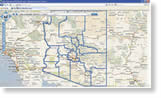
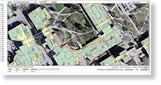
Dawn J. Wright, Esri's new chief scientist, has conducted oceanographic research all over the world. The map above shows some of the places her work has taken her.
Tip of the Month
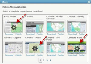
Publish Your Custom Applications via ArcGIS Online
You can now publish your maps in configurable templates directly from ArcGIS Online. Read this tip to learn how.
Connect with ArcWatch
ArcWatch is published monthly by Esri and contains GIS news, practical advice, and updates about the company's software and events. To submit article ideas, e-mail editor Carla Wheeler at arcwatch_editor@esri.com.
Join the Conversation
Working with ArcGIS at Home
 Professionals like Jill Oliver and Ryan Hunsicker signed up for the ArcGIS for Home Use Program to create maps and applications for volunteer projects they care about. Available for a $100 annual fee, ArcGIS for Home Use includes ArcGIS for Desktop Basic and several popular extensions. It's the ideal program for improving your GIS skills or putting those skills to use on noncommercial volunteer work. Read the article to learn more about some ArcGIS for Home Use projects.
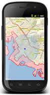 The Future of Mobile GIS
What lies ahead for mobile GIS this year and beyond? David Cardella, Esri product manager for mobile technologies, talks about what's in store at Esri for mobile development and why both GIS and non-GIS professionals are embracing ArcGIS for smartphones and tablets. Read the article.
Spatial Statistics: Best Practices
In a technical workshop, Lauren Scott and Lauren Rosenshein from Esri tackle real-world questions that a local government might face related to 911 calls. They also explain in detail how spatial pattern analysis and regression tools can be applied. Watch the video presentation.
A Macroscopic View of Our World
Jerome E. Dobson, president of the American Geographical Society, writes that GIS, GPS, satellite remote sensing, and popular geographics collectively constitute a macroscope that allows scientists, practitioners, and the public to view the earth as never before. Read his article.
Newsroom
Map Story: New Madrid Quakes
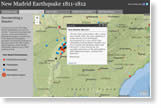 "The ground is going to eat us alive," said a witness to the terrible temblors that shook the central United States in 1811 and 1812. Esri's New Madrid Earthquake Bicentennial map story shows the epicenters of the quakes, along with photos, first-person accounts describing what occurred, and other details. The New Madrid Seismic Zone potentially affects people living in Missouri, Kentucky, Tennessee, Mississippi, Arkansas, Illinois, and Indiana. Learn more in this blog post by Esri's George Dailey and see the earthquake map he created using ArcGIS Explorer Online.
Esri Releases 2011/2016 Updated Demographics Data
Get the most accurate demographic variables based on Census 2010 counts and in 2010 geography in Esri Updated Demographics. Demographic data categories include population, households, income, and housing.
Download Color Ramps 3
Esri just released the latest set of color ramps for mapping elevation, bathymetry, environmental phenomena such as wildfires, and more. Read the article to learn more about and download the new version.
Register for the Esri UC
Join us for the world's largest GIS gathering. Register today to attend the Esri International User Conference (Esri UC), which will be held July 23-27, 2012, in San Diego, California.
Free 30-Day CityEngine Trial
Download and explore the new release and then start creating high-quality 3D content. Watch the video demonstration Redesigning Paris with CityEngine.
National Geographic World Map Released
This map, developed by National Geographic and Esri, can be used as a general reference map for information and education. It can also be used as a basemap for web maps and web mapping applications by GIS professionals and other users.
A Well-Utilized Web Map
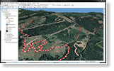
 Arizona Public Service (APS), an electricity utility headquartered in Phoenix, developed a web-based mapping application for managing vegetation, conducting pole inventories, installing smart meters, and more. The application also enables APS staff to view the proximity of wildfires to high-voltage facilities. The web application was created using ArcGIS API for Silverlight. Read the article.
Telling Stories with Maps
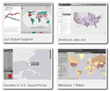 Stories fascinate and educate us. Maps can tell wonderful stories, which is why Esri launched Map Stories. Allen Carroll, ArcGIS Online content program manager at Esri and former chief cartographer at National Geographic Maps, heads this initiative. "We're striving to be more relevant and newsworthy, so look for more map stories in 2012 that relate to current issues, including the economy, unemployment, the elections, sustainability, and poverty," he said. Read this interview with Carroll to learn how you can contribute to the project.
Building a GIS
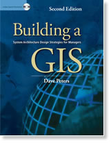 The second edition of Building a GIS includes an updated Capacity Planning Tool (CPT), which automates system design analysis tasks. GIS managers and technical architects can use the CPT to better assess implementation options before committing resources. The CPT is available on the book's DVD, along with exercises and video presentations that help readers further hone their expertise. Buy the book.
Technical Talk
 Earn an Esri Certification
Looking for a way to stand out? Earning an Esri Technical Certification can help you advance in your career and distinguish you from your peers. Esri offers certifications in three areas of expertise: desktop, developer, and enterprise. Learn about the benefits of certification.
Add Labels to ArcGIS Online Web Maps
Learn how to create halos for labels and add graphics to your ArcGIS Online web map in part 2 of a tip from Esri research cartographer Kenneth Field.
Help Others Find Your Web Map Services
Planning to publish web map services using ArcGIS? Follow these tips to make it easier for people to find and use your services through ArcGIS Online.
Maintain High Performance with Big Datasets
If you are a JavaScript developer, how should you handle big datasets for your web map? The answer is feature layers. Read the article.
Getting Started with ArcGIS Runtime SDK for Android
What steps do you need to take to install ArcGIS Runtime Software Development Kit (SDK)? Read this blog post.
Creating Animations Using ArcGIS
Esri's Colin Childs and Hardeep Bajwa present a technical workshop explaining how to use the animation capabilities in ArcGIS. Watch the video.
Sample the Exam Questions
Need help preparing for the ArcGIS Desktop Associate and ArcGIS Desktop Professional exams? Esri just released two free sample question sets on the Esri Training website. Learn more about the sample question sets.
Spatial Roundtable
 Big Data—A Banking Bust or Boom?
Big data presents some big challenges. The ability to process large amounts of data very fast can help banks understand their customers better, even if branches are closing and personal interactions are becoming less frequent. As banks connect their enterprise systems to acquire greater insight and understanding, complexities and costs can explode. Simon Thompson, Esri's global director of commercial solutions, asks if it is possible to use location analytics to harness big data and put an end to these problems. Contribute your thoughts at the Spatial Roundtable.Tracking a Climb in Antarctica
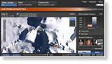 Fifteen-year-old Jordan Romero of Big Bear Lake, California, fulfilled a dream in December when he reached the 16,050-foot summit of Vinson Massif in Antarctica. He has now climbed the Seven Summits, the highest mountains on each of the world's seven continents. Esri created an application that let Jordan's family, friends, and well-wishers track his ascent. View the app.
Web Resources and More
Designing a Smart Campus
 In embarking on a $1.5 billion campus expansion, University of Calgary planners relied heavily on ArcGIS and geodesign principles to help analyze and evaluate the impacts of design alternatives for the university early in the development process. "Using GIS as a decision-making tool is a smart way of gathering all the things you already know and placing them in a single spot so you can see the entire picture," says Tom McCaffrey, GIS coordinator, University of Calgary. Read the article.
Ten Quick References for Mapmakers
Alex Tait, chief cartographer and vice president of International Mapping, lists the 10 pieces of essential information he keeps on his bulletin board. No. 1 is a map of the 60 universal transverse Mercator (UTM) zones in the world. Read the article.
Using ArcGIS for Smartphones and Tablets
Start your free, 90-minute training session now.
Data Collection and Editing with ArcGIS for Smartphones
In this video demonstration, Esri's Adam Pittman shows you how to use your Apple iOS, Windows Phone, or Android mobile device to collect and update ArcGIS field data.
ArcGIS for Desktop Free 60-Day Trial
See what ArcGIS can do for you. Request a download or a disc.
Test the ArcGIS 10.1 Beta
Join the beta program to test Esri's latest software.
Web Course: Building Models for GIS Analysis Using ArcGIS 10
Webcast: Introducing ArcGIS for INSPIRE
Download Papers from the Electric and Gas User Conference
Blog Spotlight
The Support Services Blog offers ArcGIS users tips and tricks; interviews with support staff; information about service packs, patches, and hot fixes; and much more.
Hardware Offers
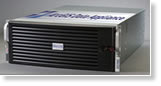 Esri offers US customers two versions of the popular Data Appliance for ArcGIS, one each for Windows and Linux. Both are manufactured by Cutting Edge for Esri. Depending on the data collection package purchased, the Data Appliance for ArcGIS can provide terabytes of prerendered nationwide and worldwide data, including street and transportation, place-name, administrative boundary, and raster imagery data. Learn more about all the Esri and Cutting Edge offers.
Visit the Esri Store to find more software and extensions, upgrades, data, books, and hardware bundles.