ArcWatch: GIS News, Views, and Insights
August 2012
Designing the Oceans' Future
By Will McClintock and Evan Paul
Marine Science Institute, McClintock Laboratory, University of California, Santa Barbara
Geospatial technology is now being used to analyze data and weigh various options on how to best manage ocean resources. Quick feedback on designs using geospatial technology is called geodesign, and it's used in many diverse fields, including marine planning.
SeaSketch, a new online application developed at the Marine Science Institute and supported by Esri, will give marine spatial planners and ocean resources managers the tools to make decisions related to fisheries, energy development, shipping lanes, and protected marine areas.
SeaSketch was developed using Esri's ArcGIS, including ArcGIS Online, which is a cloud-based collaborative content system for maps, applications, data, and other geospatial information. Via ArcGIS Online, planners can view an enormous amount of geospatial data that they might need for their projects.

SeaSketch can be used to draw new shipping lane routes so vessels can avoid the common migratory paths of whales.
Tip of the Month
Making Snapping More Visual on Imagery
Imagery is now often added as a background layer and used to update map features. This process can sometimes be challenging because SnapTips in ArcMap, the text descriptions that interactively appear to indicate current snapping settings, are often hard to read against the background imagery. Read this tip to learn how to make SnapTips displayed over imagery more legible. Read the tip.
Connect with ArcWatch
ArcWatch is published monthly by Esri and contains GIS news, practical advice, and updates about the company's software and events. To submit article ideas, e-mail editor Carla Wheeler at arcwatch_editor@esri.com.
Join the Conversation
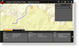
GIS Routes Voters to the Polls
Voters in Cabarrus County, North Carolina, can now get voting information and directions to the polls via the web or their mobile devices using a new mapping application. The county used its GIS and a free mapping application template from Esri to develop and launch the Election Polling Place Finder. The project took just a few weeks. The application was used in the run up to the July 17, 2012, primary and will be an excellent resource for the general election on November 6, 2012.
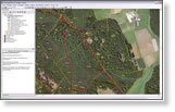
Cutting Down the Workload
Germany's state forest agency, Hessen-Forst Enterprise, uses Esri's ArcGIS Workflow Manager to complete data management tasks and GIS processing jobs quickly and accurately. ArcGIS Workflow Manager tracks the status and progress of jobs and generates a detailed history of a user's work activities. Read the article.
Video Highlights of the 2012 Esri UC
"Impressive!" That's the word Paige Porter-Buhl used to describe the Esri International User Conference (Esri UC), which she attended for the first time in July. If you missed the event, visit this page to view videos of Esri president Jack Dangermond's opening remarks and a series of technology demonstrations to get a flavor of what Porter-Buhl and 14,000 other attendees saw and heard all week.
Introducing Geodesign: The Concept
In this paper, Bill Miller, director of GeoDesign Services at Esri, writes about the definition, history, context, and importance of geodesign, along with the nature of design, managing complexity, and the technology of digital geodesign. Watch a video of Miller talk about geodesign and read a blog about his vision of geodesign.
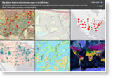
Take a Tour of the Map Matrix
ArcGIS Online contains thousands of intelligent web maps, created and shared by you, the users. The maps cover a wide range of topics, including climate change, home mortgages, unemployment, and soil types. View the map matrix.
Esri Maps for Office Released
Business professionals can use the new Esri Maps for Office to visualize and analyze data directly within Microsoft Office. "By bringing the power of location analytics to Microsoft Office, Esri Maps for Office extends mapping and geographic intelligence capabilities to new people and departments," said Jack Dangermond, Esri president.
Roadway Fatalities Mapped Using ArcGIS
View the location of traffic fatalities using the SafeRoadMaps website, which was developed using ArcGIS API for Flex. SafeRoadMaps uses data from the Fatality Analysis Reporting System (FARS), provided by the National Highway Traffic Safety Administration for 2001–2010. Read the article.
Esri Technology Powers USDA Map
The Know Your Farmer, Know Your Food Compass map from the US Department of Agriculture (USDA) maps farmers' markets across the United States. You can also see government-funded programs mapped, including youth gardening classes, food bank renovations, and farmers' market training.
Students Solve Problems with GIS
Read the blog and watch the videos of four high school students from Washington-Lee High School in Arlington, Virginia, demonstrate how they apply GIS to real-world issues such as preventing watershed pollution. The students, all enrolled in the Geospatial Semester, spoke at the Esri International User Conference.
Podcast with Pictometry
In this podcast, Brian Beha, director of business development for Pictometry, talks about how the beauty of imagery is in the eye of the beholder, telling different stories for everyone from assessors to fire fighters. He also explains why ArcGIS is the ideal platform for working with his company's aerial oblique imagery data.
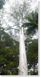
GIS Puts Big Bob on the Map
A giant eucalypt was discovered in the Australian state of Queensland after GIS was used to map aerial laser survey data. The 229-foot-tall tree was nicknamed "Big Bob" after Sunshine Coast mayor Bob Abbot.
"The survey results contained about seven billion laser measurements, which is an enormous amount of complex information," said Esri Australia Pty. Ltd. business manager Anton Delporte.
But Delporte said the data was meaningless until GIS technology was used to map, analyze, and view the information.
Where to Grow Breadfruit?
 A map serves as a powerful visual tool, but can it help solve world hunger, rejuvenate agricultural soil, and prevent mosquito-borne infections? Can a map help slow global warming and spur sustainable economic development in tropical regions? Perhaps not alone, but a map can display the real potential of a very special tree, the breadfruit. Read the article.
Mapping Census 2010
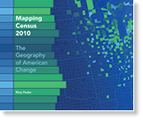
Using the latest census data and GIS technology, Mapping Census 2010 examines how the US population is moving and changing. This new atlas from Esri Press offers large, full-color maps to illustrate US population, age, and racial and ethnic composition with clarity. Buy the book.
Newsroom
DevSummit Heads to Europe
The Esri Developer Summit (DevSummit) will go on the road to Europe in November 2012. Join us for a DevSummit in Rotterdam, the Netherlands; Berlin, Germany; Madrid, Spain; or London, England. The technical sessions will focus on helping you become more effective at building web, mobile, and desktop applications. Senior Esri development staff will be among the presenters, so you will get an opportunity to hear about what's coming next in GIS technology. Learn more.
ArcCASPER Routes People to Safety
ArcCASPER (Capacity-Aware Shortest Path Evacuation Routing) is a custom ArcGIS Network Analyst tool created for evacuation planning. It uses a state-of-the-art routing algorithm to produce evacuation routes to the nearest safe area for individuals or groups of evacuees. Read the article.
Download the Well Count Map Template for ArcGIS 10.1
This template was designed to help you map complex point data. The Well Count web map, which uses provided sample data as well as your own data, shows how a complex data source, such as gas wells in a producing field, can be aggregated and portrayed in a way that's easy to understand.
Tip: Add Pinterest Photos to ArcGIS Online Web Maps
You can add photos from the social media site Pinterest to your ArcGIS Online web maps. Learn how.
Never Fear: Technical Workshops Are Here
Missed the Esri International User Conference? Don't worry. You can still look over these PowerPoint presentations from more than 200 technical workshops.
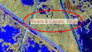
Display Imagery with Appropriate Band Name Labels
Tip: Using Yahoo! Pipes to Create Dynamic Map Layers
ArcGIS Runtime SDK 1.0 for Java and Linux Developers Released
There's Something about a Map
Bern Szukalski, Esri product strategist and technical evangelist, has always been drawn to and fascinated by maps. Why? "Perhaps it is because I like the power of simplicity, and maps capture information in an understandable, shareable, and simple way," he says. Read his Esri Insider blog post about how GIS maps have the power and possibility to be works of art.
A Map for Every Story
 A father and son out hiking use a smartphone to access ArcGIS Online and a world of interesting maps such as one that tracks the migration of penguins in Antarctica. Watch the video A Map for Every Story and see what other types of web maps you can create and share using ArcGIS Online.
New Esri Partner Directory
Esri recently launched the new Esri Partner Directory, giving users access to information about more than 1,600 Esri partners from around the world. The site offers an easy way to learn about partner solutions and services. Search capabilities let you filter by country, industry, solution and service types, and more. The directory's landing page also includes links to hardware offers and information about the Esri Partner Network program.
Attend Two New Free Live Training Seminars
Join Esri for the live training seminars Introduction to Runtime SDK for WPF on August 23, 2012, and Using the Python Toolbox at ArcGIS 10.1 on August 30, 2012. Learn more and subscribe to receive reminders.
Mapping the Future of Corrections
Lew Nelson, Esri's global law enforcement manager, discusses the opportunities GIS provides for corrections and law enforcement agencies to manage inmates and parolees. Join him at the Spatial Roundtable.
Get Esri Instructor-Led ArcGIS 10.1 Training
Find the ArcGIS 10.1 courses that are right for you.
Listen to a Podcast about GIS Modeling
In this podcast, Esri's Andy Mitchell discusses the practical applications of GIS modeling detailed in his book, The Esri Guide to GIS Analysis, Volume 3: Modeling Suitability, Movement, and Interaction.
Mapping Soil Liquefaction in Orange County, California
Try Esri CityEngine 2011 for Free
Hardware Offers
Technical Talk

Web Resources and More
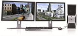 US customers can take advantage of a special offer of Esri CityEngine Advanced packaged with a Dell Precision T5600 Workstation. Esri CityEngine is a stand-alone software product that provides professional users in architecture, urban planning, entertainment, GIS, and general 3D content production with a unique conceptual design and modeling solution for creating 3D cities and buildings.
Visit the Esri Store to find more software and extensions, upgrades, data, books, and hardware bundles.