displaying 818 results

This tutorial combines 2D and 3D data in an ArcGIS Pro Local Scene to visualize the topography, imagery, and cultural features of a region.
Organizations can use GIS to implement a multidimensional system of record that combines imagery, real-time data, and realistic 3D environments.
The City of Honolulu used Esri CityEngine to model a proposed rail system and analyze the impacts of the rail corridor in 3D.
The City of Québec is the second largest municipal in the province of Québec, Canada, and continues to grow; its population jumped a remarkable..
If you want to know where 3D mapping is going and how UAVs play a role, register to attend the Esri 3D Mapping Forum in California this July.
Cumbria, England, a rural northwestern county, is home to Garsdale Design, Ltd., an architectural, planning, and urban design firm housed in a…
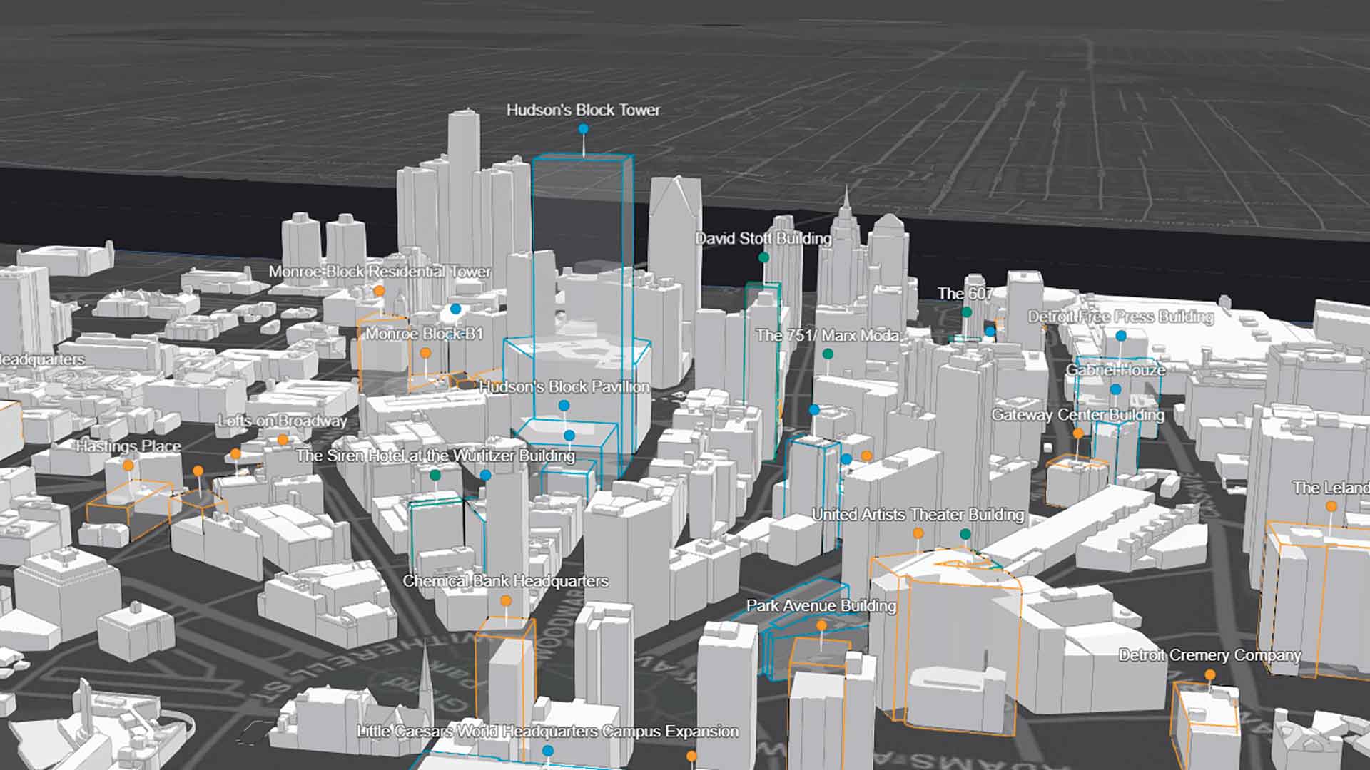
The Downtown Detroit Partnership (DDP) turned to 3D mapping to creatively market its metropolitan areas.
With the ArcGIS API for JavaScript, developers can now create 3D experiences that work well in both mobile and desktop browsers.
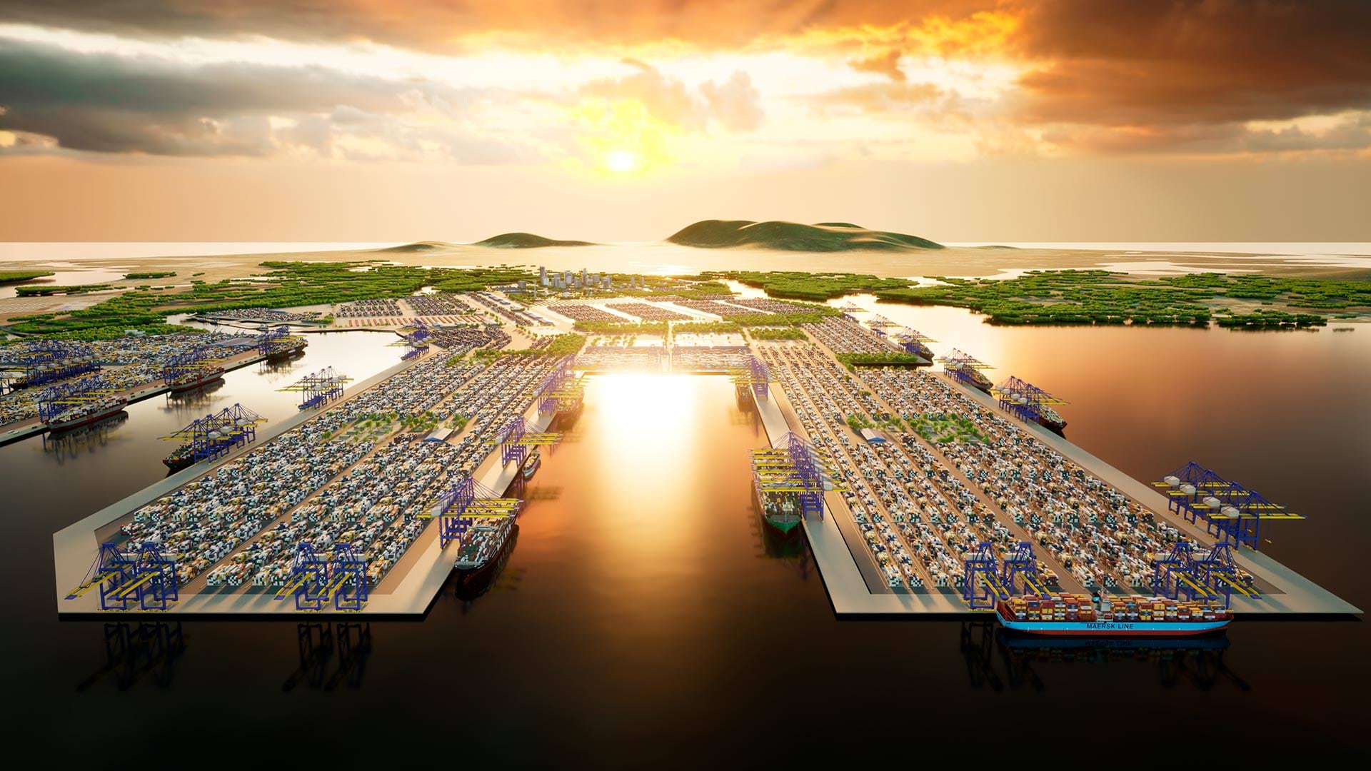
3D GIS workflows and models have created a digital twin to help guide development of port facilities in Vietnam.