Seeking to Make Cycling a Viable Mode of Transport, Czech City Relies on GIS
After collecting data on streets, public spaces, and people’s cycling habits, Ostrava is strategically updating its cycling infrastructure.
After collecting data on streets, public spaces, and people’s cycling habits, Ostrava is strategically updating its cycling infrastructure.
Victoria’s Department of Transportation and Planning has developed innovative custom web apps that streamline processes and cut manual work.
The app, built with ArcGIS Experience Builder and ArcGIS Survey123, shows whether housing projects can access simpler environmental reviews.
To account for unique geography and elevation variation, the city used an ArcGIS Pro script tool to model streetlight distribution in 3D.
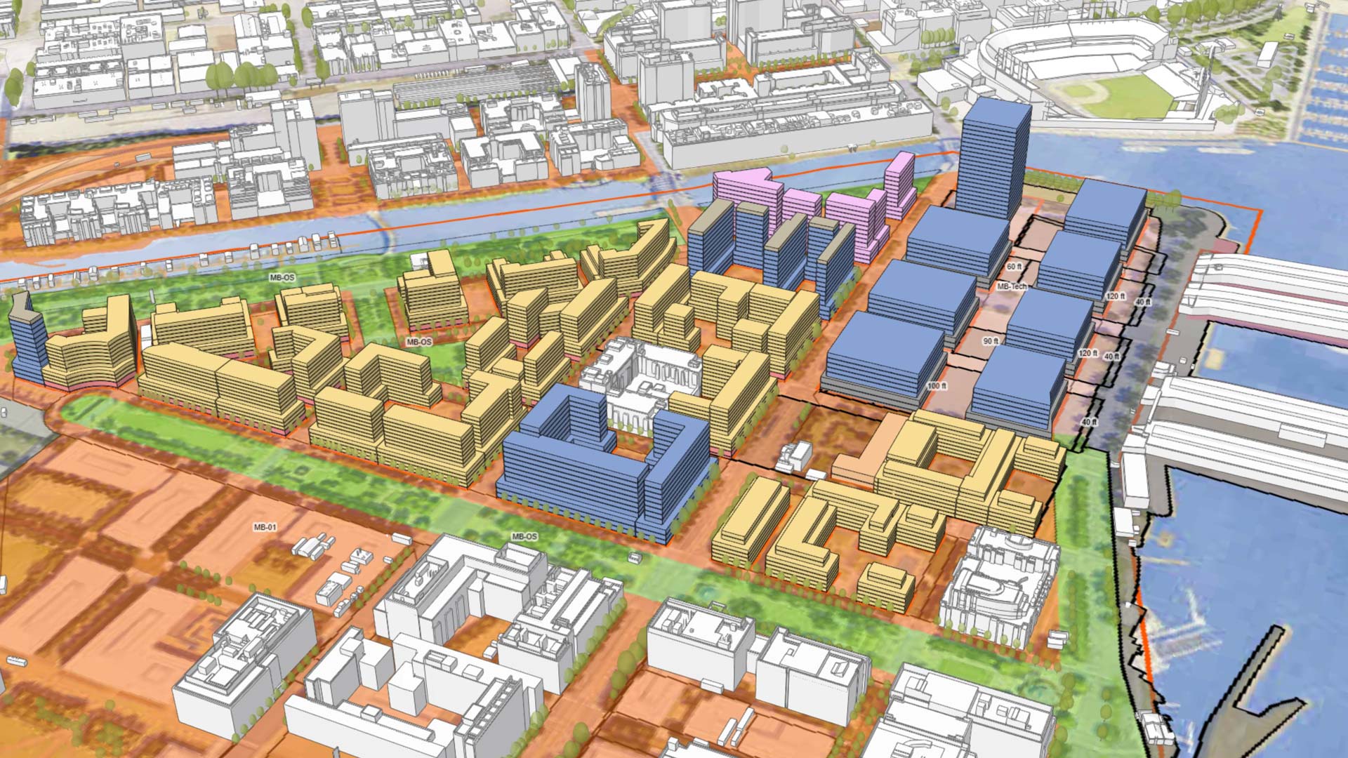
To show stakeholders what proposed developments would look like in context, Houston implemented 3D GIS. The result is increased engagement.
Following a catastrophic wildfire, a California town turned to GIS to rebuild and improve its stormwater system.
In Tacoma, Washington, the city’s chief technology officer led her team to create a GIS-powered equity map that helps guide city decisions.
Argentina uses geospatial tools to help the city of Córdoba improve efficiency, become more inclusive, and promote sustainability.
The City of Philadelphia has created a map that is highly accessible, informs city spending, and empowers people with disabilities.
An early love of the sciences led Breece Robertson to a GIS career and to the creation of ParkScore, a database that scores US park systems.
A pioneer in GIS, Metro—the area’s metropolitan planning organization—is using ArcGIS Hub to democratize access to authoritative data.
Users have more flexibility when sketching buildings, can get real-time feedback on goals, and have more tools for collaboration.