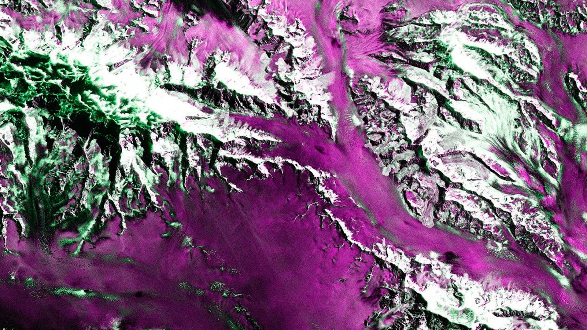
Hundreds of miles above the Earth’s surface, satellites collect petabytes of data. Open to the public, these datasets support precision agriculture, energy efficiency, emergency response, and a host of other use cases.
GIS practitioners are well positioned to turn this data into actionable intelligence. But two persistent problems get in the way: Many GIS users are unaware that these resources exist, and those who are aware find them too complex to integrate into daily operations.
To break down these barriers, the National Aeronautics and Space Administration (NASA) is leading the Earth Science to Action (ES2A) strategy. The goal is to maximize the potential societal and economic impacts of Earth science by ensuring it can inform real-world decisions at scale.
Scientists recognize the challenge of what they call “bridging the last mile”—translating complex scientific outputs into the tools that industry professionals already use. This requires a concerted effort, so NASA and Esri are collaborating to connect Earth science and operational GIS.
-
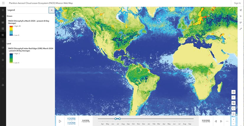
NASA’s Earthdata GIS (EGIS) platform provides image services, like the ones used in this map, for PACE data. (Image courtesy of NASA GSFC.)

To build that bridge, NASA needed to meet GIS teams where they work. For many state, local, and federal government organizations, as well as commercial entities, that environment is ArcGIS. To widen its reach, NASA delivers data in GIS-friendly formats such as custom rasters, provides image services, and adds datasets to ArcGIS Living Atlas of the World. NASA also engages with Esri technology users through instructional blog posts, newsletters, and even live events.
NASA’s Earth observation data can point miners to surface deposits of rare earth minerals, help water treatment facilities monitor water quality, or guide government agencies in air quality forecasting. The imagery captures insight across land, water, and the atmosphere, making it valuable for nearly every industry.
Breaking Down Barriers to Data
Supporting ES2A are NASA scientists and mission application leads Dr. Dana Chadwick, Dr. Morgaine McKibben, and Dr. Elodie Macorps. They ensure that data from cutting-edge missions is accessible and actionable for leaders.
“Our role is to figure out how best to provide datasets to users who are going to make decisions with them,” explained Chadwick. “We’re helping to communicate what the data [is], how [it] can be used, and what the access points are.”
Three key missions these scientists support highlight the breadth of NASA’s data capabilities:
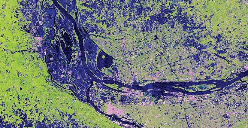
- NISAR (NASA-ISRO Synthetic Aperture Radar): Designed to measure physical change and motion, this mission—in partnership with the Indian Space Research Organization (ISRO)—tracks land deformation, monitors ice sheets, and measures vegetation structure regardless of cloud cover or darkness.
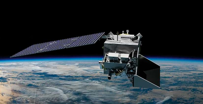
- PACE (Plankton, Aerosol, Cloud, ocean Ecosystem): PACE provides daily global monitoring of the health and diversity of aquatic and terrestrial life, including algae and plants; types and quantities of aerosols, such as smoke and dust; trace gases; and more.
- EMIT (Earth surface Mineral dust source InvesTigation): Mounted on the International Space Station, the EMIT instrument identifies specific surface materials and gases, maps mineral composition, and detects large methane emission events.
All these missions generate insight into how Earth functions and changes. But the data they produce is often massive and highly technical.
“All of our data is generally available at one access point in one format,” said McKibben. “We learned this can create barriers for some in the GIS user community, which is exactly the sort of broad and solution-forward user community we’d like to support.”
So the team set out to learn directly from GIS users how NASA can better integrate data into their existing technology and workflows.
-
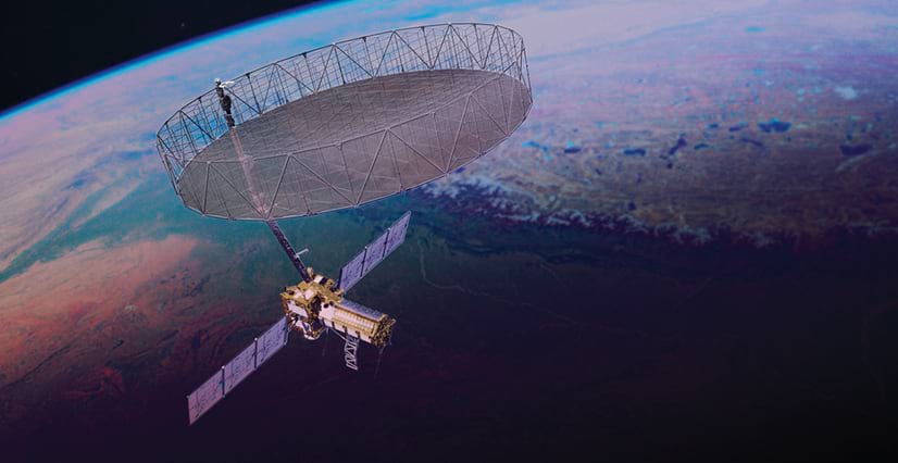
NISAR measures physical change and motion on Earth.
“We’re hosting regular user group meetings, workshops, and early adopter programs to gather feedback,” said Macorps. “We learn how the GIS community needs the data delivered and then codevelop tools with both experienced and new users.”
This collaborative approach helps ensure that data products solve real-world challenges and are accessible to a diverse user base.
Making NASA Data Easier to Find
As NASA creates analysis-ready data for GIS users, Esri integrates that data directly into its technology.
A major step in this process is the development of image services and cloud-enabled data access. Hosting data as image services lets users stream massive datasets directly into ArcGIS Pro and ArcGIS Online without having to download them locally.
NASA’s Earthdata GIS (EGIS) platform provides image services for NASA datasets. Services are already available for PACE data and are in development for NISAR.
“We’re connecting GIS practitioners directly to the most current data sitting in NASA’s Earthdata Cloud,” McKibben noted.
In the meantime, users can access specialized raster types in ArcGIS that make it easier to work with files from NASA missions.
This integration is further highlighted by ArcGIS Living Atlas. Stephanie Dockstader, Esri’s director of imagery and remote sensing solutions, is raising awareness among ArcGIS technology users that these datasets are available.
“More than 120 NASA data layers are available now in ArcGIS Living Atlas,” Dockstader said.
NASA publishes these from the Earthdata GIS repository into ArcGIS Living Atlas.
“That’s where GIS practitioners go to find new, authoritative data sources, so the team has made it easy to find,” explained Dockstader.
Resources for Learning How to Use This Data
Enabling GIS users to discover analysis-ready NASA data helps, but that isn’t always the full solution for complex scientific data. This is especially true for synthetic aperture radar (SAR) information or full hyperspectral satellite data cubes from PACE and EMIT, which currently cannot be streamed directly into ArcGIS.
For NISAR, that’s where experts like Heidi Kristenson—a GIS specialist at the Alaska Satellite Facility (ASF)—come in. ASF supports NASA as a Distributed Active Archive Center (DAAC) in NASA’s Earthdata Program.
“NASA scientists create the datasets, and DAACs such as ASF distribute [them] to the world,” Kristenson said.
For her, this means making complex SAR data more GIS friendly. ASF provides on-demand services that generate analysis-ready datasets. It also publishes EGIS image services to support access to SAR data.
However, there is still a learning curve to understanding the characteristics of SAR imagery. Unlike conventional optical imaging, SAR uses longer wavelengths to image the Earth. Radar backscatter characterizes different surface properties than optical data, and SAR images include speckle—granular, salt-and-pepper features that mask fine details. Kristenson publishes ArcGIS StoryMaps tutorials, such as NISAR in GIS, RTC On Demand!, and OPERA Sentinel-1 RTC, to help GIS practitioners access, understand, and use SAR data.
-
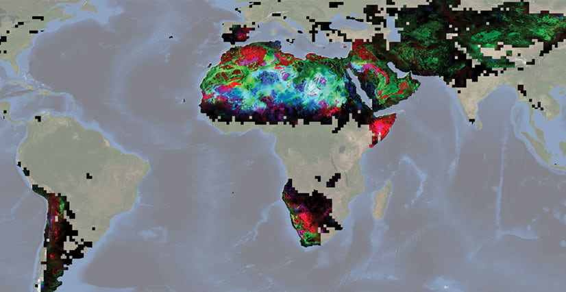
A global mosaicked map of surface mineralogy from the EMIT mission displays a false color image where red, green, and blue represent hematite, goethite, and kaolinite, respectively. (Image courtesy of NASA/JPL-Caltech.)

The spectral resolution provided by the PACE and EMIT missions also yields large and complex files that are challenging to import and use. To serve the GIS community, these missions have teamed up with Esri to create instructional content on importing and working with hyperspectral data in ArcGIS. Two resources—an ArcGIS StoryMaps story and an ArcGIS Blog article—detail the powerful hyperspectral-data support features being added to ArcGIS.
The Impact of GIS-Ready Satellite Data
Bringing NASA data into the ArcGIS environment enables organizations across sectors to use it. And they don’t need special processing software, extensive computing power, or manual file conversions to get there.
“This hosting model allows organizations to connect directly to these trusted data sources without incurring additional storage or transfer costs,” Dockstader emphasized.
For commercial users, the ability to easily integrate NASA data with their proprietary workflows is a game changer. For example, an insurance company could use NISAR data to assess flood damage. An agricultural firm could use EMIT’s hyperspectral imagery to monitor crop health and forecast yields. A regional fishery could employ PACE data to observe potentially harmful algal blooms and engage in proactive, risk-based management.
The accessibility of these datasets enables precise, scalable decision-making. Plus, NASA’s long-term, high-quality, and consistent data archives offer the kind of reliable foundation for advanced predictive analytics and AI applications.
A New Era of Problem-Solving
By transforming complex scientific data into analysis-ready products—hosted in ArcGIS and the cloud—NASA and Esri are giving decision-makers powerful intelligence to address ongoing challenges.
“This is a really exciting time,” Chadwick reflected. “These sensors provide new and different data than what we’ve had in the past. If we can help people work with [this] data, it can support a lot of different applications.”
While these datasets are useful for government agencies, commercial organizations can also benefit from them. By making it more accessible to GIS users, NASA ensures that insights gathered from space can have a tangible impact here on Earth.