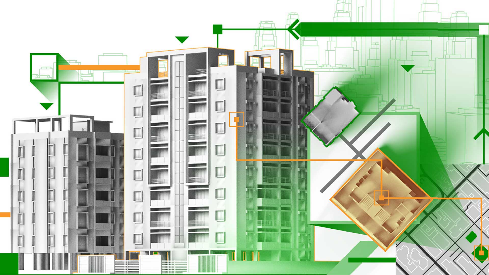
Esri’s continued focus on the integration of building information modeling (BIM)and CAD with GIS has created some exciting results. As the divisions between GIS, BIM, and CAD workflows continue to fade, great opportunities are emerging. Ultimately, these advances help project collaboration, critical stakeholder engagements, and innovative project delivery solutions.
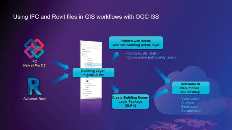
With the release of ArcGIS Pro 2.8 in May 2021, Esri introduced new capabilities for CAD and BIM integration that make more BIM content available for ArcGIS workflows. ArcGIS Pro can now directly read BIM files in Industry Foundation Classes (IFC) format in addition to Autodesk Revit (.rvt) and Autodesk Civil 3D (.dwg) files.
IFC is a standard for openBIM data exchange. It is used for transferring model data between software systems. This widely used schema helps designers share BIM content from any source that supports the standard. Many BIM software vendors export to IFC. Adding this capability brings a powerful method to share data between those applications, directly with ArcGIS. Currently, ArcGIS Pro supports Building IFC 2×3 and 4x and will expand as future standards are adopted.
New BIM Format with the Same Workflows
This new direct IFC integration uses the same BIM workflows already familiar to those who have used Revit files with ArcGIS Pro. These workflows encompass:
- Direct read and conversion into a building layer.
- Conversion to geodatabase and I3S building scene layers.
- IFC file access through ArcGIS Pro BIM Cloud Connection to BIM 360 or the Autodesk Construction Cloud.
- Attributes and BIM categories, which are preserved during the process.
The Foundation for Digital Twins
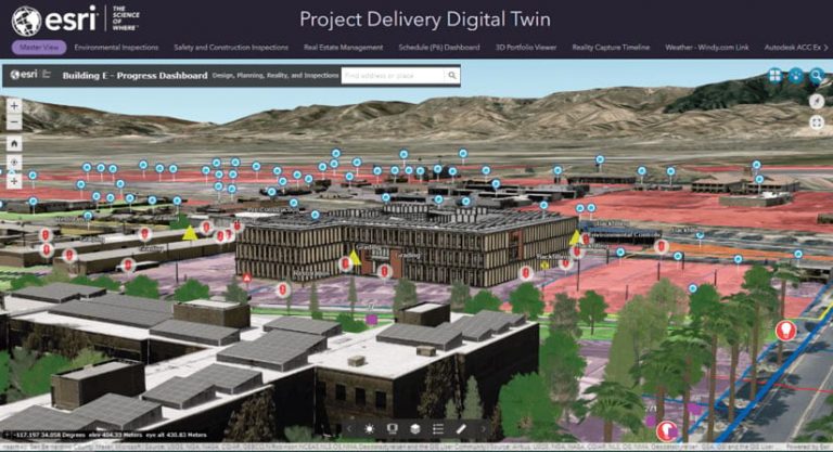
Bringing an IFC or Revit BIM model into ArcGIS Pro empowers GIS professionals, who can incorporate and share BIM in context with other projects and geospatial data. By bringing the model into ArcGIS, it can become part of the overall project delivery strategy. The model can be directly viewed in context with all project data, including geospatial data, construction and environmental inspections, information on safety issues, and reality capture data. This is the foundation for building a digital twin to help manage the success of the project.
Publishing BIM content to ArcGIS Online or ArcGIS Enterprise helps get the data into the hands of all project teams. Creating out-of-the-box end-user web mapping applications with ArcGIS Experience Builder or ArcGIS Web AppBuilder changes the game for project delivery. This allows highly technical content to be leveraged by nontechnical users for greater stakeholder insight and collaboration.
Autodesk Revit and Civil 3D Support
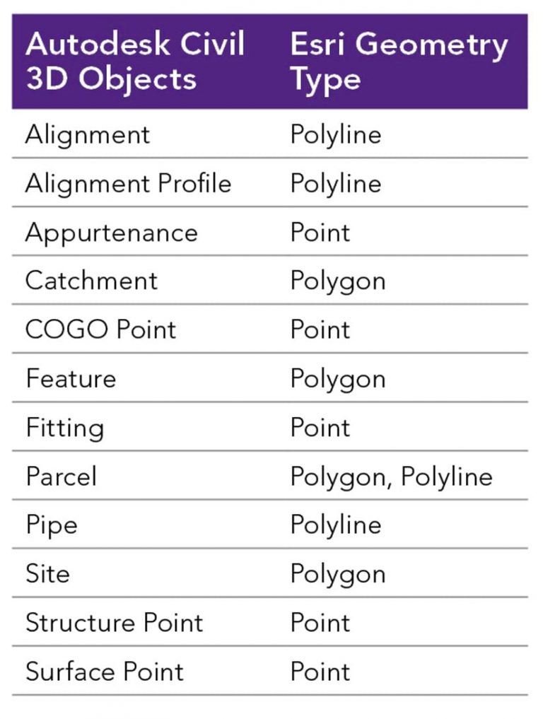
In addition to IFC support, ArcGIS Pro 2.9 builds on existing Autodesk Revit integration by supporting versions 2017–2022. The Revit files are upgraded to the latest version in memory while loading. Direct support for Autodesk Civil 3D has expanded and includes alignment, parcel, and pipe objects. Now site designs, GIS data, and building models can all share the same space. In addition, this can give valuable insight to office staff and field crews. The bottom line is that all project teams can streamline their project workflows, which can save time and money. Ultimately, this enables greater opportunities for project success.
BIM Cloud Connection
The BIM Cloud Connection in ArcGIS Pro allows users to directly connect to Autodesk BIM 360 or Autodesk Construction Cloud. This BIM and CAD content connection helps to manage models, versions, and collaboration efforts between design and GIS teams. Because users can go directly to the source of truth for BIM and CAD designs, they manage versions being represented in ArcGIS over multiple iterations.
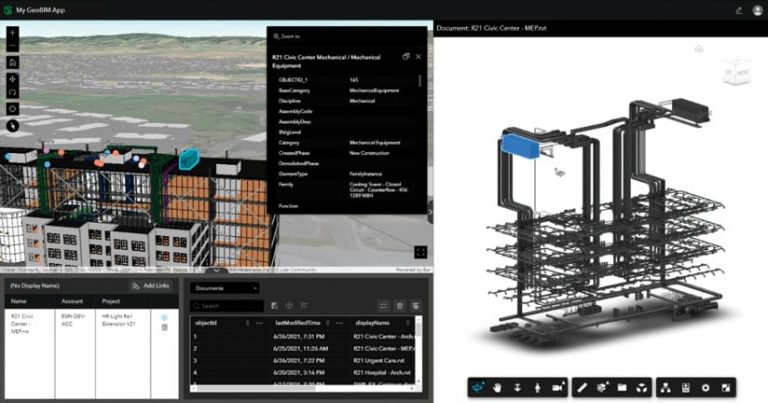
ArcGIS GeoBIM—The Next Step in BIM Integration
The other big news in GIS and BIM integration is the release of ArcGIS GeoBIM. After leveraging ArcGIS Pro to establish BIM content and publish the models, powerful new web applications can be created. These applications can include direct links to Autodesk Construction Cloud or BIM 360 content with ArcGIS GeoBIM. Connecting the ArcGIS cloud directly with the Autodesk cloud means design teams can interconnect and collaborate directly. The result is an easy-to-use, cloud-to-cloud solution to help project teams make coordinated, informed decisions.
The ability to tie GIS features directly to the corresponding BIM element gives powerful insight to stakeholders beyond the GIS and design teams. Linking data from multiple systems and configuring ArcGIS GeoBIM web applications simplifies communication and collaboration. Viewing issues and linking to drawing sheets and other records has never been easier.
The initial October 2021 release of ArcGIS GeoBIM supports ArcGIS Online. ArcGIS Enterprise support will follow in 2022.
About the author