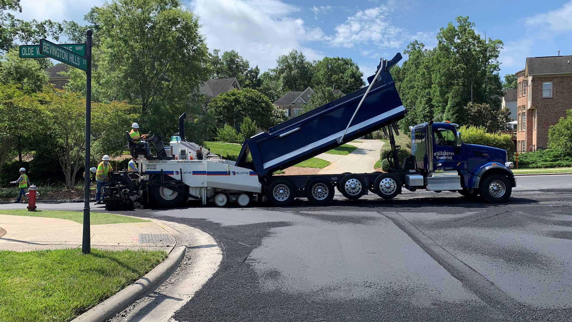
The growing demand in the United States to return to manufacturing and add warehouses to shore up supply chain gaps has made past-industrial land more interesting, particularly in and around the major port city of Bridgeport, Connecticut.
Developers in the area want to take advantage of proximity to both New York City and Boston as well as the connectivity available along the heavily traveled Interstate 95 corridor. But they also know that there are bare or run-down sites that are unused because they are likely hazardous due to past uses.
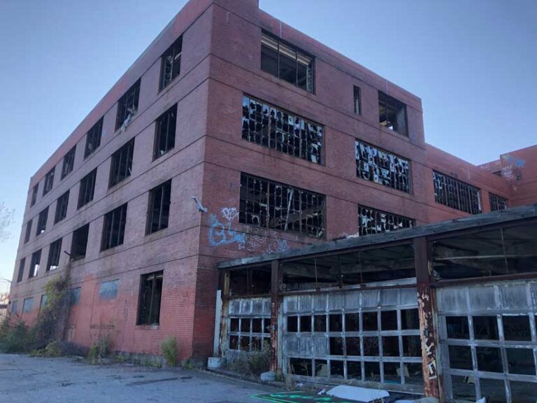
“Connecticut has a very rich industrial past, which was great in the early-to-mid-1900s, but it left a significant contamination issue we’re still struggling to climb out of,” said Matt Fulda, executive director at the Connecticut Metropolitan Council of Governments (MetroCOG). “Bridgeport had Remington and other munitions and heavy industrial activities, which has left a lot of the city undevelopable. Roughly 30 percent of the parcels in the city are vacant or underutilized.”
City planners and developers needed a way to understand the opportunity cost of so-called brownfield redevelopment sites, and a smart map helped them see where the turnaround could happen quickly.
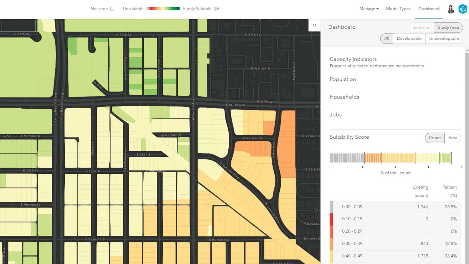
MetroCOG created the Brownfields Inventory Site Selector tool to fill in knowledge gaps, using GIS to visualize, analyze, and prioritize sites based on contamination, connectivity, and resilience to climate change.
“We’re trying to eliminate as many impedances as possible,” said Patrick Carleton, deputy director at MetroCOG. “Getting information out there and accessible makes an easier path forward for redevelopment.”
Reconnecting along the Northeast Corridor
Brownfield redevelopment provides a potential win-win-win for municipalities because remediation and reuse address environmental contamination, offer jobs to residents, and generate corporate tax revenue. Removing brownfields has psychological value: it shows that a city isn’t mired in its past.
MetroCOG has a history of redeveloping brownfield sites, having secured grants from the US Environmental Protection Agency (US EPA) and state agencies for both assessment and remediation.
“The scale of remediation varies dramatically across different properties,” Fulda said. “Some just need a million dollars to remove contaminated soils or building asbestos. Other sites are far more complex, with different industries on the same property over the course of 100 years with all sorts of legacy contaminants.”
The first step of assessments involved inventorying sites. Staff got busy gathering background details and adding them to the map. Documents were scanned from municipal and state records, detailing past facilities that occupied each site, the type of contaminants, and where hazardous materials were likely located.
MetroCOG also conducted some spatial analyses to look across the region and see where remediation work would have the greatest impact. Communities around some sites are in areas with persistent poverty as well as education and health disparities that mark the need for environmental justice.
“We’ve tried to target specific corridors in Bridgeport and Stratford, the two most urbanized and disadvantaged communities and with the most problematic sites,” Carleton said.
Next, MetroCOG hired environmental remediation experts to sample and analyze the soil, groundwater, and any remnants of structures to measure contamination and make cleanup plans for priority sites. GIS is a commonly used tool for collaboration on these kinds of projects. It’s used to map where the work needs to be done and report where—and to what extent—each site is contaminated.
MetroCOG’s Brownfields Inventory Site Selector tool unleashes all the historical records—many of which were previously only available on paper and tucked away in file drawers—and provides access to the latest environmental assessment reports.
Showing Redevelopment Potential
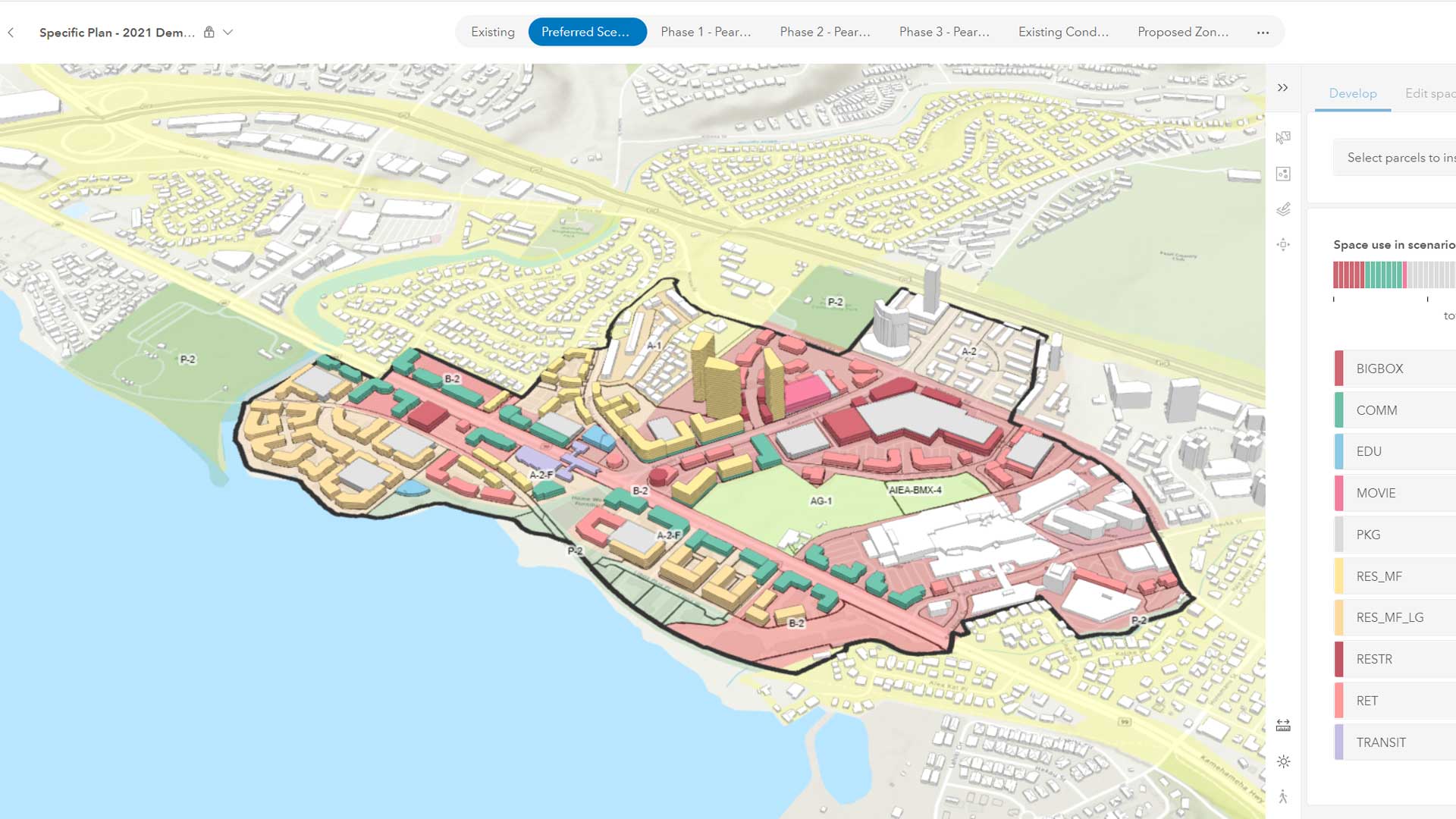
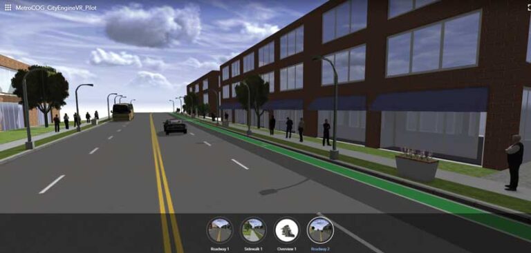
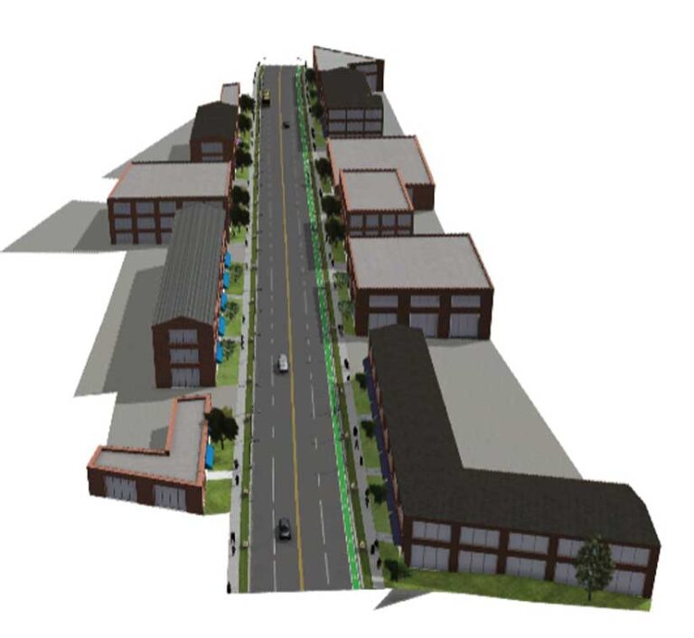
Brownfields aren’t the only focus of MetroCOG. It administers cooperative planning in one of nine regions in the state for issues related to land use, transportation, housing, public facilities, open space, environment, energy, and economic development. Increasingly, MetroCOG staff members have been applying and promoting their GIS capacity to the member communities of Bridgeport, Easton, Fairfield, Monroe, Stratford, and Trumbull. This includes creating issue-oriented tools similar to the brownfield site selector and creating 3D visualizations to help city planners visualize the changes they want to foster. With several brownfield sites in the area moving through remediation, planners have shifted from making assessments to selling the transformation.
In Stratford, MetroCOG worked with city planners to visualize different development options for a former metal plating facility currently going through cleanup. Using ArcGIS Urban to visualize the area in 3D, MetroCOG staff created a digital twin of the immediate area. The immersive visualization that showcased several redevelopment scenarios, accompanied by the deep-dive details in the brownfields tool, impressed the US EPA, which chose to showcase the project during its annual brownfield conference.
“The metal plating site in Stratford is next to another site undergoing extensive remediation with the help of US EPA,” Carleton said. “They are both close to the interstate and close to commercial and industrial corridors within the town, and the visualization helps the town market those properties.”
Meeting Industrial Demands
MetroCOG recently completed a comprehensive economic development strategy for the region that identified industrial space as the highest demand for real estate. There is a growing interest from companies in the transportation, logistics, and supply chain industries to have their own space, and it’s difficult to find that in the region.
With the port, the interstate, and a state highway that originates in Bridgeport and moves north to connect to Interstate 84, the region is well positioned for advanced manufacturing. Defense contractors—such as Sikorsky Aircraft headquartered in Stratford—reinforce the viability of the area for other manufacturers. With more than 300 small-to-multinational manufacturers in the region, MetroCOG and the municipalities it serves are hopeful that new industrial uses will lead to renewal and drive the economy forward.
“Mapping the vacant or underutilized parcels in Bridgeport has helped us work with the city and with developers to prioritize locations for remediation,” Fulda said. “We’re hopeful those locations will have a cascading effect—to get more properties cleaned up, advertised, and developed so they will attract other developments.”