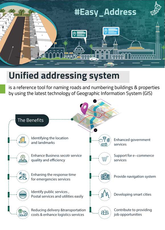
The Sultanate of Oman is developing a unified addressing system (UAS) that will benefit the government’s operations, support the country’s residents, and help Oman achieve its long-term goals.
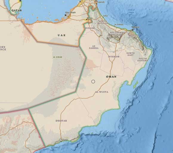
Oman is strategically located on the southeastern corner of the Arabian Peninsula, bordered by the Arabian Sea and Gulf of Oman. It is governed by a sultanate. During the nearly 50-year rule of his late Majesty Sultan Qaboos bin Said Al-Said, Oman achieved impressive government reforms, infrastructure development, and economic gains.
One of his programs provided Omani citizens with free parcels of land. This program increased the workload of the government’s surveying and planning departments. In response, Oman adopted Esri technology nearly 30 years ago to develop a basemap and database for better land records management.
“The Ministry of National Economy was another of the early adopters of GIS in the Sultanate,” said His Excellency Dr. Khalifa bin Abdullah Al Barwani, CEO of the National Center for Statistics and Information (NCSI). “We first used it in our 1993 census.”
In 2020, Sultan Haitham bin Tarik succeeded as the head of government and launched Oman Vision 2040, the road map for economic and social development in the Sultanate for the next 20 years. One of its primary goals is the digital transformation of government services in the country. The implementation of a GIS-based UAS is a key driver for that transformation.
The Need for a UAS
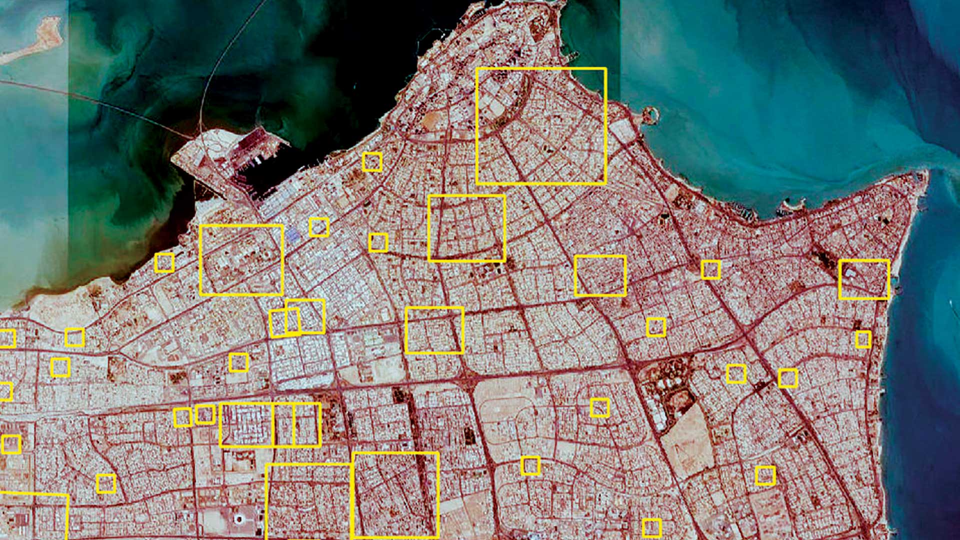
Although Oman has a population of more than 4.5 million people, current address data existed only for the cities of Muscat, Sohar, and Salalah. This impeded the development of the location intelligence needed by decision-makers in government and business.
NCSI has been given the mandate to implement a UAS for the Sultanate of Oman in coordination with Municipalities, Ministry of Interior, Ministry of Housing, and Royal Oman Police. The capture of trusted, accurate, and regularly maintained address data in Oman will underpin the nationwide UAS. This system will support Oman’s Vision 2040 goals to facilitate a strong, prosperous, and knowledge-based economy.
“The Oman National Spatial Data Infrastructure initiative is the key driver of our National Unified Addressing System,” said Hassan bin Alawi Al-Ghazali, an engineer and the director general of the National Spatial Data Infrastructure at NCSI. “The initiative provides a framework for geospatial standards, policies, institutional arrangements, and technology infrastructure. The framework is necessary to coordinate, facilitate, and support the sharing and utilization of geospatial information across multiple government organizations in the Sultanate of Oman. The UAS is part of a larger plan in Oman to achieve geo-enabled digital transformation throughout the Sultanate. The UAS will include the addresses of all buildings and residences in the country, and we are currently in the process of completing this step.”

Creating the UAS
The UAS project was divided into separate phases: development, testing and verification, and implementation. The development phase is complete, and the system has been handed over to Municipalities for field verification, implementation, and ongoing maintenance.
The system makes use of a wide range of Esri products. The ArcGIS Desktop suite has been used to develop and perform data quality control procedures. The versioned geodatabase is maintained in ArcGIS Enterprise. Data is disseminated using ArcGIS Enterprise and Enterprise portal and utilizes the Esri Leaflet Geocoder, which is a series of API helpers and UI controls that interact with ArcGIS Online geocoding services. In addition, ArcGIS API for JavaScript was used to develop several applications for the address system. Several government agencies have worked together to develop the related centralized address database.
“The database will be integrated with government applications that require the addresses of individuals or buildings. These agencies include Oman Post; National Centre of Statistics and Information; Royal Oman Police; the Ministries of Technology and Communications; Regional Municipalities and Water Resources; Housing, Interior, and Transport; and the Municipalities of Muscat, Sohar, and Dhofar. In addition, we have developed an address locator app for the general public,” according to Saud bin Salim Al-Nofali, the director of Spatial Strategy at NCSI.
NCSI anticipates many benefits from the addressing system. As a valuable source of statistical data and information, the UAS will enhance national security by providing information to better integrate intelligence, plan operations, manage national security threats, and improve disaster preparedness. It will be an essential first step in the development of Oman’s Smart Cities plan.
UAS will support national and regional planning and decision-making processes related to urban expansion. This data will help with planning public services, such as postal delivery, education, health services, sanitation, public transport, and utilities. It will also improve the tax collection and utility payment systems, thus increasing government revenues. Eliminating duplicated paper work will improve government efficiency and reduce operational costs for transportation and logistics sectors. The UAS will help attract high-tech industries to the region, creating new investment opportunities, and it will also be attractive to tourists visiting Oman.
Oman’s national UAS will also bring numerous benefits to its residents. By more reliably routing ambulances and the police in towns, cities, and rural areas, emergency services response will improve, saving lives and property. Reduced travel times also will improve the delivery of goods. Official records, such as ID cards, residence permits, driver’s licenses, and other government-issued documents, can now include addresses.
“At the National Spatial Data Infrastructure, we have many plans in the pipeline for the promotion of GIS technology in Oman at various scales,” concluded Al-Nofali. “We are working with a defined road map, which aims to strengthen the national GIS capabilities, promote use of shared services, and focus in exploiting the power of GIS for national planning and e-transformation initiatives.”
About the author