Learn How to Make Your Own Geo Apps
Get access to ArcGIS apps, learn from experts, and build skills to create apps without writing code during an online class that starts in March.
Get access to ArcGIS apps, learn from experts, and build skills to create apps without writing code during an online class that starts in March.
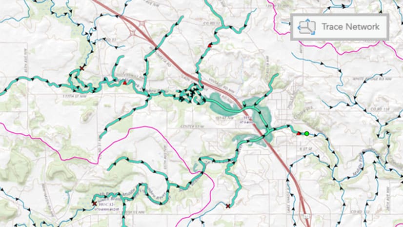
From voxel layers to trace networks and from graphic layers to link analysis, see what’s new in ArcGIS Pro 2.6.
An ArcGIS Online update brought many enhancements such as a better 3D visualization and the enforcement of HTTPS, ensuring all data is encrypted.
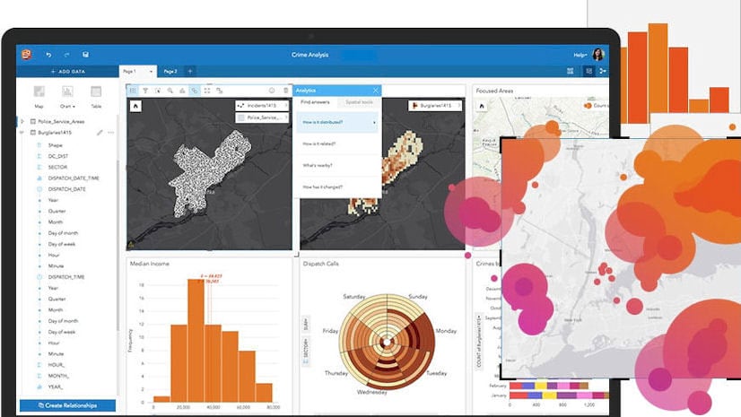
Discover the power of drag-and-drop data analytics in a one-day class.
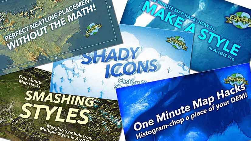
Do you have a point, line, polygon or raster symbol just the way you like it and want to reuse it? Here's how to save it as a style.
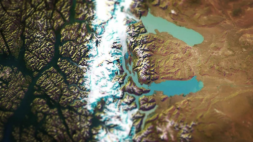
Esri cartographer John Nelson offers two color schemes for your hillshades for use in ArcGIS Pro: ice and mountains.
The ArcGIS StoryMaps team tells the story of Victor Vescovo’s expeditions, including one to the deepest spot in the ocean: Challenger Deep.
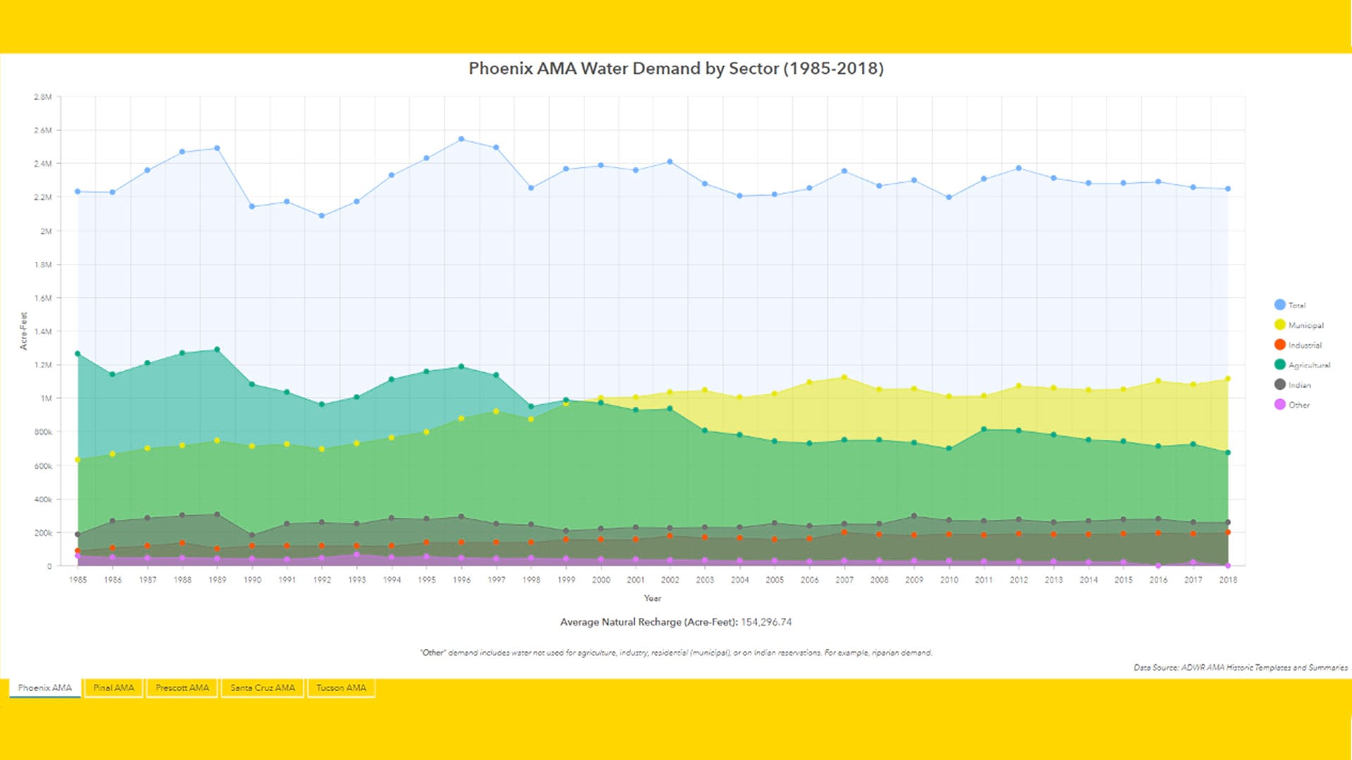
The Arizona Water Blueprint Viewer was created using ArcGIS Online and its configurable ArcGIS Web AppBuilder, along with ArcGIS Pro.
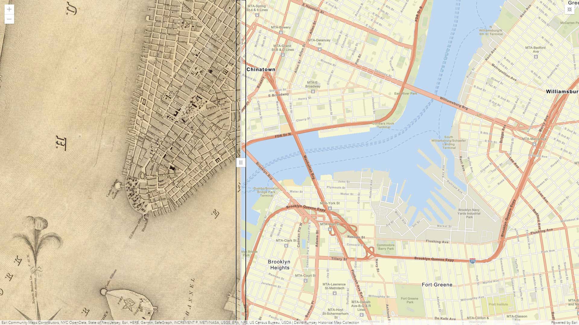
Learn how to create a simple application that features a swipe tool, using Media Map, one of the configurable app templates in ArcGIS Online.
The current version of ArcMap is the last release and support for it continues until March 1, 2026.
In this StoryMaps Live webinar, you will get tips on how to make ArcGIS StoryMaps and learn how they are being used by Yale University students.
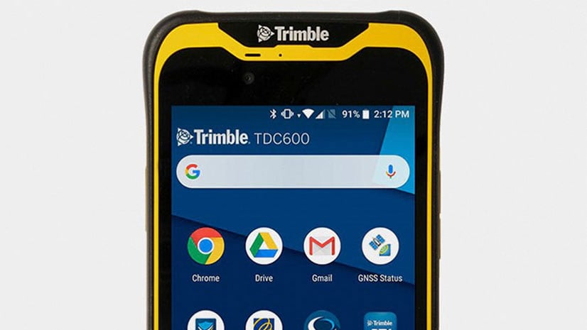
US customers can buy the Trimble TDC600, an all-in-one rugged smartphone with a built-in professional GNSS receiver. It supports Esri field apps.