Hardware Offer
Enhance your GIS productivity with an ArcGIS Pro license packaged with a Dell Workstation or Rugged Tablet.
Enhance your GIS productivity with an ArcGIS Pro license packaged with a Dell Workstation or Rugged Tablet.
You can now use geotagged photos to locate tour places in ArcGIS StoryMaps guided tours. That's just one of the new enhancements available.
Learn how to map a map of a fire in about a minute, locate the hot spots, and find out how many people live in the affected area.
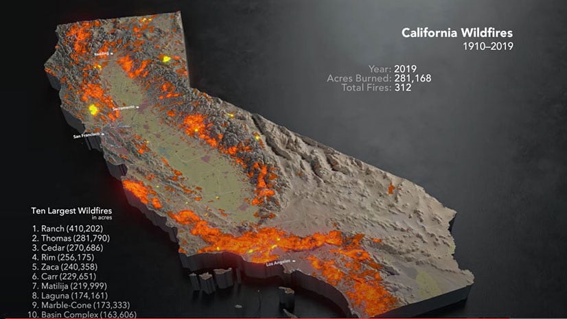
A map created using ArcGIS Pro, Cinema 4D, and other technologies shows an animation of the ten largest wildfires recorded over the last century.
Do you have to convert maps made in Map Viewer classic to Map Viewer beta? Learn the answer and get your other Map Viewer queries answered.
Allen Carroll, program manager for storytelling at Esri, shares a collection of his favorite stories created by the ArcGIS StoryMaps community.
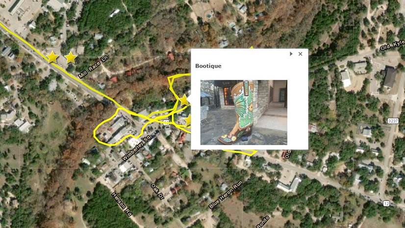
A story called Famous Boots of Wimberly, Texas, serves as an example of how to integrate GIS with art, history, and geography in education.
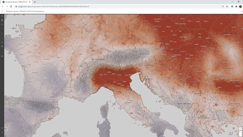
See how air quality has changed over time using a new layer that has been added to ArcGIS Living Atlas of the World.
The City of Escondido, California, used ArcGIS Hub to recruit volunteers to prepare a trail for a 50-kilometer run in Daley Ranch.
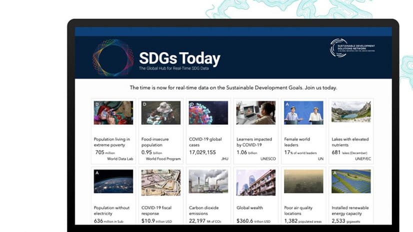
Generate ideas on how to solve climate change, equity, and poverty: Enter the ArcGIS StoryMaps Competition for Sustainable Development Goals.
Learn how to set up your ArcGIS Online home page galleries and groups for the public and organization members.
Learn how to link your ArcGIS Online organizational accounts to make managing them much easier.