Get Smart with Smart Mapping
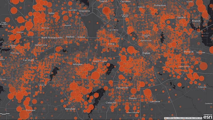
Esri cartographic product engineers Jennifer Bell and Diana Lavery demonstrate the smart mapping capabilities in ArcGIS Online.
Esri cartographic product engineers Jennifer Bell and Diana Lavery demonstrate the smart mapping capabilities in ArcGIS Online.
Tune in to Introduction to Official Statistics, the first in a series of webinars about how to use GIS in conducting the 2020 census.
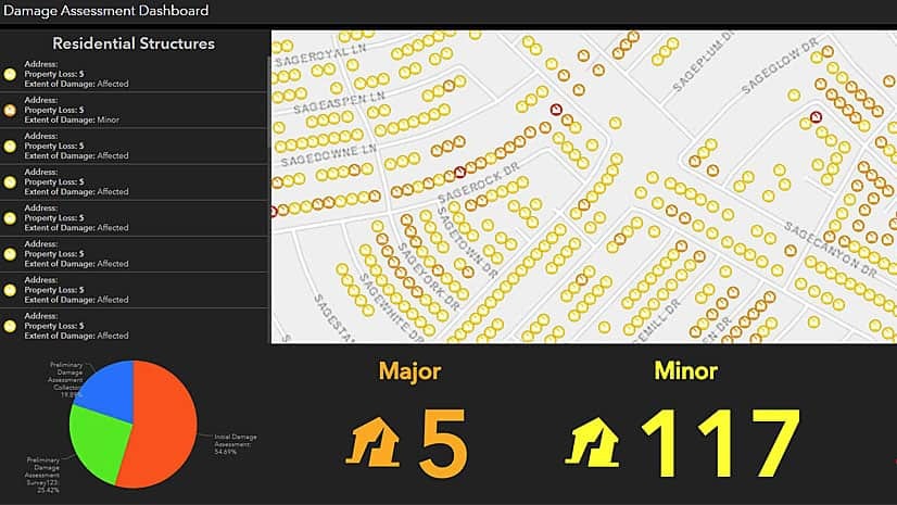
Work with ArcGIS apps and ArcGIS Pro software to create, collect, and share hurricane damage assessment information in this Learn ArcGIS lesson.
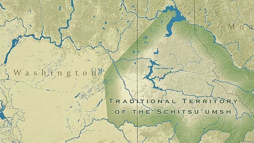
The Samish Indian tribe, the Native Village of Georgetown, and the Coeur d'Alene tribe of Indians were recent Tribal Story Map Challenge winners.
Celebrate GIS Day this November by hosting or attending a program that showcases GIS technology.
New trail markers and an Esri app speeds the response to emergency calls from hikers on a state park trail in Long Island, New York.
Want to hone your GIS skills and knowledge? Read these six books from Esri.
You can use ArcGIS API for JavaScript to render the edges of buildings to improve the perception of a building's actual shape,
Brighten the look of your maps when you use the new firefly symbols, available in ArcGIS Online. Cartographer John Nelson from Esri walks you...
In this Learn ArcGIS lesson, you will learn how to use ArcGIS Pro to create a localized, custom basemap and then publish it to ArcGIS Online.
Ty Fitzpatrick and J. D. Overton from Esri answer some commonly asked questions about ArcGIS Pro and share their tips and tricks on how to use...