Mapping National Park Service Lands in ArcGIS Pro
Mappers can now combine multiple visualization techniques using unique values symbology in ArcGIS Pro.
Mappers can now combine multiple visualization techniques using unique values symbology in ArcGIS Pro.
GIS training in a midwestern US city is helping to foster an environment of innovation and collaboration.
A GIS administrator for Three Rivers Park District relies on Esri Community to assist other departments with their geospatial needs.
With the 10th anniversary of ArcGIS Pro approaching, it’s time to look to the future. Learn how updated user types transform your GIS experience.
In this 5-minute video, discover how to identify and visualize patterns of clustering in ArcGIS Pro.
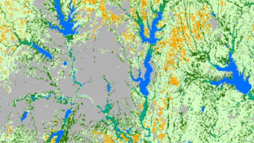
In this ArcGIS lab, determine the amount of land developed over a period of time to help policymakers plan for the future.
Check out this forthcoming Esri Press title that shows readers how to build a geodatabase, use 3D GIS, create maps for presentations, and more.
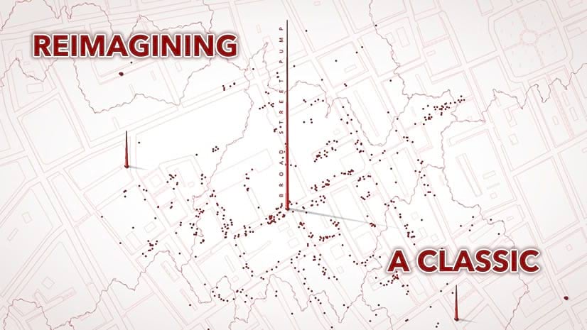
Check out this recreation of the classic map that launched epidemiology.
Opening April 3, Esri’s no-cost course explores the cartographer’s craft using the latest ArcGIS Pro 2D and 3D map design tools.
Learn how to use GIS and the geographic approach to improve the way you manage infrastructure and assets.
In this seminar, you will learn the ArcGIS Pro editing environment, including the user interface and key options to increase efficiency.
Countries around the world are using the Mountain Green Cover Index developed by the UN to monitor changing vegetation and improve conservation.